UK weather: Britain to be smothered in unearthly 'radiation' mist as temperatures rocket to 20C
High pressure is expected to anchor in place through the week before shifting to allow cooler temperatures
Don't Miss
Most Read
Trending on GB News
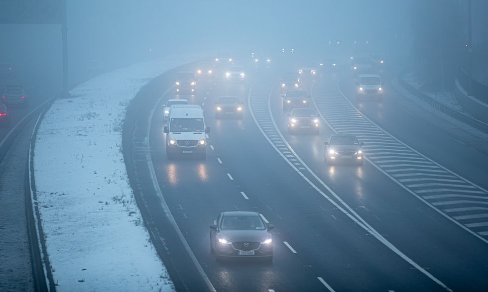
A spooky fog dome will descend over Britain smothering the nation in an unearthly ‘radiation’ mist for Halloween.
Trick or treaters will be delivering scares amid a swirling fug trapped under a lid of high pressure.
Temperatures in parts of the country will rocket to 20C to simmer Britain in a freakishly warm fright season.
But as the mercury falls, heat radiating from the ground overnight will trigger dense fog to be trapped under clear, windless skies.

Heat radiating from the ground overnight will trigger dense fog to be trapped under clear, windless skies
PA
Jim Dale, meteorologist for British Weather Services, said: “High pressure is bringing very calm weather, and there will be few if any scares in terms of wind and rain through the next week.
“This will bring the risk of fog which may be stubborn to clear, and this will be more of an issue in the glens and valleys.
“Temperatures in parts will be much higher than average for the time of year, and we could be looking at daytime highs of 20C.”
High pressure at this time of year causes winds to settle under a dome of sinking air frequently drives thick morning fog.
Beneath clear skies, overnight temperatures drop through ‘radiation’, causing water to condense into mist and ‘radiation’ fog.
LATEST DEVELOPMENTS:

Temperatures in parts of the country will rocket to 20C to simmer Britain in a freakishly warm fright season
PA
This is reluctant to shift under the high pressure, leading to a characteristic ‘anticyclonic gloom’.
High pressure is expected to anchor in place through the week before shifting to allow cooler temperatures.
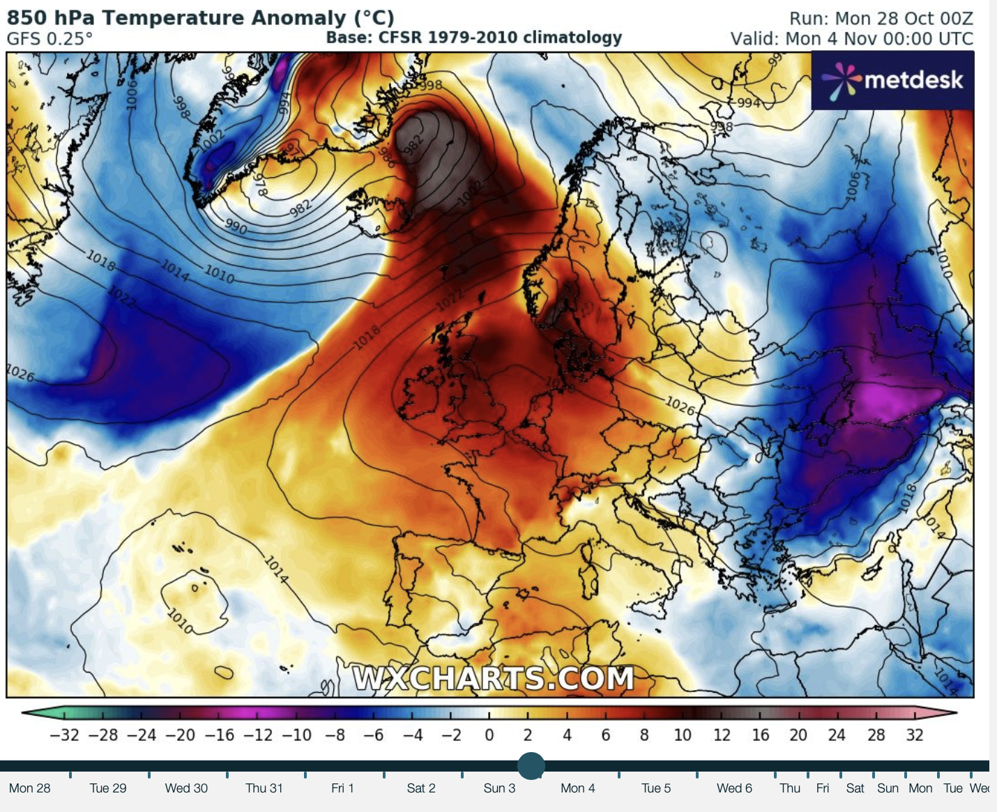
However, a shape-shifting jet stream sweeping and swerving out of the Atlantic is giving forecasters ‘nightmares’.
Met Office meteorologist Alex Deakin said: “It is the shorter-term forecast that has been giving meteorologists nightmares of late.
“The reason is the jet stream dipping to the south way out in the Atlantic and dipping further south and doubling back on itself, and this is called a disrupting trough and it always causes more headaches for meteorologists.

A shape-shifting jet stream sweeping and swerving out of the Atlantic is giving forecasters ‘nightmares’
WXCharts
“There is a small chance of things turning a bit colder towards the back end of [this] week.”
High pressure will also bring a dearth of rainfall into the last month of autumn, particularly to south-eastern Britain.
Dry weather will come as a relief after a vigorous start to the storm season kicked off last week with Storm Ashley.
Mr Dale said: “This is going to be a bit of a recovery period for those regions hit by heavy rain and storms earlier in the month.
“There is no sign of this dry weather changing until the middle of next month, and we could well see half a month with no rain which is unusual.”


