


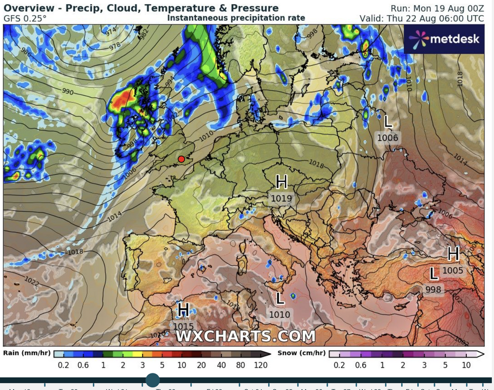
An ex-hurricane will smack Britain with a ‘double-hit’ spicy cocktail of 60mph winds, torrential rain and tropical warmth.
The remains of Hurricane Ernesto will arrive from the Caribbean on Thursday having hitched a ride on the jet stream over unusually warm seas.
The exact route of the storm has had experts scratching their heads since it emerged during the middle of next week.
But they think it is likely to swerve north of the UK, bringing wind and rain to Scotland and northern England while giving the south a temperature boost.
 UK weather: Britain to be rocked by ‘double-hit’ event with ex-hurricane on collision courseWX Charts
Jim Dale, meteorologist for British Weather Services and social commentator, said: “Ernesto is looking like giving Britain a double hit on Thursday and Friday when we are expecting some wind and rain in the north and warmer conditions further south, especially in the southeast.
“The major problem will be the rain in the northwest, and here there could be some pretty high totals before the end of the week.
“It will be a different tale in the south, where it will be quite dry, and temperatures could push into the mid-to-high-20Cs bringing a spell of very pleasant weather.”
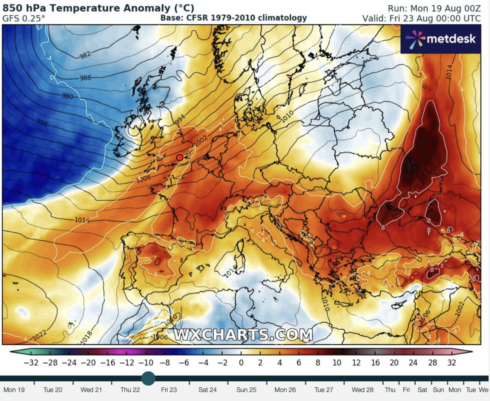
Where ex-Ernesto delivers a punch, this will be boosted by unusually high Atlantic Ocean temperatures.
Moisture and energy from the sea will feed the dying hurricane, helping it pack an added punch when it arrives.
LATEST DEVELOPMENTS:Dale said: “The sea temperatures are above average in parts of the Atlantic after a very hot summer in America with some recordings in the high-20Cs which is just incredible.
“This is fuelling Ernesto and will have an impact on the effect we see in the UK when the remains of the storm arrive later this week.
“This will add to the heaviest rainfall on Thursday, with the Highlands and north-western regions of Scotland, and northern England most at risk.”
Ernesto’s effects on the UK will depend largely on where it ends up on its journey with the jet stream.
Some computer models say it may move south bringing more widespread rain, while others suggest a more northerly path.
Turning warmer in the south, cooler in the north
WX Charts
The most likely is something in between, with the dying embers of the tropical system ending up between the UK and Iceland.
Met Office meteorologist Alex Deakin said: “There is a lot of energy within this system when it interacts with the jet stream.
“It could be pushed north towards Greenland or it could dip south and head down to the south Atlantic
“The most likely scenario is for it to head up somewhere between the UK and Iceland, but there is quite a big jump, and there is not a lot of agreement on the model, so there is a fair amount of uncertainty which is typical.”
An early taste of autumn to the north this week, while the south continues to swelter, will split the nation’s weather in two.
Temperatures in southern Britain will hover in the low- to mid-20Cs through the rest of the week.
Scotland and northern England could dip into single figures, with a wetter, windier picture in store.
The Met Office has issued a yellow warning for up to six inches of rain later this week with winds threatening to hit 60mph.
Deputy Chief Meteorologist Tony Wisson said: “[Ernesto] will break down before it reaches us, but the warmth and moisture it once contained will become entrained within a mid-latitude frontal weather system.
“This will lead to unsettled conditions for the UK, especially across the north and west, with heavy rain and strong winds expected here.”
