


A ‘cyclonic-anticyclonic’ battle zone will keep Britain on the cusp of a return to sunshine through the end of April.
Tussling weather systems will bring more rain and dreary skies through the next couple of days before the weather makes a weekend about-turn.
Unsettled low pressure rattling in from the west will hammer against high pressure to the east, keeping any early scorcher at bay.
However, experts say change is afoot from the end of the month as high boots out the rain.
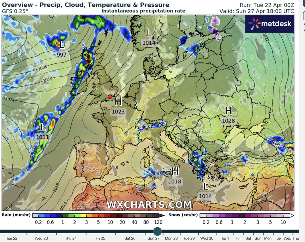
High and low battle it out
WX Charts
Met Office meteorologist Ellie Glaisyer said: “Into the start of Saturday, a weather front continues to push its way eastwards but bumps into an area of high pressure so it is quite slow moving, and then there are hints that we will see high pressure building from the southwest as we go over the weekend.
“It could be quite slow to push its way northwards across the UK, and there are still weather fronts around, so definitely a watch point, but it does look like things are settling down as we head into the weekend and next week.”
In the meantime, ‘cyclonic’ low pressure will lock horns with ‘anticyclonic’ high pressure bringing further grey skies and rain.
Sluggish weather systems will waddle across the country as mid-week temperatures struggle to breach the high teens.
LATEST DEVELOPMENTS:Coastal areas face being draped in a dreary shroud of cloud and “fret and haar” sea fog, Glaisyer warned.
She said: “On Wednesday, an area of low pressure slowly slips its way south and eastwards, mainly affecting the southern half of the country.
“The very far north will get away with some drier conditions, but we do have a weather front across the far northeast so there will be some cloud and some outbreaks of rain across Shetland and Orkney.
“Temperatures on Wednesday will be down a touch because of the cloud, and as we head through Wednesday evening that weather system eventually clears away towards the Continent but the next system is waiting in the wings, and an easterly wind does mean quite a bit of low cloud, sea fret an haar.”
Britain’s up-and-down weather has kept meteorologists on their toes through spring with freakishly hot weather at the start of April followed by rain and floods.
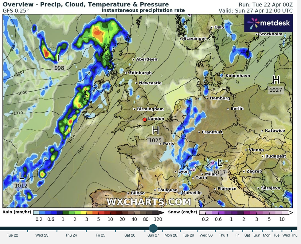
The pressure battle will bring bands of rain
WX Charts
Weather models have struggled to agree as high and low pressure systems straddling the country battle it out.
High pressure is expected to win by the end of the month, finally ushering the long-awaited spring sunshine.
Jim Dale, meteorologist for British Weather Services, said: “It depends on where the high pressure ends up on whether we see temperatures rise and the weather improving.
“It think it is more likely that by the end of the week, high pressure will be further to the north and this could bring cooler conditions rather than warmer, although it will feel pleasant.
“But it is unlikely we are yet at the point when we start talking about exciting temperatures, with highs more likely in the high teens.”
AccuWeather’s lead international forecaster Jason Nicholls added: “There are some modelling differences later in the week showing either a drier pattern or further chances of rain.
“It is likely we see a drier outcome, later in the week with northern regions most likely to see rain.”
