


An Arctic blast is set to batter Britain, sending temperatures plunging to -10C.
From February 12, temperatures are set to plummet, with Scotland seeing the mercury dropping to -10C.
Scotland is also set to be hit with large amounts of snow as the following day, February 13, will bring up to 25cm of the white stuff.
Temperatures will also fall in other parts of the country, with London seeing the mercury read as low as 0C.
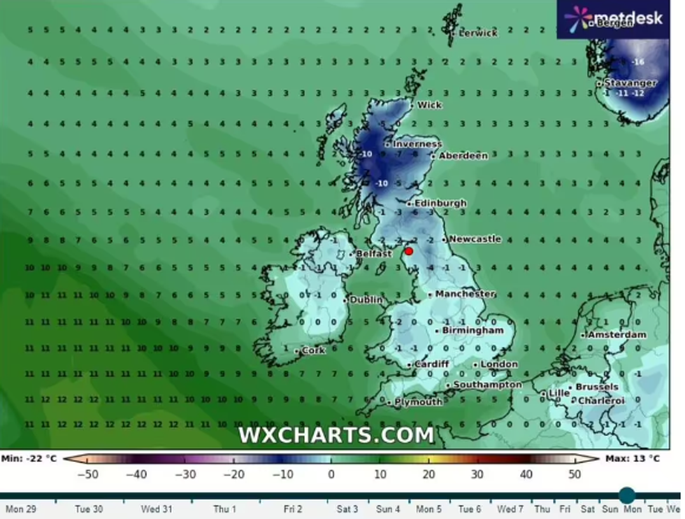
Temperatures will plunge in the following weeks
|WXCHARTS
Meanwhile Manchester and Birmingham are also expected to see snowfall, with up to 4cm.
Newcastle, Cardiff and Belfast are also expected to see the white stuff.
Craig Snell, meteorologist at the Met Office, said: "We’ve really got a weather front kind of slicing the country and that’s where the rain band is – to the south of it we’ve got the milder air, to the north of it the colder."
Netweather suggests a low pressure system may centre on Britain, before moving onto Scandinavia.
LATEST DEVELOPMENTS:
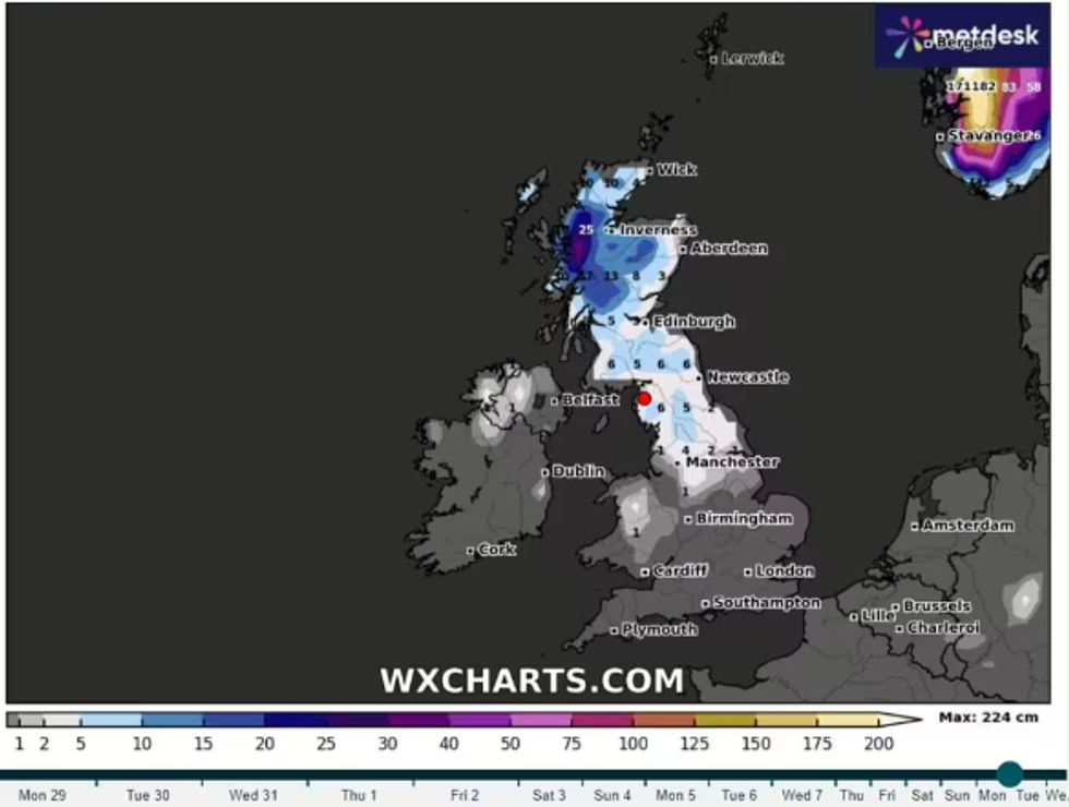
Scotland is set to see a large amount of snowfall in coming weeks
|WXCHARTS
The forecaster's long-range prediction for February states: "It will increasingly turn cold and sunny with northerly winds and potential for some snow, particularly in northern Scotland, and widespread overnight frosts."
Ian Simpson, a forecaster at Netweather said: "For the longer term, we are watching for the potential for a marked pattern shift around 5-10 February.
"When there is strong support from long-range forecast models for the high pressure to the south weakening and high pressure developing to the northwest of Britain, which would result in winds becoming predominantly northerly, resulting in much colder weather with potential for snow in some areas.
"The forecast models often struggle with blocking highs around Greenland and Iceland.
"So this is not a certainty at this range, but the medium-range models, such as the ECMWF and GFS, are increasingly tending to show potential for northerly winds to set in after around February 5."
This comes after yesterday saw the hottest January day ever in Britain.
The 19.6C record temperature was recorded in Kinlochewe, in the Scottish Highlands.
Other parts of Scotland, as well as North Wales and south west England also saw bizarre highs up to 19C throughout the day.