Temperatures over the coming days will be higher than average for the time of year
Don't Miss
Most Read
Trending on GB News
Britain faces one of the driest Novembers on record as an ‘anticyclonic’ pressure dome secures another fortnight of rainless skies.
Traditionally one of the wettest periods of the year, the run into winter threatens near-drought conditions.
A stubborn high-pressure ‘anticyclone’ wedged over the UK will keep all but the merest shower at bay.
This autumn could rival 2004, 2006 and 2007 in recording one of the driest-ever starts to November.
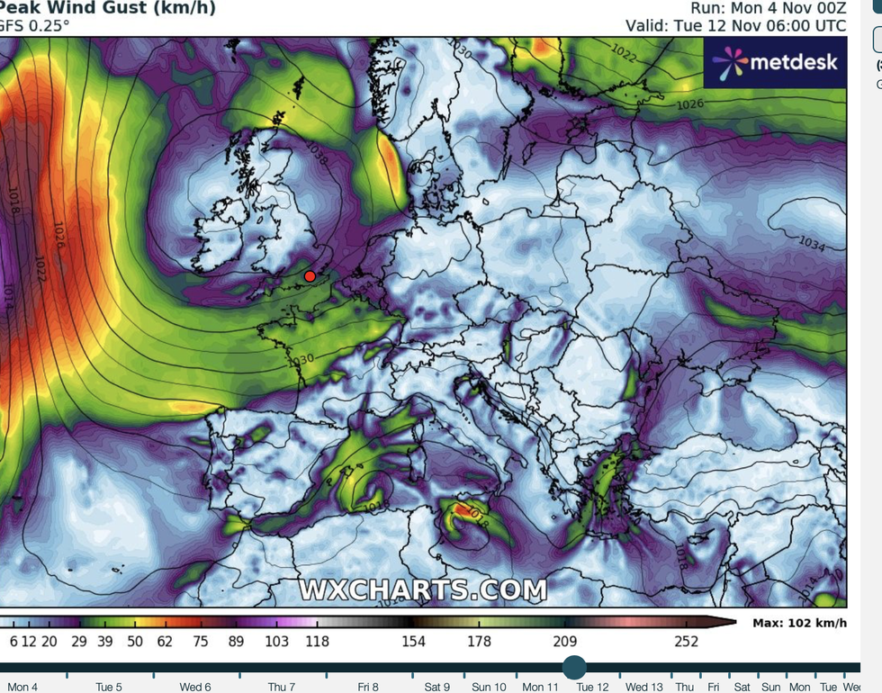
 UK weather: ‘Anticyclonic’ pressure dome threatens to break November recordWX Charts
Jim Dale, meteorologist for British Weather Services and social commentator, said: “High pressure is firmly in situ, and this is keeping anything from coming off the Atlantic, which means that for the next fortnight at least we will see no rain apart from only a bit of drizzle here and there.
“This is very unusual as November is one of the wettest months of the year, but through the start of the month, there is nothing in the forecast.
“This is going to be a very dry period and there may well be records broken, although for parts of the country which had heavy downpours later in the summer, it will bring some relief.”
The driver of the dry weather is a huge high-pressure system locked over the UK keeping stormy lows at bay.
High pressure ‘anticyclones’ lead to dry, hot weather in the summer and colder nights during the winter.
LATEST DEVELOPMENTS:- Labour blasted over 'open invitation' plan to 'fast track' migrants from Afghanistan, Iran and Syria - 'The traffickers are laughing!'
- Nigel Farage makes plea to 'long time friend' Donald Trump as voters head to polls in knife-edge election
- BBC slammed for playing Chris Kaba documentary while gang bounty remains on firearms officer

Winds circle around the UK, but kept away by the dome
WX charts
Temperatures over the coming days will be higher than average for the time of year, but chilly mornings are on the cards.
Dale said: “It will be unusually mild in parts with temperatures in the mid-teens, although there will be the risk of a morning frost in exposed regions.”
Those hoping for a wintry festive season will be disappointed with long-range experts predicting the calm weather to stick around.
Cold mornings after mild days will bring the risk of overnight fog, especially in the valleys, experts warn.

Temperatures higher than normal
WX charts
Exacta Weather forecaster James Madden said: “There are currently no storms or wintry blasts expected as high pressure and settled weather continue to dominate.
“The weather wants to be kind and mild to warm until around mid-November, with the worst conditions coming from fog and developing frosts from cold overnight conditions.”
Clearer overnight skies will lead to cooler mornings and the risk of frost in exposed regions, according to the Met Office.
North-western parts of the UK will have the greatest risk of any rain although the general outlook is dry.
Met Office meteorologist Alex Burkill said: “The same high pressure is going to continue to dominate our weather as we go through much of the week.
“There is relatively high confidence that this high pressure will stick around.
“It may take quite a while for a breakdown to develop, and so it is looking largely dry and fine, and it will be a bit fresher than the last few days.”


