


An anticyclone "smack bang" above Britain is set to bring warm and settled conditions before giving way to the remnants of Storm Boris - which has left catastrophic flooding across central Europe.
Higher pressure sweeping across the British Isles will ensure conditions remain dry and warm early this week.
However, forecasters say the anticyclone is expected to transfer to the north of the UK - allowing showers from Storm Boris to hit the southern half of England and Wales midweek and into the weekend.
It comes as heavy flooding has caused some central European countries to declare national emergencies.
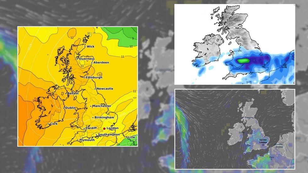 An anticyclone "smack bang" above Britain is set to bring warm and settled conditions before giving way to the remnants of storm Boris - which has left catastrophic flooding across central EuropeWXCHARTS/ Net Weather/ Ventusky
The large anticyclone will dominate much of the UK today with "fine and dry conditions".
Temperatures will remain warm for most while a northerly breeze towards Kent could bring some passing showers.
NetWeather forecaster Terry Scholey said temperatures will range from 15 to 18C in the North and 20 to 22C in the South.
By midweek, the anticyclone - which produces calm conditions - is set to move North.
LATEST DEVELOPMENTS:
Higher pressure sweeping across the British Isles will ensure conditions remain dry and warm early this week
WXCHARTS
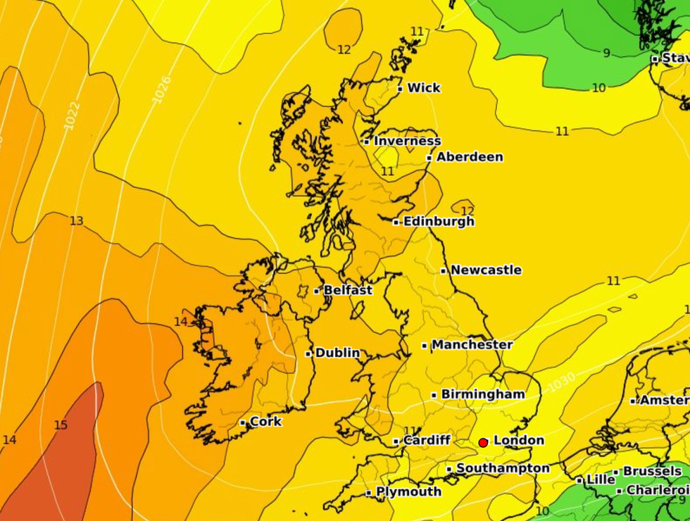
As the anticyclone moves, showers will strike southern parts but should stay mostly fine and dry further north.
Temperatures are expected to stay chilly overnight with a north easterly breeze developing across the South East that may bring some cloud later, especially towards North Sea coasts.
Scholey said: "Lowest temperatures 5 to 8C, but lower than this in some rural valleys of the North and West, perhaps giving a touch of grass frost again briefly around dawn.
"Much of the country remains fine and dry towards mid-week, but later and more particularly towards the weekend, the threat of showers from the South becomes more acute.
As the anticyclone moves, showers will strike southern parts but should stay mostly fine and dry further north
Net Weather
"An East or North East wind will also freshen, bringing quite gusty conditions and variable amounts of cloud to the East and South."
The Met Office said some of the showers over the south could at times be heavy and thundery.
A spokesperson said: "Through the weekend, similar conditions will prevail in the north of the UK, while southern parts see an increasing chance of showers, some of which could be heavy or thundery.
"Into next week, while the threat of showers remains in the south, high pressure may well become re-established from the north with settled conditions becoming more prevalent once again, albeit cooler than at the beginning of the period."
