


A tropical anticyclone about to lock horns with storms heading in from Europe will unleash an explosive late-spring deluge.
Thunder, lightning and torrential downpours are back on the menu as the weather ‘swingometer’ throws the taps back on.
Government storm warnings have been issued ahead of mid-week with further wind and rain forecast through the end of May.
The Azores High – an ‘anticyclonic’ high-pressure system in the sub-tropical Atlantic which drives hot weather – will be nudged away by low pressure from the east.
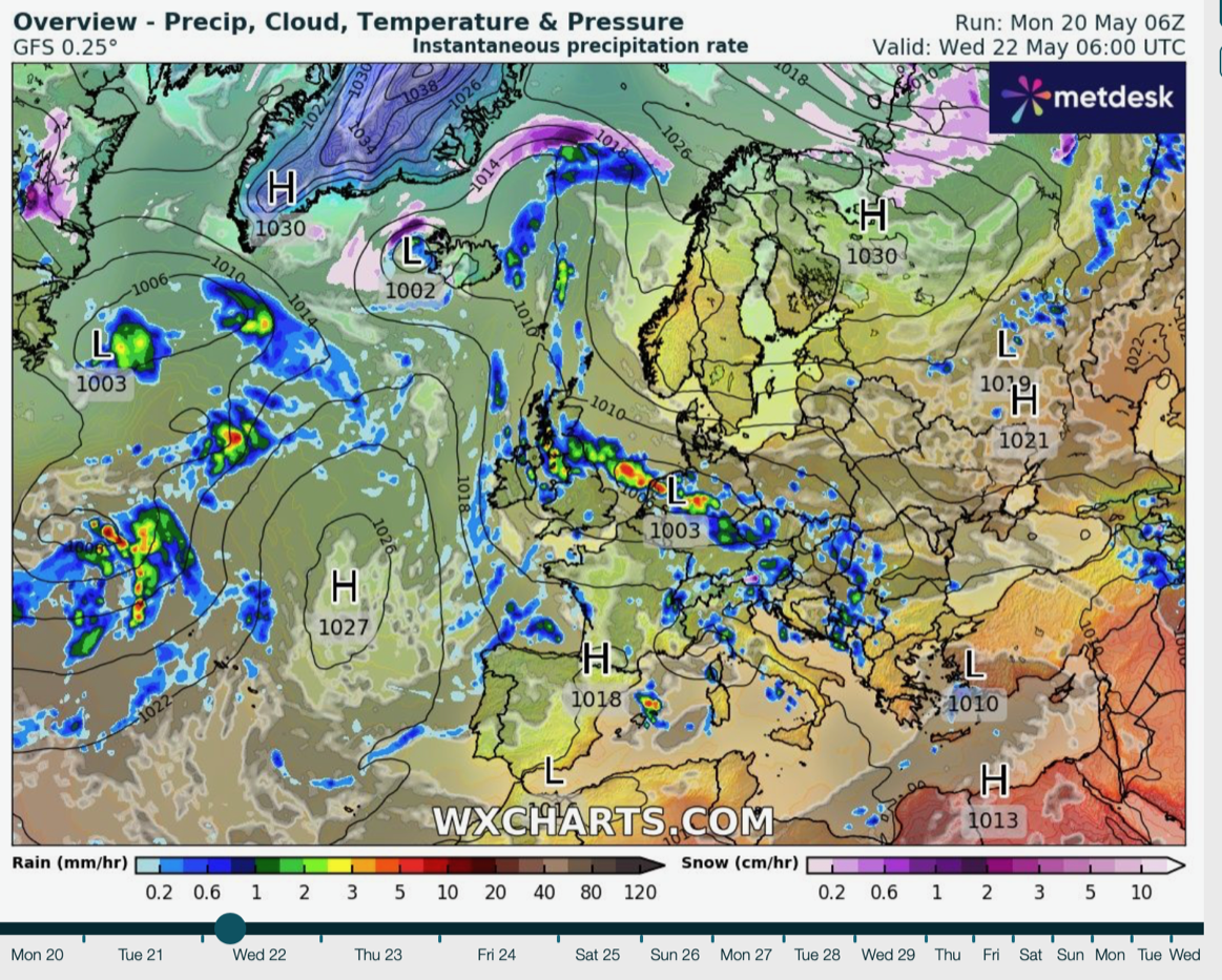
High pressure battles low pressure
|WX charts
The ensuing battle between high and low pressure through late May will pendulum swing Britain’s weather between sunny and spiteful.
Jim Dale, meteorologist for British Weather Services and social commentator, said: “The Azores High is pushing in from the southwest, but with low pressure coming out of Europe, there will be a battle between the two, and we are once again at the mercy of the swingometer.
“Through the week, and towards the weekend, it looks like low pressure will win.
“Unfortunately, this means we could be back to square one, with a mid-week splash on the way bringing thundery downpours.”
LATEST DEVELOPMENTS:Temperatures will hover in the high teens or low-20Cs through the coming days, he said.
A duo of volatile weather fronts sweeping through at the weekend will bring a further risk of wind and rain, he added.
He said: “The first front comes through on Saturday, and so it looks like the wet weather will return.
“In terms of temperatures, we are not looking at anything out of the ordinary, around 19C, 20C or the low 20Cs, which is around the seasonal average.”
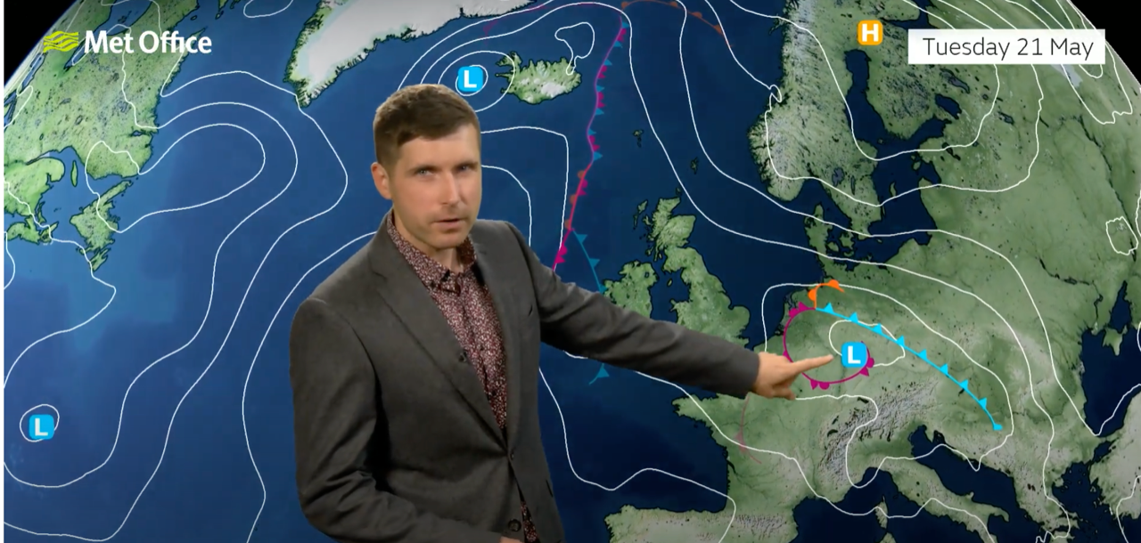
Alex Burkill warns low pressure will bring unsettled weather
|Met Office
The Met Office last night warned of further weather misery this week, putting the west country and Northern Ireland under a thunder alert.
Lightning strikes, strong winds, heavy rain and hail threaten floods, damage to buildings and power cuts.
A large pressure low from the east will spin into the UK whipping up foul weather through mid-week, the Met Office warned.
Deputy chief meteorologist Dan Rudman said: “Low pressure is going to influence our weather from the middle of this week, bringing some heavy rain to parts of the UK.
“Eastern areas are most likely to see the highest rainfall accumulations, though this will depend on the precise positioning of the low pressure.
“It is important to keep an eye on the forecast as the detail becomes clearer, and it is possible Severe Weather Warnings will also be issued.”
Met Office meteorologist Alex Burkill added: “Our attention turns towards an area of low pressure that is developing across Europe, and that is going to push its way westwards towards the UK.
“There is some uncertainty as to how far west it is going to get, and that plays a part in how much rain we see on Wednesday.
“But it does look likely that we are going to see some pretty heavy persistent rain especially across eastern parts as we go through the day.”
Winds in the west will pick up through the middle of the week and it will turn cooler, he explained.
He said: “Temperatures do look like they will be a degree or so down compared to Tuesday and Wednesday.”