


The Met Office has issued an urgent weather warning as snow and ice are set to batter the UK.
A 283-mile blizzard is due to sweep over parts of Britain, with new weather charts showing a deep blanket of snow lasting in certain areas for up to ten days.
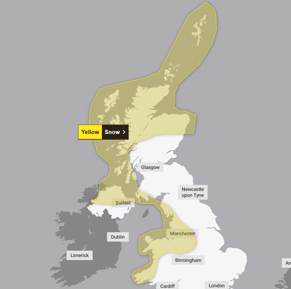
The weather office has issued a yellow snow and ice weather warning across parts of Scotland, northwest England, parts of Wales and the West Midlands.
It comes into effect on Wednesday at 12.00am and lasts until 11.59pm on Thursday.
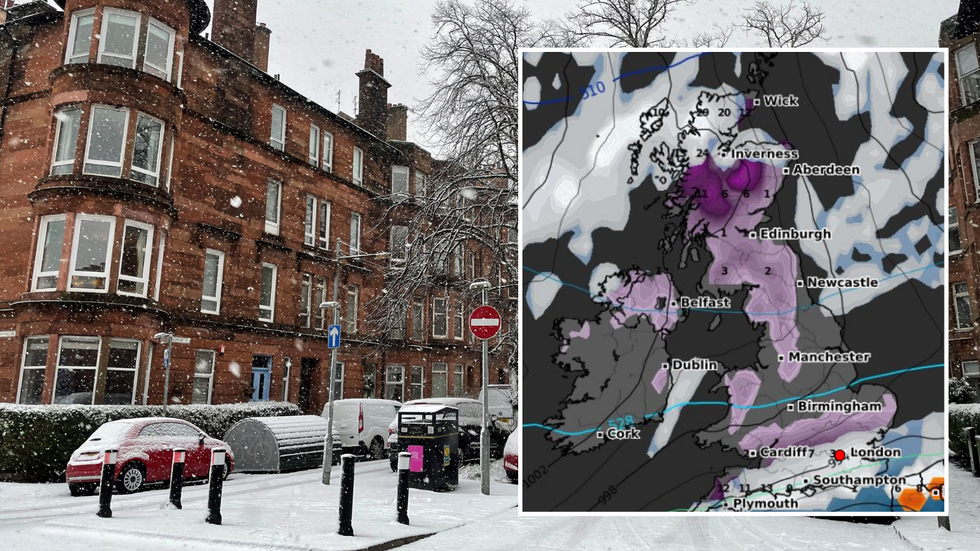
UK snow warning: Urgent alert issued by Met Office as 283-mile blizzard strikes
|PA/WX Charts
The Met Office has cautioned that disruption is likely, as the blanket of snow, which is expected to be as thick as 20cm in some areas, covers the UK.
In their latest alert, the weather office said that some roads and railways will be impacted by the snow.
Power cuts could also occur, and Britons facing the worst of the frosty conditions should brace themselves for patchy mobile phone coverage.
The Met Office also warned that as the blizzard sweeps over the UK, there is a “slight chance that some rural communities could become cut off”.
WEATHER LATEST:
The warning comes into effect on Wednesday at 12.00am and lasts until 11.59pm on Thursday
|Met Office
Travellers should also be aware that roads covered in snow could lead to vehicles and passengers becoming stranded.
In their latest update, the Met Office said: “The heaviest and most frequent snow showers will be across northern Scotland during Wednesday morning, before developing across parts of southwest Scotland, Northern Ireland, northwest England and Wales later in the day.
“Snow showers are likely to continue during Wednesday night and well into Thursday. Whilst accumulations will vary due to the nature of showers, 2-5 cm of snow is expected in many places.
“Where showers become more organised, there is a chance some low-lying areas could see 10 cm in a few hours. Across northern Scotland over 20 cm of snow could build up in a few locations.”
The warning is the latest in a series of cold weather alerts the Met Office has issued for the forthcoming week.
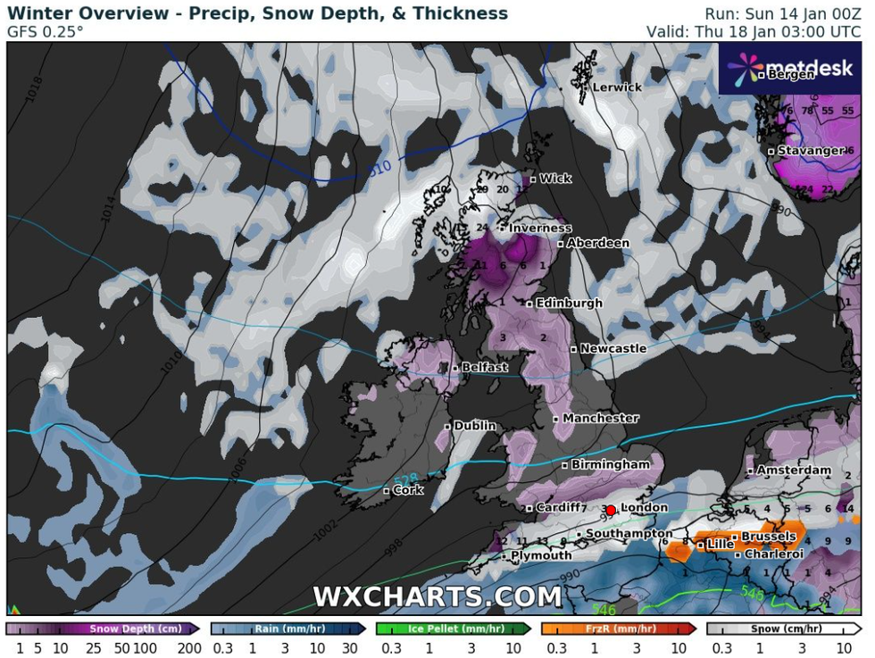
Weather maps from WX Charts indicate that parts of the UK could see snow up to 20cm
|WX Charts
The first began today at 12.00am, with the weather office warning that the perilous icy conditions could result in slips and falls.
Scotland is the first to be hit by the unrelentless cold spell, which will see mercury barley reaching zero over the coming days.
Weather maps from WX Charts indicate that parts of northern Scotland could see around 10cm of snow over the next two days.
The weather warnings continue until Thursday, with the affected regions impacted by the snow growing day by day.
By Tuesday, the snow is set to have settled in northern England, whilst come Wednesday, the south will feel the brunt of the cold blanket.
Up to 11cm of snow an hour will fall in parts of Cornwall and Devon. And even after the snowfall stops, the ground will be covered in up to 12cm of white for days to come.
WX Charts suggest it won't be until heavy rain fall in ten days time that the last of the snow is wiped away.