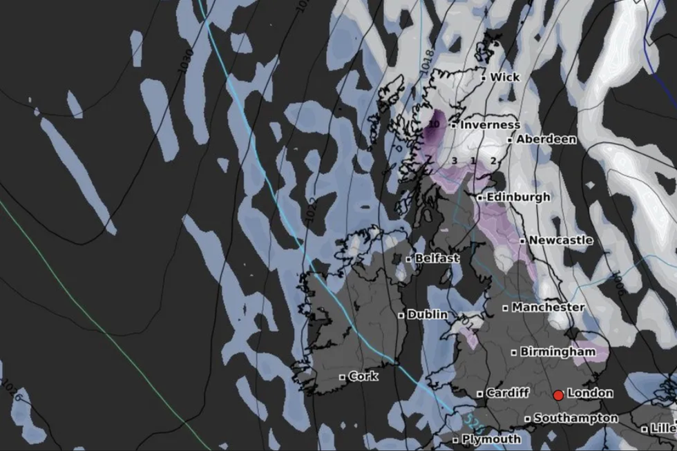
Temperatures are set to be bitterly cold at the end of December
WXCHARTS
The snow is set to travel from Scandinavia on Friday, December 22 at around 6pm
Don't Miss
Most Read
Trending on GB News
New charts have revealed a 'snow wall' could hit parts of the UK on Christmas Eve, setting up the possibility of a White Christmas.
The map, published by WXCharts, shows a wave of wintry showers coming in from the Nordic countries in the week before Christmas.
It comes as the Met Office is forecasting a period of unsettled weather for weekend before Christmas and into the last week of December.
The festive period is set to be wet and windy for most, however there could be snow.
WATCH: The latest weather forecast for GB News from the Met Office
The snow is set to travel from Scandinavia on Friday, December 22 at around 6pm.
According to WX Charts, there is expected to be snowfall of ten inches on Saturday, December 23 around Inverness and the Scottish Highlands.
Wintry showers are set to travel along Eastern coastlines with snowfall possible on Christmas Eve in Edinburgh and Newcastle.
It comes as the Met Office has warned of a possibility of more snow and ice over the Christmas and New Year period.

Snow is set to hit the country from the Nordic countries
WXCHARTS
A spokesperson from the Met Office said: "Most likely to be unsettled with further bands of rain crossing the UK with brighter conditions and showers in between.
"The wettest and windiest conditions are most likely in the west and northwest.
"The chance of a colder spell of weather, with hazards such as snow and ice, does increase later in December and into the New Year period.
"However, conditions are more likely to remain generally mild and wet."
Officially, The Met Office counts it as a White Christmas if one snowflake falls in the 24 hours of 25 December somewhere in the UK.
According to the Met Office, there was no snow recorded in 2018 or 2019.
The last widespread White Christmas came in 2010, when there was snow at 83 percent of stations in the UK.
This was the highest ever amount recorded.


