Cold arrives later in November with the threat of snow
WX Charts
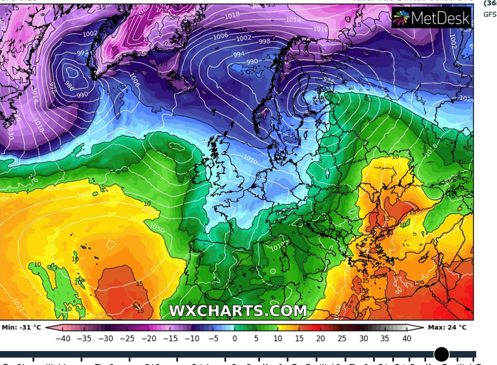
The first proper cold winds of the season are due to encroach from the north this week
Don't Miss
Most Read
Trending on GB News
Britain could be weeks away from the first snow blast of the season as fears mount of a possible repeat of last year’s early winter freeze.
A strengthening Polar Vortex reportedly showing signs of possible collapse similar to the 2018 Beast from the East could drive months of snowfall.
Meteorologists are also watching a potential Sudden Stratospheric Warming (SSW) event, another ingredient of extreme cold and snowy weather in the UK.
Weather patterns building over Greenland and the Arctic circle suggest winter could deliver its first blow during November with snow possible until the end of the year.
It raises the chilly spectre of last year’s cold snap, which ground swathes of the nation to a near standstill at the start of December.
James Madden, forecaster for Exacta Weather, said: “The first proper cold winds of the season are due to encroach from the north this week, and then, while there are still a number of important factors that need to play out, we cannot entirely rule out some early snow from mid- to late-November and into December.

Cold weather will be returning to the UK with a bang
WX Charts
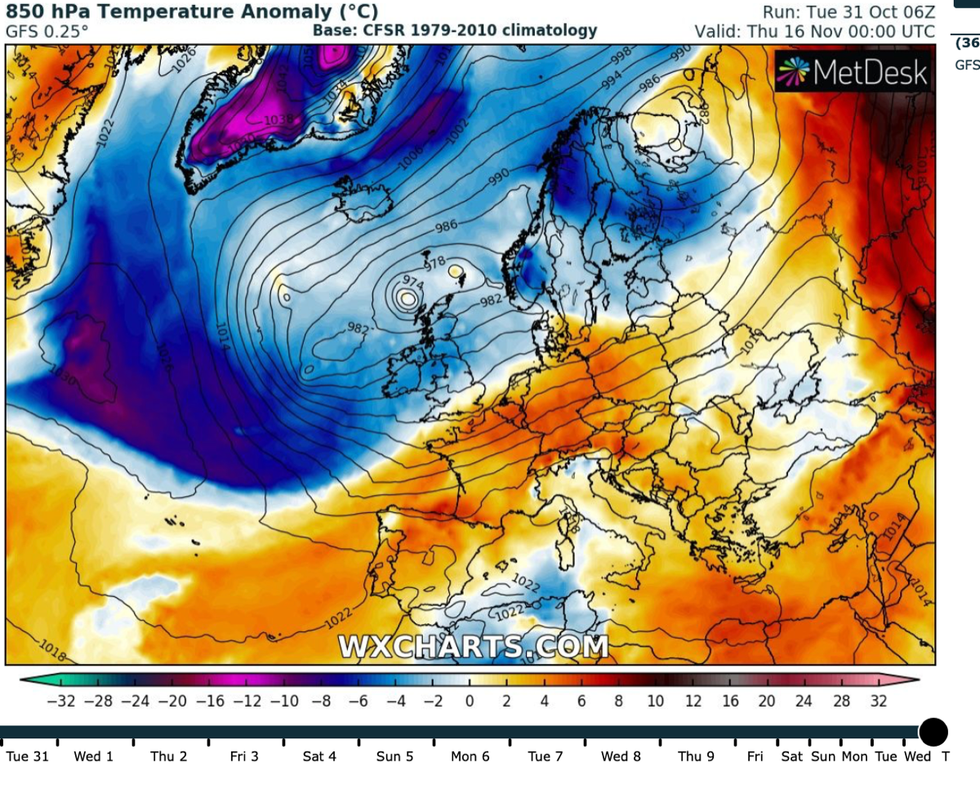
“Events we will be looking at are a blocking area of high pressure building in Greenland, and expansion of snow across the Arctic regions and Europe.
“While this so called ‘Snow Advance Index’ is currently near to below-average, it can often change drastically in November to give some strong indicators down the line.
“However, there is a chance we could see a number of wintry blasts in the run up to Christmas.”
Experts say a SSW event is possible this year, which would open the gates to repeated snow blasts through the coming months.
The phenomenon is caused when winds high over the North Pole slow or even change direction, causing air to fall and warm, pushing the polar front southwards over north Europe.
This was the main driver behind the 2018 Beast from the East which saw bitter winds and heavy snow in late winter blanket the nation.
While there is nothing yet to suggest a repeat, forecasters say long-term climatic and meteorological events, such as the onset of El Nino, could raise the chances.
One such event is the current strengthening of the Polar Vortex, the body of cold air which surrounds the Nort Pole.
A rapid strengthening can play into a SSW event, which are also more usual during El Nino years, according to Federico Di Catarina, a meteorologist for Weather and Radar USA.
He said: “As the current polar vortex over the North Pole continues to strengthen this year, it's crucial to be aware of its potential impacts”
Britain may be in for a colder than usual start to winter, according to the government’s long-range outlook.
Met Office forecasters say the chance of a cold snap between now and January is ‘higher than for equivalent periods in many recent years’.

Cold air sweeps in mid-month
WX Charts
Cold weather impacts from snow and ice are ‘possible’ according to the Met Office’s three-month contingency outlook.
While wetter, milder conditions are possible early in the season, the risk of colder weather rises during the start of next year.
The report blames a combination of a strong El Nino, favouring of easterly winds, and a general change in the climate.
A Met Office spokesperson said: “The likelihood [of cold] is higher than has been typical for this period over many recent years.
“Therefore, the impacts from cold weather remain possible throughout the period but are more likely later in the period.”
Bookmaker Ladbrokes has slashed the odds to 1-2 of snow in November, with a White Christmas now 6-1.
Spokeswoman Nicola McGeady of Ladbrokes said: “With temperatures set to nosedive, we are bracing ourselves for a big freeze, with the odds falling on snow before the month is out.”


