


The remnants of Hurricane Kirk are set to batter into Britain, sending temperatures plummeting and bringing snow.
According to data from the Met Office, the middle of October is set to see unsettled weather, with frequent bouts of wind and rain.
Low pressure systems tracking in from the Atlantic are expected to bring difficult conditions to much of the country.
Scotland and Northern Ireland will bear the brunt of the harsher weather, with snow in the mountains.
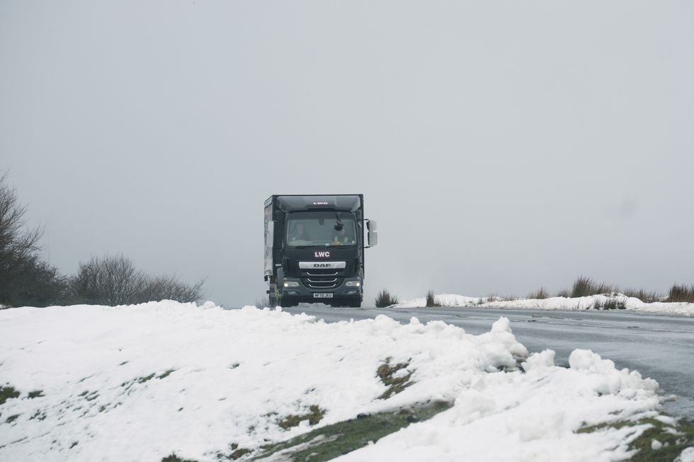
Britain could see some snow later this month
|PA
Scotland will also bear the brunt of the cold, with the mercury plunging to as low as -2C on October 13 according to WXCharts.
The cold conditions are expected to work their way south as the month progresses.
England and Wales are set to be hit with wet and windy weather at times.
Weather expert Jim Dale, senior meteorologist and founder of British Weather Services, described the unsettled weather as “one to watch”.
LATEST DEVELOPMENTS:
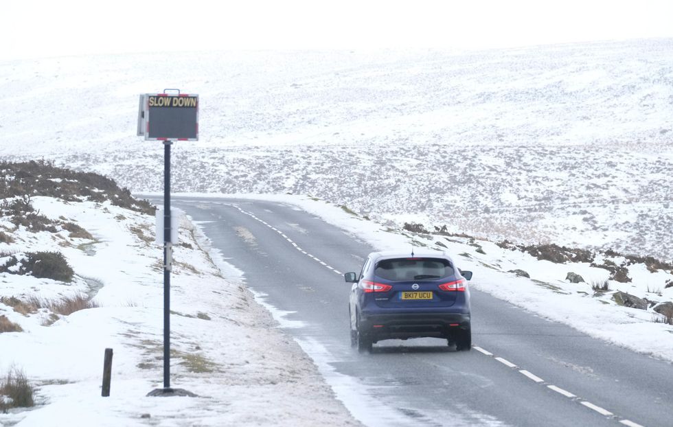
Scotland and Northern Ireland will bear the brunt of the harsher weather, with snow in the mountains
|PA
He told BirminghamLive: “It’s the cold backside of ex-hurricane Kirk, which by then may have become Storm Ashley.
“As it moves through England and Wales and out into the North Sea on October 11 and October 12, that cold air surges in behind giving the potential of some temporary wet snow especially over higher ground.
"However, long ways to go with the steerage on all of that and strong winds/heavy rain from that system are likely to be the first points of concern.”
In addition to the unsettled weather, the Met Office has announced the potential for aurora visibility in parts of the UK over the next few nights.

In addition to the unsettled weather, the Met Office has announced the potential for aurora visibility in parts of the UK over the next few nights
|PA
This celestial display, though not expected to be as bright as the aurorae which stunned Britons earlier this year, is linked to recent spikes in solar activity.
Met Office Space Weather Manager Krista Hammond said: "There is the potential for a coronal mass ejection to arrive at Earth late on Friday or early on Saturday, which could lead to visible aurora for Scotland, Northern Ireland and parts of northern England."
Hammond added: "In addition, we recently observed an X9 solar flare – the largest of this solar cycle so far.
"The accompanying coronal mass ejection is likely to arrive at Earth overnight on Saturday into Sunday, meaning that enhanced auroral visibility is possible further south across central England and similar latitudes, though cloud and rain could hamper viewing potential for some."