The latest weather maps from WX Charts indicate that snow looks set to hit the UK from Thursday Febraury 8 onwards
Don't Miss
Most Read
Trending on GB News
Snow is blanket parts of the UK within just days as new weather models point to an Arctic blast descending next week.
Snow could fall from next Thursday and into the weekend as unsettled conditions strike.
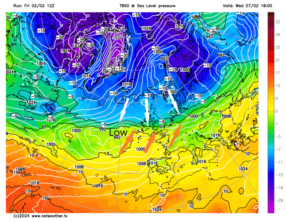
NetWeather's Nick Finnis said: "Although it will be mild through into early next week, it does look like it will turn colder from the north later next week, perhaps with some snow in places, as Atlantic lows moving into the colder air create battlegrounds somewhere over the UK.
"It looks like the cold air will win out by next weekend, but how long it stays cold and whether there will be further snow, remains very uncertain for now."

Arctic weather is sweeping in near the end of the week
NETWEATHER
He explained that near the end of the week, cold Arctic air was set to sweep in and impact parts of the country.
"How far north or south the low track east or northeast will determine how far south the cold arctic air gets," he added.
"Most favoured areas appear to be central or northern areas.
"But if the low tracks further south, it could end up being central or southern areas – but a lower risk for these areas for now."

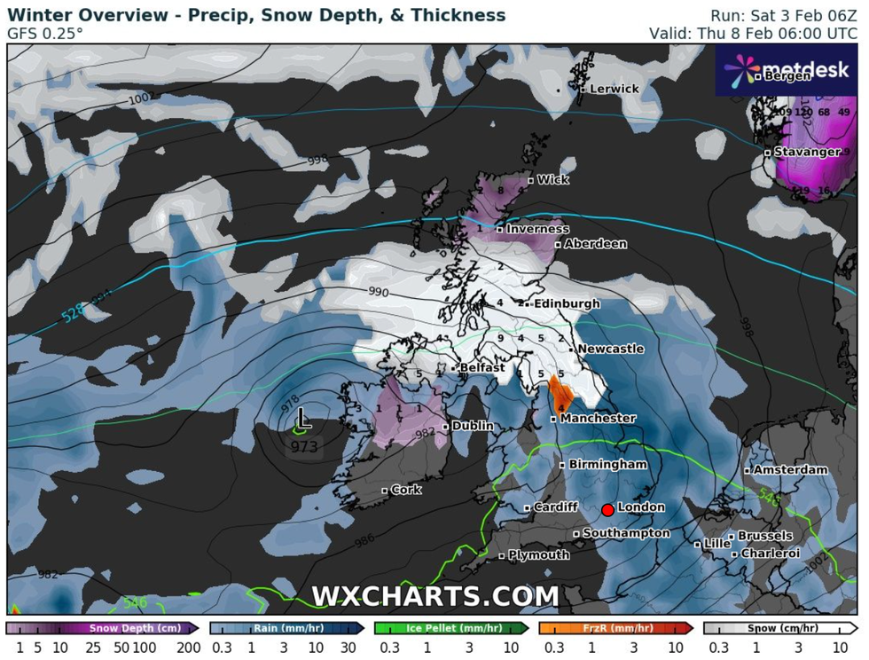
Weather maps show that snow will start to hit the UK next Thursday
WX CHARTS

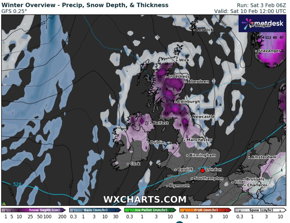
The snow will continue to sit blanket parts of the country for a number of days
WX CHARTS
He explained that while there was "definitely a signal for snowfall later next week", the uncertainties in the models meant "where and exactly when is uncertain".
The latest weather maps from WX Charts indicate that snow looks set to hit the UK from Thursday February 8 onwards, with snow hitting Scotland all the way down to Manchester.
Snow looks set to continue to lie on the ground for a number of days.
The Met Office's long range weather forecast for Wednesday February 7 to Friday February 16 says: "Initially unsettled with cloud and rain across a still mild south whilst clearer and colder conditions across the north with some wintry showers in the far north.
"Rain likely pushing back north late in the week with potential for snow for a time across the northern edge of this alongside gusty winds.
"Through the weekend a change toward a north or north-westerly wind will bring cold conditions spreading across the UK with wintry showers across coasts but clearer inland as rain clears southeast.
"A further change of type expected by mid-week as high pressure becomes increasingly dominant allowing winds to drop.
"Temperatures potentially recovering to average with this, though any prolonged clear skies liable to bring localised frosts and fog risk."


