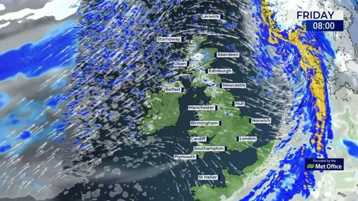
A long-range forecast predicts a deep freeze is set to sweep across Britain
Don't Miss
Most Read
Trending on GB News
Heavy snow is set to strike Britain as sub-zero blizzards could batter the UK, according to the latest weather maps.
A low pressure zone is expected to drag freezing air from Scandinavia across Britain, plunging temperatures as low as -10C.
A long-range forecast predicts the deep freeze will hit the UK from February 11.
According to WX Charts, heavy snow threatens to blanket huge swathes of Britain as the cold snap hits.
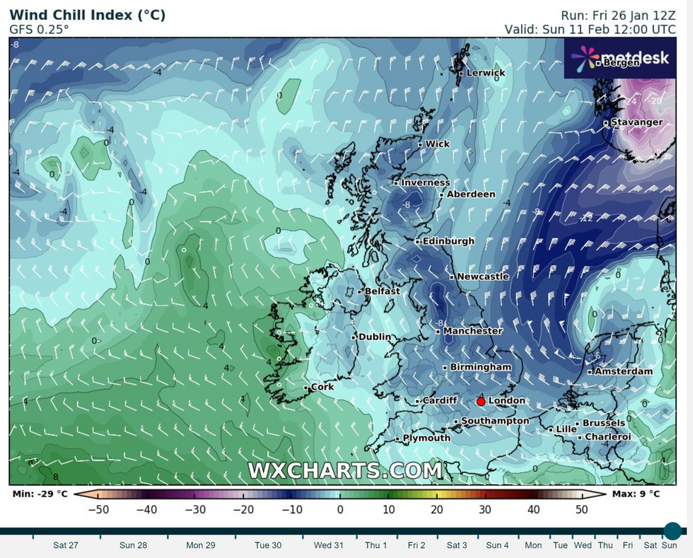
A band of low pressure is expected to sweep across Britain from Scandinavia, bringing temperatures as low as -10C
WXCHARTS
Snow looks set to fall across Scotland, Northern Ireland, Wales, northeast and northwest England.
A wave of blizzards also looks set to bring a -10C chill in parts of Scotland and northern England.
Milder temperatures experienced in recent days might not last long, with colder spells expected between February 8 and February 22.
A Net Weather spokesperson said: "The weather will start off fairly mild with variable cloud and mostly dry away from northern Scotland.
LATEST DEVELOPMENTS:
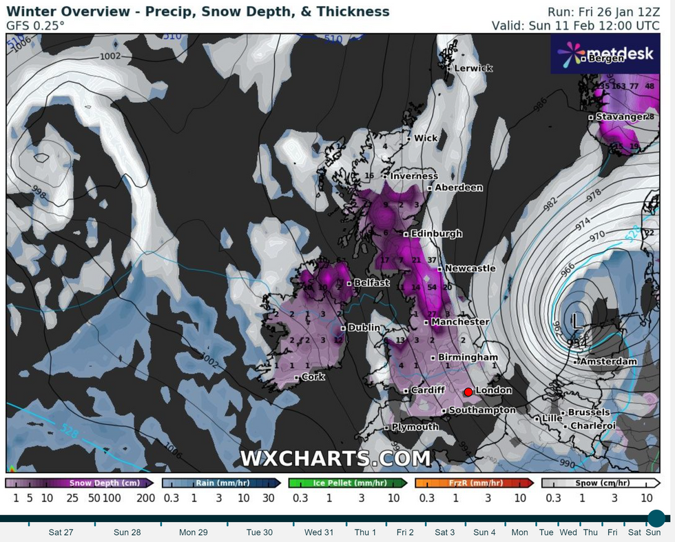
Heavy snow is set to strike Britain as sub zero blizzards batter the UK, according to the latest weather maps
WXCHARTS
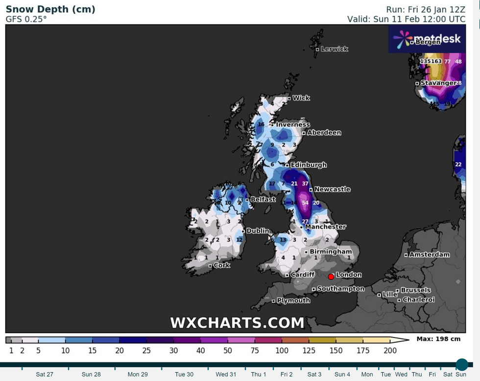
According to WX Charts, heavy snow threatens to blanket huge swathes of Britain as the cold snap hits
WXCHARTS
"But will increasingly turn cold and sunny with northerly winds and potential for some snow, particularly in northern Scotland, and widespread overnight frosts."
The Met Office's forecast from February 8 to February 22 suggests snow could return to the UK.
Weather maps suggest that as we enter the mid-February period, temperatures could drop sub-zero again.
The Met Office said: "Through the middle of February, changeable conditions are most likely with the wettest and windiest conditions in the north and northwest.
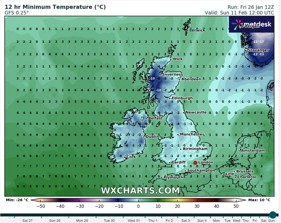
A wave of blizzards also look set to bring a -10C chill in parts of Scotland and northern England
WXCHARTS
"It is likely to be drier further southeast, although some wet and windy spells are still possible here.
"Later in the month there is an increasing likelihood of winds from the north or east, which will increase the chance of some colder spells and perhaps snow."
It follows a brutal stint for Britain which has been battered by relentless barrages of wind and rain.
Gale-force winds and heavy rain led to power cuts, disruption to travel and flooding.

