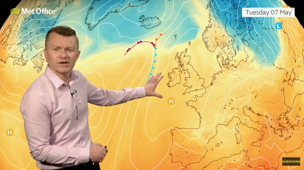
Warmer temperatures will arrive in the UK this week
NET WEATHER
The Met Office said there will be "plenty of hazy sunshine and dry weather"
Don't Miss
Most Read
Trending on GB News
A taste of summer will bring the hottest day of the year so far this week pushing temperatures almost 10C above normal.
Months of wet and windy weather are about to give way to a lengthy blast of sunshine and blue skies.
High pressure, the harbinger of summer warmth, will call time on the persistent barrage of low-pressure storms.
Thermometers in parts could hit 25C ahead of the weekend, with even the wind-battered north about to dig out summer hats.
Met Office meteorologist Greg Dewhurst said: “It is good news for many parts of the UK as high pressure is building and settling the weather down.
“At the end of the week, high pressure holds on and weather fronts stay away from the UK, so it will be another settled day for Friday.
“There will be plenty of hazy sunshine and dry weather, with temperatures 22C or 23C, and even further north temperatures rising close to 20C as a sunnier day is expected on Friday.
“The average in the south at this time of year should be around 17C, so above average for many of us.”
Hot weather, however, will send UV and pollen levels soaring sparking warnings for hay-fever sufferers.
A tree-pollen surge at the start of the season will be compounded by grass pollen as it emerges later this week.

The Met Office's Greg Dewhurst describes high pressure building to drive up temperatures
MET OFFICE
Dewhurst said: “In the sunshine, UV will get to high– level six– for many central and southern parts, further north it will be moderate.
“Pollen levels will continue to rise further, and grass pollen will become more dominant across southern parts of England and Wales.
Into the weekend, high pressure is just about holding on, and that brings in some warmer air and temperatures could rise a little further into the weekend, and some of us could see 24C or 25C .”
High pressure, which drives clear skies and sunshine during the spring and summer, has been unusually absent since last summer.
Instead, low pressure, strengthened and steered into Britain on the jet stream, has dominated the weather.
Since September, the UK has been battered by 11 named storms, with numerous smaller low-pressure systems keeping the wash cycle on spin.
A large area of high pressure, or ‘anticyclone’, will build from the south through the coming days.
Jim Dale, meteorologist for British Weather Services and social commentator, said: “At long last, high pressure is going to start to build, and this is something that we haven’t seen at least since January, if not for longer.
“I expect this to build from mid-week, and we will see temperatures build and some pleasantly warm weather.
“We are not yet talking heatwave, but temperatures by the end of the week in parts are likely to reach 25C.”
Rising thermostats have prompted bookies to slash the odds on a record run-in to summer with Coral offering 1-2 from 6-4 on a record May.
Spokesman John Hill said: “The outlook for the rest of the month is looking quite positive, so we have slashed the odds on this ending as a record-hot May.”
Exacta Weather forecaster James Madden added: “The first major warm spell of the year is set to develop almost immediately on cue, and the rest of May is looking pretty good too.
“We will see high pressure move in next week to deliver a largely warm, sunny, and settled spell of weather for most, if not all parts of the country.
“Temperatures will exceed the 20 Celsius mark quite widely from around Wednesday, and it is plausible maximum temperatures could hit or exceed 25C.”


