


Storm Lilian will usher a Bank Holiday weekend of autumnal wind and thundery downpours before summer surges back for a last fling.
Lilian became the twelfth named storm of the season on Thursday night, swept in from the Atlantic on an ‘active’ jet stream.
Cooler wetter weather will hang on in the north through the start of the weekend while a nationwide split pushes temperatures in the south into the 20Cs.
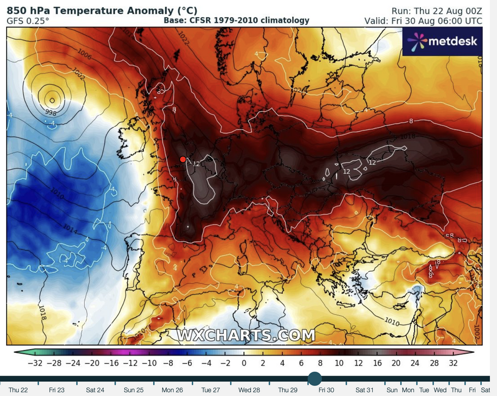
However, sun-starved Britons can look forward to summer’s sizzling comeback at the end of August as tussling pressure patterns will give way to a sultry tropical surge.
UK weather: Summer to make sizzling comeback but not before spell of thundery downpours
WX charts
Met Office meteorologist Annie Shuttleworth said: “Next Friday, low pressure is still centred to the north and west of the UK with high pressure more widely across the UK.
“We could start to see warmer air moving up from the south and the west, and that means it looks quite a bit warmer than this week and next week.
“So, there are some improvements to come before summer is out.”
It will mark the end of a generally lacklustre summer which has paled in comparison to the scorchers of the last few years.
LATEST DEVELOPMENTS: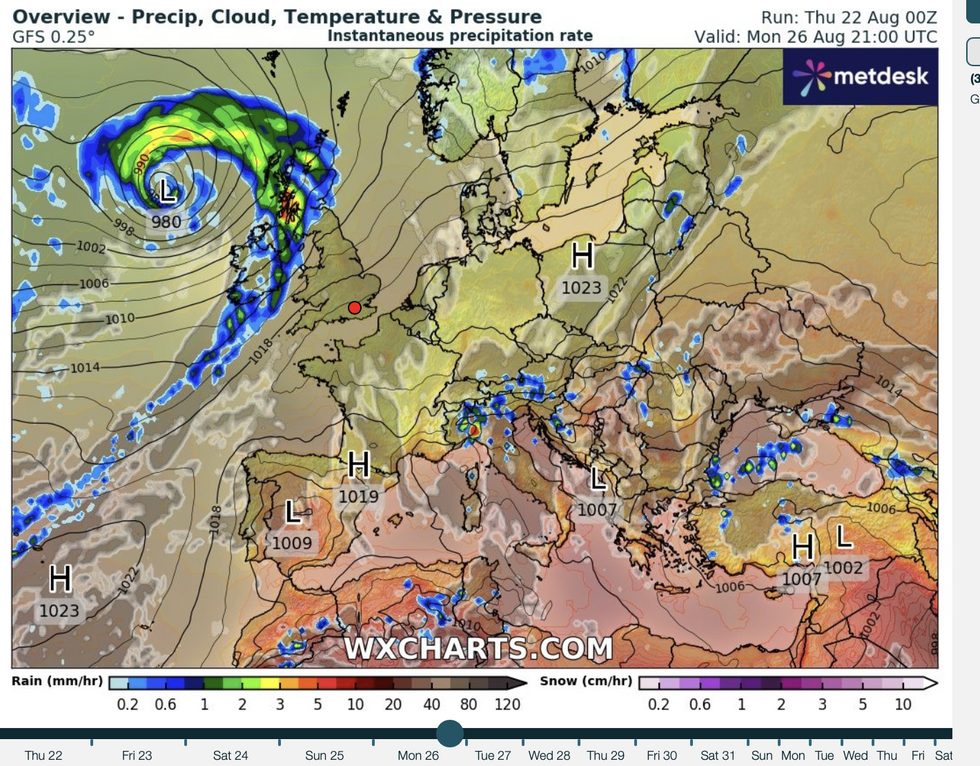
But low pressure swirls to the north
WX charts
The last week of August took a stormy turn last night as Lilian swept in at short notice, dishing up torrential downpours and gale-force gusts.
Throughout summer, temperatures have hovered around average, with the last three months bringing only the odd hot spell.
The August bank holiday looks to follow suit with a wet and windy start to the weekend on the cards.
Things will improve through the next three days, although warmer weather will be confined to the south.
Shuttleworth said: “It is going to be a fairly unsettled start to the bank holiday weekend, but things will improve as the weekend goes on as an active area of the jet stream sweeps away to the east of the UK.
“On Monday, another area of the jet stream will develop the next area of low pressure to bring some further wet and windy weather to the north and west but many eastern and southern areas will remain fairly dry.
“After a fairly disappointing week, it is going to stay fairly cool through the weekend for most of us with cool air over the UK.”
Rain will sweep off the Atlantic in bands through the next week driven in part by the remains of a tropical hurricane.
Ex-Hurricane Ernesto arrived on the jet stream mid-week to deliver strong winds and heavy rain.
The remains of the storm will pass to the east of the country through the weekend, leaving an autumnal legacy.
Southern Britain will enjoy the best of the weather next week, with a greater risk of rain elsewhere.
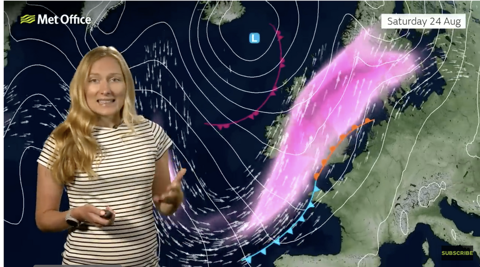
Met Office’s Annie Shuttleworth describes how the jet stream will drive the weather
Met Office
Jim Dale, meteorologist for British Weather Services and co-author of ‘Surviving Extreme Weather’, said: “There is a general theme for the next week of rain off the Atlantic.
“Ernesto kicked off a conveyor belt, and this will continue into the latter part of the month.
“However, there is every chance of another burst of better weather later on, with September the new summer month.”
Exacta Weather’s James Madden added: “There are signals for another heat surge during late August with a significant pattern switch to bring some warm to very hot weather during the end of the month and into September.”
