


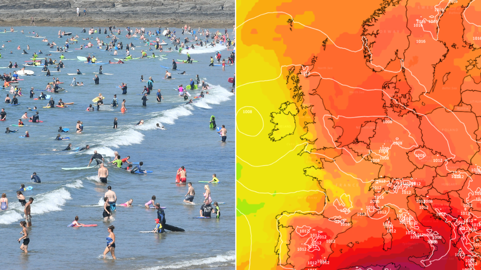
Britons hoping for a hot summer will rejoice as the first hot spell of the season will commence next week, with temperatures of a scorching 30C and above predicted.
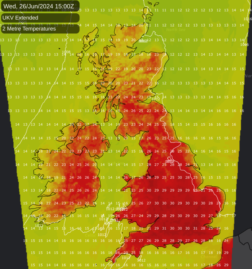
In the first half of the week, “there will be plenty of dry and sunny weather”, with London’s mercury reaching a high of 31C on June 26, according to forecaster Netweather.
It comes after the Met Office and the UK Health Security Agency (UKHSA) jointly issued a yellow heat alert across England. It begins on June 24 and lasts until June 27.
The North West, Yorkshire & Humberside, East Midlands, West Midlands, East of England, London, South East and South West all face yellow heat warnings.
 Next week will see scorching temperatures of over 30CPA/Netweather
The North East is the only English region where no alert has been issued.
Ian Simpson from Netweather said that the heat will be felt particularly strongly during the night time, which will make “cooling off difficult overnight”.
He said: “Some warm and sticky nights are indeed expected during this coming week because, to begin with, we will be bringing in some warm, moist tropical maritime air from the southwest, which tends to be mild and muggy.
“This also means that it won't be unbroken sunshine for most of us, although away from west and south-facing coasts, it will likely become predominantly sunny. From around Wednesday onwards, as the winds swing around to more of a south-easterly direction, eastern coastal areas will become more prone to low cloud coming in off the sea.”
WEATHER LATEST:
Looking to the second half of the week, the forecaster predicts it will get chillier as cooler air moves in from the west. However, if the hot weather extends further, Simpson predicts the hot plume of scorching air will bring temperatures in the low to mid 30s.
Looking ahead from Sunday to Tuesday, the Met Office said: “High pressure building to bring a lot of dry and sunny weather from Sunday.
“Becoming more widely very warm next week, locally hot and humid for some by Tuesday.”
Dan Rudman, a Met Office Deputy Chief Meteorologist, said that temperatures could reach a peak on Wednesday. He said: “After a brief, less settled interlude today and tomorrow, fine conditions will return by Sunday and into the beginning of next week. For much of the UK this will be accompanied by a boost in temperatures with many places reaching the mid-20Cs.
Ian Simpson from Netweather said that the heat will be felt particularly strongly during the night time, which will make 'cooling off difficult overnight'
Netweather
“Some central and southern areas are likely to see temperatures approaching the values needed for heatwave conditions. Heatwave conditions need to remain in situ for three consecutive days, and by the beginning to middle of next week it is possible that some parts of the UK could be reaching heatwave thresholds.
“However, whether or not everyone experiences heatwave thresholds, the majority of the UK will experience the highest temperatures so far this year.”
The warm weather will come as welcome relief for many, after Britons have faced a June plagued with downpours and cooler weather.
This year’s spring has been England’s fifth wettest, which saw 32 per cent more rainfall than average.
