Jim Dale, meteorologist for British Weather Services, said it was a "classic heatwave situation"
Don't Miss
Most Read
Trending on GB News
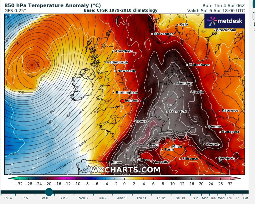
A plume of heat sucked out of Africa by Storm Kathleen this weekend will push the mercury towards a summer-like 70F.
‘Heatwave’ conditions baking central Europe and the southern Continent will brush northern Europe raising temperatures across Britain.
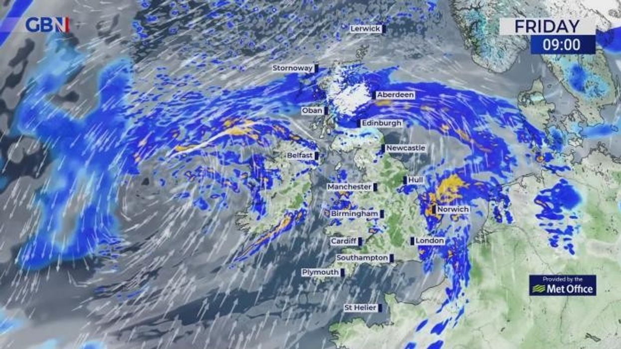
Warmth will be driven in part by a powerful storm set to unleash 70mph gales, rain and snow over the next 48 hours.
Kathleen, named by Met Eireann, will barrel into Britain ahead of the weekend, prompting the UK Met Office to issue a raft of severe weather warnings.
When the storm passes to the north, however, it will join forces with high pressure to the south to sweep in a burst of tropical warmth.
Jim Dale, meteorologist for British Weather Services and social commentator, said: “This is a massive waft of air coming out of Africa in the wake of Kathleen, partly because of the storm’s movement to the north of the UK, and partly because of high pressure to the south.

Plume of warm air spirals round Kathleen and into the UK
WX CHARTS
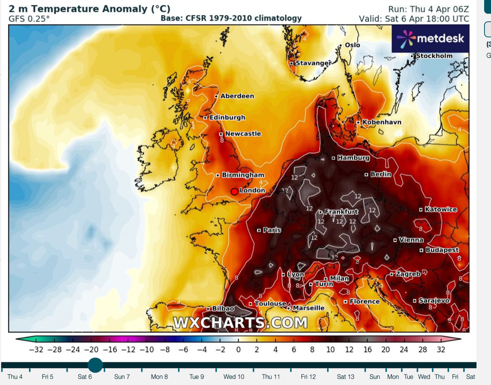
“The real heat is going to be over the Continent, with heatwave conditions over central Europe, and the UK is just on the edge of that, meaning we could see temperatures of 20C or possibly higher by the end of the weekend.
“This is a classic heatwave situation, and if we were a couple of months ahead, we would be looking at very high temperatures over the UK.”Government forecasters named Storm Kathleen, the eleventh storm of the season, yesterday with 70mph gusts and heavy snow threatening power cuts, travel disruption and flying debris.
A yellow warning for snow and rain is in force in Scotland and the northeast until 9am today with a separate alert for wind in Northern Ireland and along the west coast of England on Saturday.
The Met Office predicts a ‘smorgasbord’ of freakish weather over the coming days, including strong winds, snow and summer-like temperatures.
Warmth from the Atlantic hitting Polar air wedged over Scotland and the north will bring several inches of snow to the region.
The greatest risk will be over the hills and mountains, although flurries over lower ground have not been ruled out.

Temperatures pick up from the weekend
WX CHARTS
Met Office chief meteorologist Matthew Lehnert said: “Snow is expected to develop particularly over higher ground, during the early hours of Friday before easing during the morning.
“Accumulating snow is expected to mainly occur above around 200 metres, with a chance of temporary accumulations below this where precipitation becomes temporarily heavy.
“Accumulations of 10 cm or more are expected to be reserved for areas above 300 metres.”
Forecasters agree than after the worst of the storm has passed, the next twist in the UK’s odd weather will be unseasonable warmth.
High pressure will to build through the start of the month bringing further gusts of warm air up from the south.
Temperatures in parts could hit the mid-20s during the latter part of April, according to Exacta Weather’s James Madden.
He said: “There are signs of a change to something more settled and warmer from the middle of the month onwards.
“The peak of this warm spell during the second half of April could see temperatures reach the mid-20Cs, and this could hold out for a week or two.”
With the London Marathon looming at the end of April, fitness buffs are warned to take extra care if the mercury rockets.
Health and wellness coach Ryan French, of London-based militaryoutdoorfitness.com (Mofit), Blackheath, said: “It’s important to remember to train safely as summer approaches and the temperatures rise.
“Hot weather can catch people unawares, especially when training for something like the London Marathon, so remember hydration is important, as is adapting your schedule and being sensible as the weather changes.”


