


Britain’s current scorching 30C heat wave could be cut short, as the Met Office warns that there is a “risk of thunderstorms” ahead.
Much of England is covered by a four-day heat health alert that was issued jointly by the national weather service and the UK Health Security Agency (UKHSA). It began on June 24 and ends tomorrow at 5pm.
The yellow alert - which indicates that weather conditions could pose a risk to those who are particularly vulnerable - is in place for the North West, Yorkshire & Humberside, East Midlands, West Midlands, East of England, London, south east and south west. Only the northeast has a green colour, which means that no alert has been issued.
Balmy temperatures of between 25C and 27C have been recorded across the UK this week, with the Met Office earlier predicting that there would be “plenty of sunny spells” and “very warm sunshine”.

Hot sunshine dominates but Met Office warn 'risk of thunderstorms' ahead
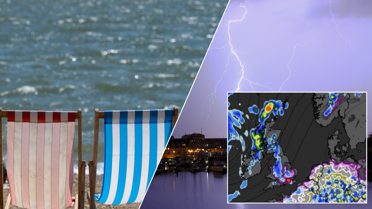
|Getty/WXCharts
Today, highs of over 30C are predicted in London and in southern regions, in what is predicted to be the highest recorded temperatures of the year so far.
However, the gorgeous weather could soon be brought to a dramatic standstill, as from Thursday onwards, a “cold front bringing a band of cloud and showery rain [will] run east/southeast across the country”.
The weather office warns that there is also “a chance of isolated heavy showers and thunderstorms developing during the afternoon,” on Thursday.
Mark Sidaway, a Deputy Chief Meteorologist at the Met Office, said: “Although we are expecting to see some very warm temperatures this week, it may not be the wall-to-wall sunshine and blue skies people are expecting as there is likely to be some cloud around in places.
WEATHER LATEST:
“Some areas, mainly central and eastern England, will see temperatures which exceed the heatwave criteria. To be officially recognised as a ‘heatwave’ though, the temperature must be reached for three consecutive days.
“Although we are looking to enjoy some nice warm temperatures, the weather this week does not look particularly exceptional or extreme.”
Jim Dale, meteorologist for British Weather Services, said: “There may be dribs and drabs of rain and thunder during the start of the week, but it is Friday when things are really expected to fall apart.
“There is the potential for some very heavy rainfall and thunderstorms, and this risk will last into the weekend.

The Met Office issued a Glastonbury Festival outlook ahead of the upcoming music event
| GETTY“It is then likely to turn cooler, with Saturday looking like the real demarcation point between the hot spell and a return to more usual conditions.”
The Met Office also issued a Glastonbury Festival outlook, ahead of the popular music event, which kicks off today with 200,000 revellers descending on Worthy Farm.
The first day of the festival will also be the hottest, with temperatures of 25°C to 27C in Somerset predicted.
However, like the rest of the country, the warm weather will take a turn and give way to cooler conditions, with clouds to replace the sunshine.
However, whilst the sun may retreat, as the main stage opens on Friday, festival goers can still enjoy temperatures slightly above average, with a maximum mercury of 21C.