UK cold forecast: SNOW BOMB to strike in 436 mile Arctic blast as weather models warn 'severe winter' imminent

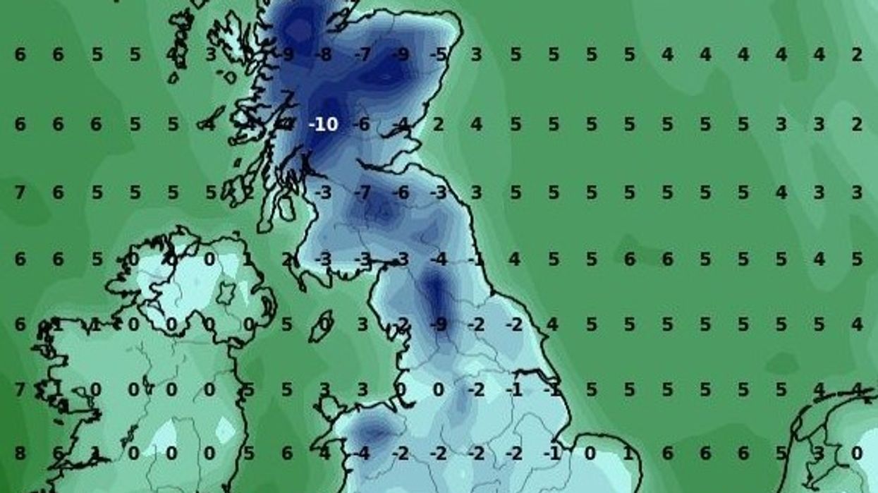
Minimum temperatures across the UK on December 8, according to WXCHARTS
|WXCHARTS

Britons could witness snowfall stretching from northern Scotland to the South East of England
Don't Miss
Most Read
A snow bomb looks set to bring a 436-mile Arctic blast to Britain as weather models suggest a "severe winter" is on the horizon.
Temperatures look set to plummet as winds from the north move down the country.
The change in conditions, which comes after a relatively mild Atlantic front, will likely remain for the coming weeks.
Snowfall could stretch from Inverness in Scotland all the way to Reading in Berkshire.
WATCH NOW: The Met Office's weather forecast
Mercury could drop as low as -10C in Scotland on December 8.
Temperatures will also fall below freezing in many parts of England and Wales.
Snowfall in expected in Scotland tomorrow, WXCHARTS has said.
December 9 appears to be a turning point, with snowfall expected across all three nations in Great Britain.

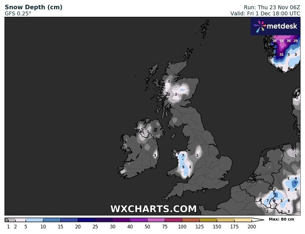
Snow is expected on December 1
|WXCHARTS
However, Wales will need to wait until December 1 for similar conditions.
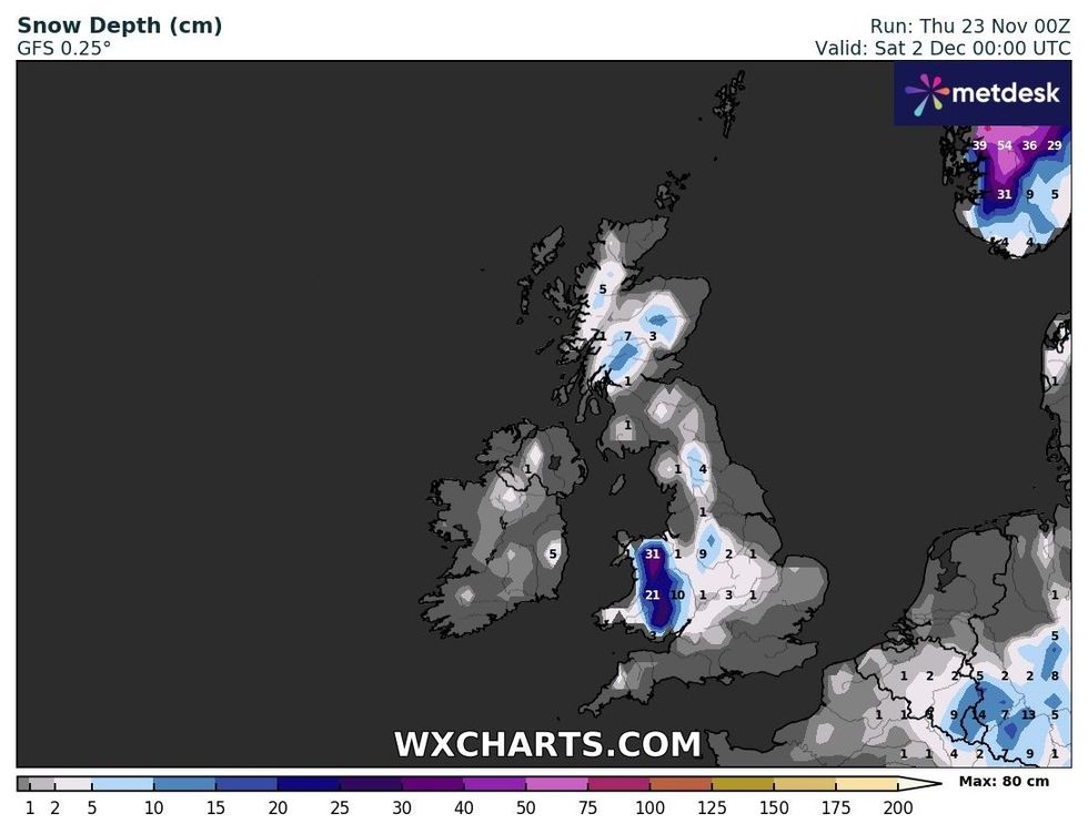
Snow will accumulate significantly in parts of Scotland and Wales on December 2.
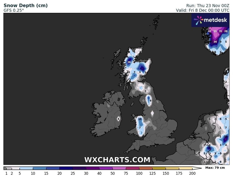
Similar conditions will persist further into the month, with 26 centimetre snow depth expected for North West Scotland on December 8.
Despite predictions of an Arctic blast, weather models have been known to change predictions rather quickly.

Snow depth will get larger on December 2
|WXCHARTS
Netweather's Terry Scholey said: "Whenever we encounter blocked or partially blocked weather patterns, models often struggle to adapt.
"Especially the 14-day models have been facing difficulties, sometimes indicating completely different outcomes.
"But what I do know is that two of the three closely matched archive years I have been monitoring produced a severe December.
"This doesn't necessarily mean we are heading towards an early severe winter, especially given our ever-warming climate.

Snow will continue to pose wintery problems until December 8
|WXCHARTS
"Nevertheless, it's definitely food for thought for the coming weeks."
However, the Met Office's long-range forecast does not predict as much snow.
Looking between December 7 and December 21, the UK's national weather service said: "A general trend through this period for a return to more changeable and unsettled weather, with wetter and windier than average conditions likely, especially in the west and northwest.
"Generally temperatures are expected to be near or above average, although short-lived colder interludes remain possible."


