


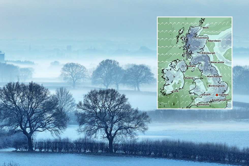
Britain is bracing for weather chaos as a polar vortex collapse sends temperatures plummeting after a brief spell of spring-like conditions.
The dramatic shift will see the mercury drop from highs of 17-19°C this weekend to potentially -4°C in parts of Scotland by Tuesday.
A 400-mile wall of snow is expected to blanket the UK from Inverness to Cardiff by midweek.
The Met Office has confirmed there is now over 80 per cent chance of a sudden stratospheric warming (SSW) occurring by mid-March.
Temperatures are set to plummet
Getty/WX Charts
A polar vortex is a circulation of winds high up in the stratosphere, up to 30 miles above Earth. The phenomenon is characterised by a reversal of these winds, which are currently weakening rapidly.
Professor Adam Scaife, Head of Long-Range Forecasting at the Met Office, said: "There is now over 80% chance of a SSW occurring by the middle of the month, this could lead to some impacts on weather in the UK toward the end of March."
The Met Office cautioned that "not all SSW events are followed by severe weather."
Weather maps show 13 counties will be hit by an Arctic blast spanning 647 miles from Wick in Scotland to Cardiff in Wales. The hardest-hit areas will include the Scottish Highlands, Aberdeenshire, Perth and Kinross, and the Borders.
LATEST DEVELOPMENTS
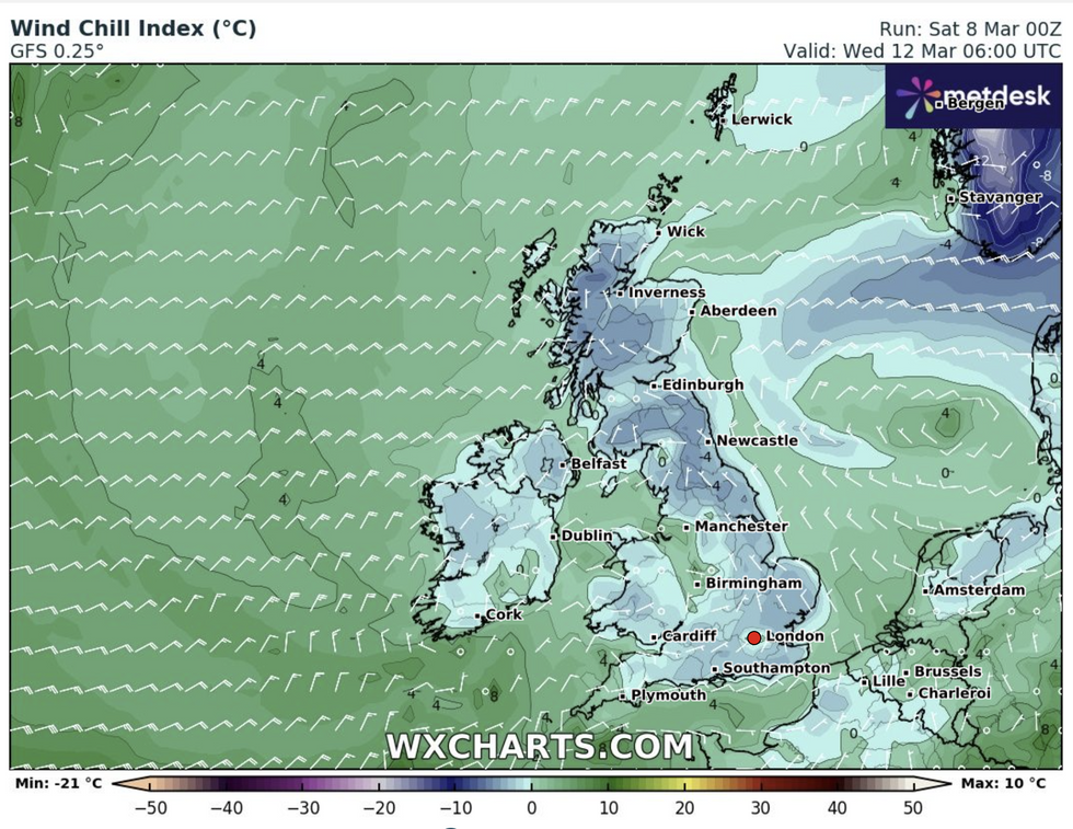
Temperatures are set to fall
WXCharts
In England, Northumberland, Cumbria, County Durham, Yorkshire, Staffordshire, Derbyshire, and Shropshire will see significant snowfall. Northern Ireland's Antrim and Down counties will also be affected.
Major cities including Inverness, Aberdeen, Edinburgh, Newcastle, Manchester and Birmingham are expected to face disruption. Snow depths could reach up to 10cm in some areas.
Deputy Chief Meteorologist at the Met Office, Chris Bulmer explains: "A frontal zone will move south across the UK during Sunday night and Monday with much colder air following from the north.
"With these cold northeasterly winds, we are likely to see some wintry showers across the north and the east of the UK next week, but any accumulations of snow are likely to be largely restricted to hills."
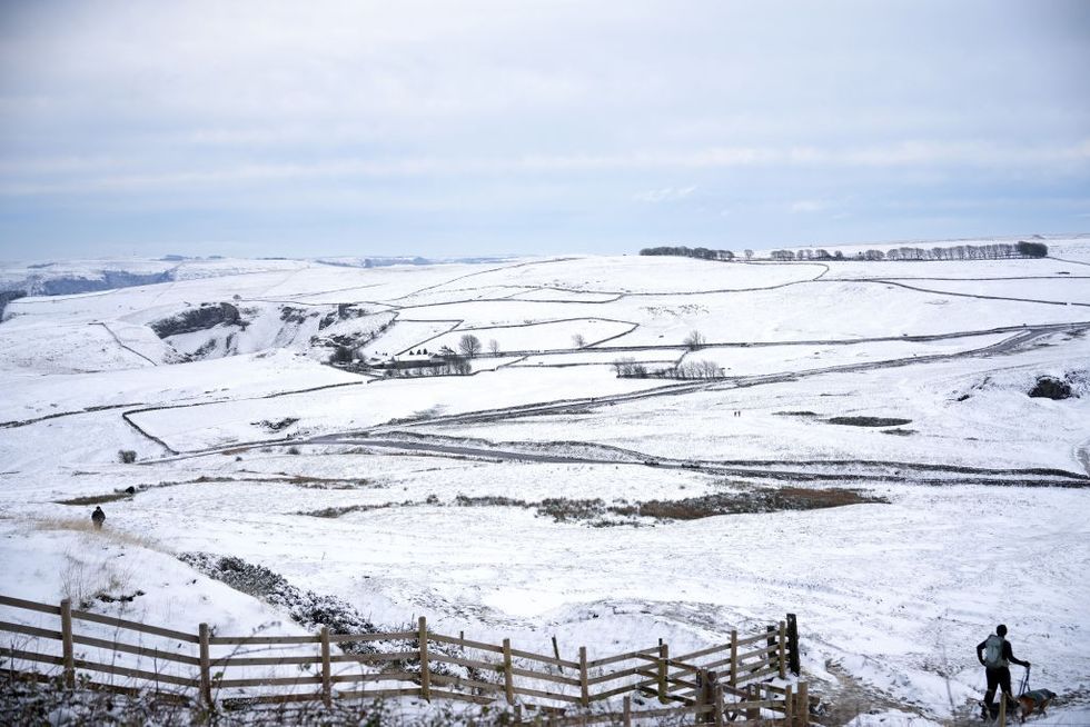
Heavy snowfall in Castleton, Derbyshire
GettyThe Arctic air mass is expected to bring strong winds alongside the sub-zero temperatures. Combined with brisk winds, the wind chill factor will make conditions feel even colder.
Rural spots in Scotland could see temperatures plunge to -4°C on Tuesday night. Daytime maximum temperatures across the UK will typically range between 5-8°C.
This marks a stark contrast to this weekend's balmy conditions, where parts of North Staffordshire and South Cheshire are expected to enjoy highs of around 17°C. The Potteries will see temperatures drop to no warmer than 7°C next week.
London, Cardiff, and Southampton may avoid heavy snowfall but could still face freezing temperatures.
