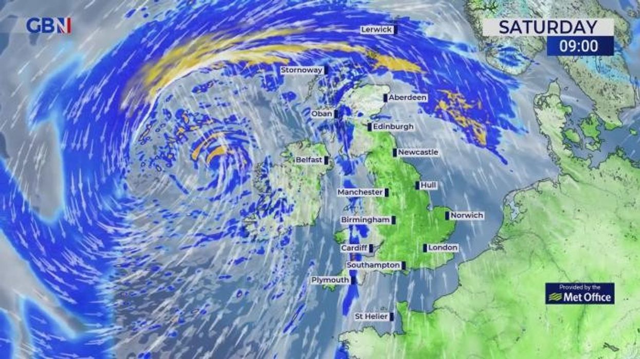
The UK’s national forecaster updated their warning as the likelihood and impact of the weather event were increased
Don't Miss
Most Read
Trending on GB News
The Met Office has issued a yellow warning over the entire West coast of England and the entirety of Northern Ireland as Storm Kathleen prepares to unleash weather hell across Britain.
Wind is expected to lash the UK today and could see parts of the country see gusts of up to 70mph as a low-pressure system collides with a strong southerly jet stream.
Damage to buildings and power lines is expected with the Met Office also warning that there is a “danger to life” from flying debris and large waves.
Transport such as roads, rail, air and ferry services may also be affected with commuters warned that journey times may be elongated and cancellations are possible.
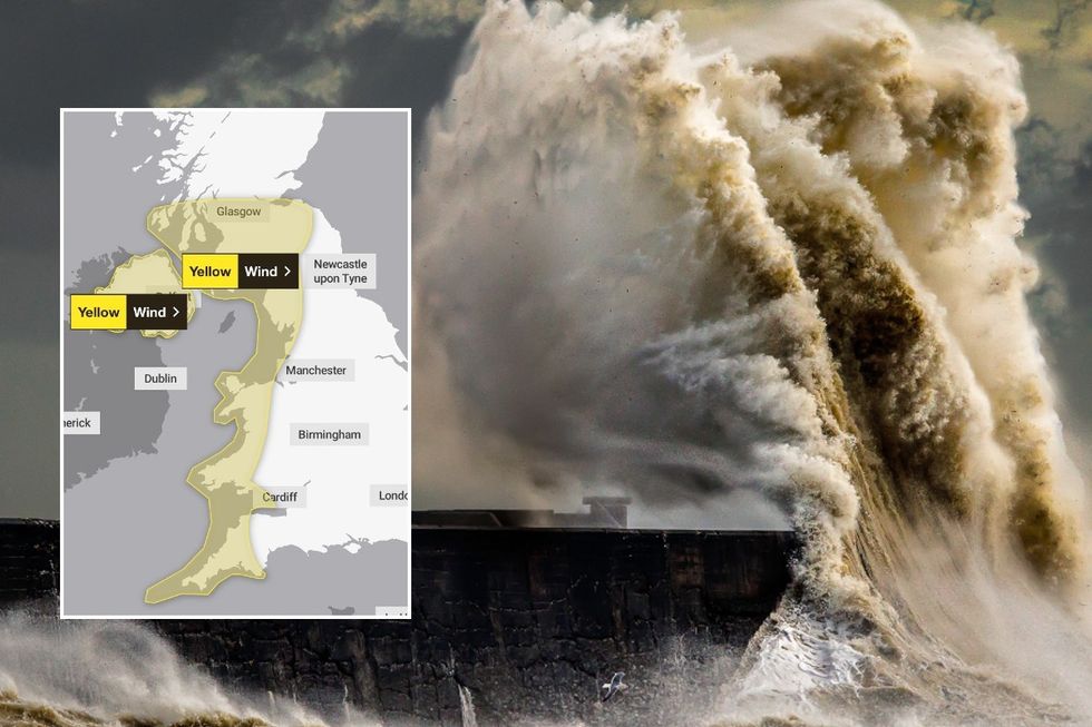 Met Office issues urgent yellow weather warning as Storm Kathleen set to pummel BritainGetty Images/Met Office
In a statement, the Met Office said: “On Saturday a deep area of low pressure – now named as Storm Kathleen and the 11th named storm of this storm season – will move towards the UK and Ireland from the southwest bringing unseasonably strong winds to Ireland and western parts of the UK.
“A yellow severe weather warning for wind has been issued for the whole of Northern Ireland and the west coast of England, Wales and southern Scotland.
“The warning is in force from 8am to 10pm on Saturday.
“Gusts of 50-60 mph are expected quite widely within the warning area, with the possibility of 70 mph gusts in exposed coastal locations, especially in eastern Northern Ireland.”
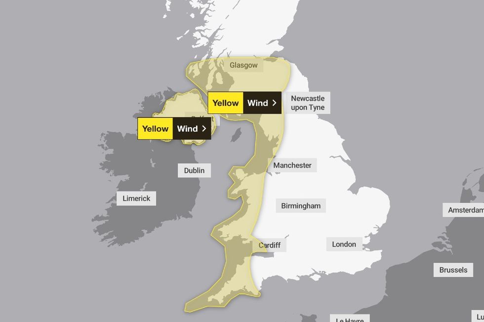
The Met Office issued a wind warning from 8am to 10pm on Saturday
Met Office
Chief Meteorologist, Dan Suri, said: “Storm Kathleen will bring strong gusty winds to western areas of the UK through Saturday. Gusts of 50 to 60 mph are expected quite widely, while some exposed spots, particularly in coastal Northern Ireland, will see 60 to 70 mph gusts with large waves also expected.
“There will also be some blustery showers in the west with the eastern side of the UK seeing a drier and brighter day.
“With the winds coming from the south, some unseasonably warm air will be drawn across parts of the UK.
“When combined with sunny spells in East Anglia we could see temperatures reaching 21C or 22C for a time on Saturday.
“These temperatures are well above average for the time of year and the highest we’ve seen in the UK since last October.”
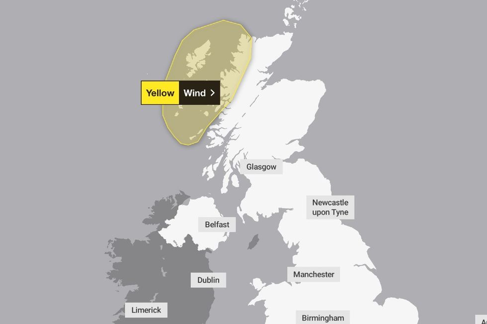
The Met office also issued a warning for Sunday in Scotland between 9am and 3pm
Met Office
In an update, the Met Office also issued a wind warning for Sunday but advised that it will likely only affect Northwest Scotland.
The weather service advised the warning is in place from 9am to 3pm tomorrow and may be accompanied by “ frequent squally showers”.
Met Eireann, the Irish Meteorological Service, also issued a warning over the storm.
The service said: “Met Éireann have issued a nationwide yellow wind warning for Saturday with orange level wind warnings coming into effect for counties Cork, Kerry and Waterford at 7am, valid until 2pm, and counties Galway and Mayo at 9am, valid until 6pm.”
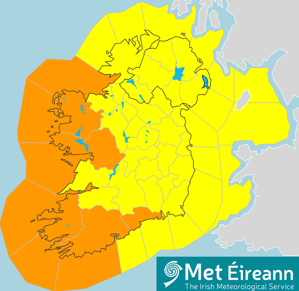
Met Eireann issued an orange warning over the storm
Met Eireann
Deputy Head of Forecasting, Liz Coleman said “It is the end of the Easter holidays so there will be a lot of people travelling and they may not be expecting such unseasonably strong and gusty winds.
“Please make sure to plan your journeys in advance by keeping in contact with the forecast.
“We are likely to see some trees down due to the saturated soils and strong winds.
“There will be dangerous conditions at sea too, coupled with wave overtopping and coastal flooding in some areas.”

