


The Met Office has issued an urgent update to a weather alert issued on Thursday.
Thunderstorms are set to strike across a vast area of the country today with the national weather service advising that the area of effect has now changed.
Lasting from 1am until midnight on Saturday night, the Met Office warned that “whilst some places will remain dry, thunderstorms and heavy showers could cause some disruption on Saturday in a few places”.
Regions affected will include the east Midlands, east of England, London and south east England, north west England, south west England, Wales, west Midlands and Yorkshire & Humber.
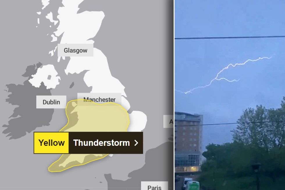 Met Office warns thunderstorms to strike in extended area as update issued on national weather alertPA/Met Office
When initially issued, the alert highlighted that the thunderstorm was likely to have a medium-high impact but was unlikely.
However, the update suggests the likelihood has now been amplified by one level.
In an update issued around 7am this morning, the Met Office said: “Warning updated to extend it further north and east, whilst removing southeast England, and to increase the likelihood to low.
“The further details have also been updated to reflect latest thoughts.”
LATEST DEVELOPMENTS: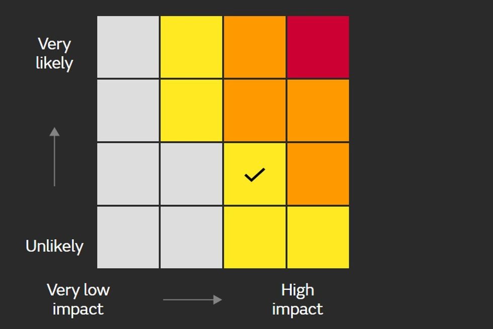
The Met Office suggests this warning has a low likelihood and a medium impact
Met Office
The latest details of the updates state: “Whilst there is some uncertainty in the details , scattered showers and thunderstorms will develop across parts of southern England and spread northwestwards through Saturday morning before showers develop more widely later in the day.
“While much of the time it will be dry, with not all places seeing showers or storms, where they do occur 20-40mm could fall in less than an hour, with a small chance of isolated accumulations of 50-80mm over the course of a few hours.
“In addition, hail and frequent lightning may accompany the most intense storms, especially during Saturday afternoon and evening in parts of the Midlands, western England and east Wales.”
The Met Office says those in the impact zone should expect spray on roads and sudden flooding could lead to difficult driving conditions and some road closures.

Rain on roads
PA
They added that "where flooding or lightning strikes occur, there is a chance of delays and some cancellations to train and bus services".
Power cuts could occur and other services to some homes and businesses could be lost.
The national weather service added that "fast flowing or deep floodwater is possible, causing a danger to life".
