


The Met Office has issued a rare amber weather warning as they forecast that heavy rain could lead to mass flooding.
Issued around 10am on Sunday, the warning for heavy rain is set to affect a large area of the Midlands and will touch on Yorkshire & Humber and London and south east England.
The warning will be in place from 5am to 9pm on Monday 23 September.
The Met Office warning read: “Heavy rain is expected to produce some flooding and travel disruption.”
⚠️⚠️ Amber weather warning issued ⚠️⚠️
— Met Office (@metoffice) September 22, 2024
Heavy rain across parts of central and northeast England
Monday 0500 – 2100
Latest info 👉 https://t.co/QwDLMfRBfs
Stay #WeatherAware ⚠️ pic.twitter.com/BiQrIkQHZ6
The Met Office warned: “An area of heavy rain is expected to develop across central and southern England during the early of hours of Monday, edging north and west and then becoming slow-moving somewhere across the warning area for several hours.
“It will then weaken and move away eastwards later Monday evening and overnight.
“Not all counties within the warning area will be equally affected, but it seems likely that some areas will see 60-80 mm and a few places may receive 100-120mm or more.
“This is likely to result in travel disruption and some flooding. Lightning may be an additional hazard in places.”
LATEST DEVELOPMENTS: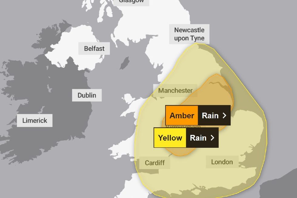 Met Office issues rare AMBER weather warning as heavy rain to strike BritainMet Office
The national weather service adds that the rain could lead to “potentially dangerous road conditions“ and warns that “if you must travel, ensure you watch for possible danger and drive cautiously”.
Additional advice issued warns residents that “it is not safe to drive, walk or swim through floodwater, avoid it where possible and if you are affected by fast flowing or deep-water call 999, and wait for help.“
In the yellow alert, which covers a much larger area and extends to the east Midlands, east of England, London and south east England, north west England, south west England, Wales, west Midlands and Yorkshire & Humber, is set to last for 24 hours from midnight Sunday to midnight Monday.
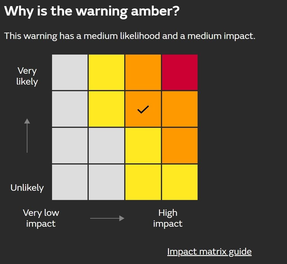
Met Office matrix explains why alert has been registered as amber
Met Office
The yellow warning states: “Areas of of heavy rain are expected to affect many parts of England and Wales during Monday.
“There is still some uncertainty regarding which areas will be affected by the heaviest rain, but at this stage parts of the Midlands, northeast England and east Wales look most likely to see the greatest accumulations.
“However, anywhere within the warning area could have impactful rainfall through the course of Monday.
“There is potential that 30-50 mm could develop in any part of the warning area, much of which could fall in six hours or less. Some locations could see 80-100 mm over the course of 12 to 24 hours.”
