The Golden State is in the firing line for what has been described as the "largest storm of the season"
Don't Miss
Most Read
Trending on GB News
A huge mega-storm hurtling off the Pacific threatens "life-threatening floods" while "feet of snow" pile up in a "rare" weather event.
California is in the firing line for "the largest storm of the season" this week as the National Weather Service (NOAA) issues a raft of danger-to-life alerts.
Potentially "unprecedented floods" will be driven by torrential downpours whipped through the region by fierce gales.
Coastal regions are at greatest risk from severe weather which meteorologists warn should be "taken seriously", as flood watches remained in place for nearly 40million people.

Life-threatening floods have been warned on the West Coast of the US
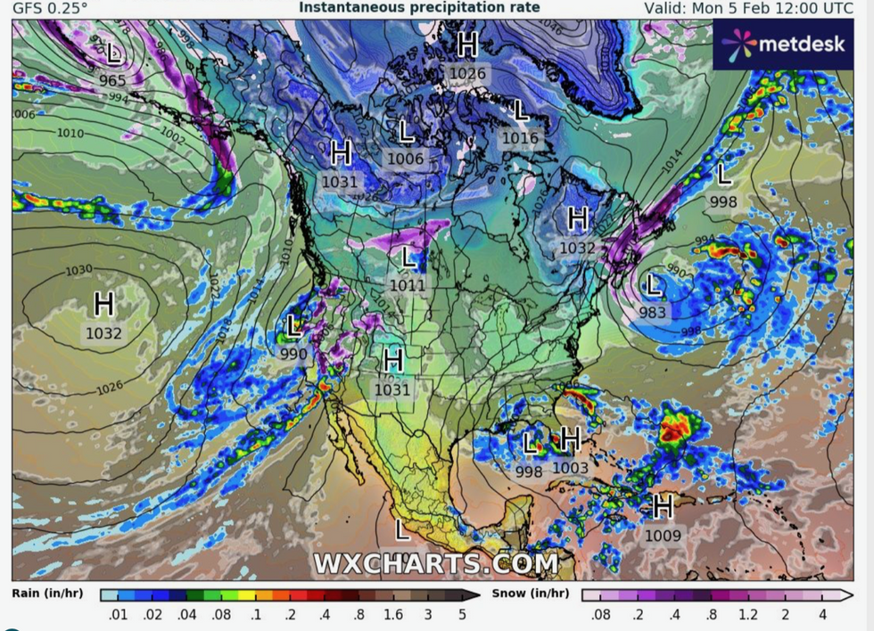
WXCHARTS
An atmospheric river of rain, the second in a week, will drench the west coast of America through the coming days.
A Weather Channel meteorologist said: “There is a high risk of flooding, so if you are out and about and driving be really, really careful.
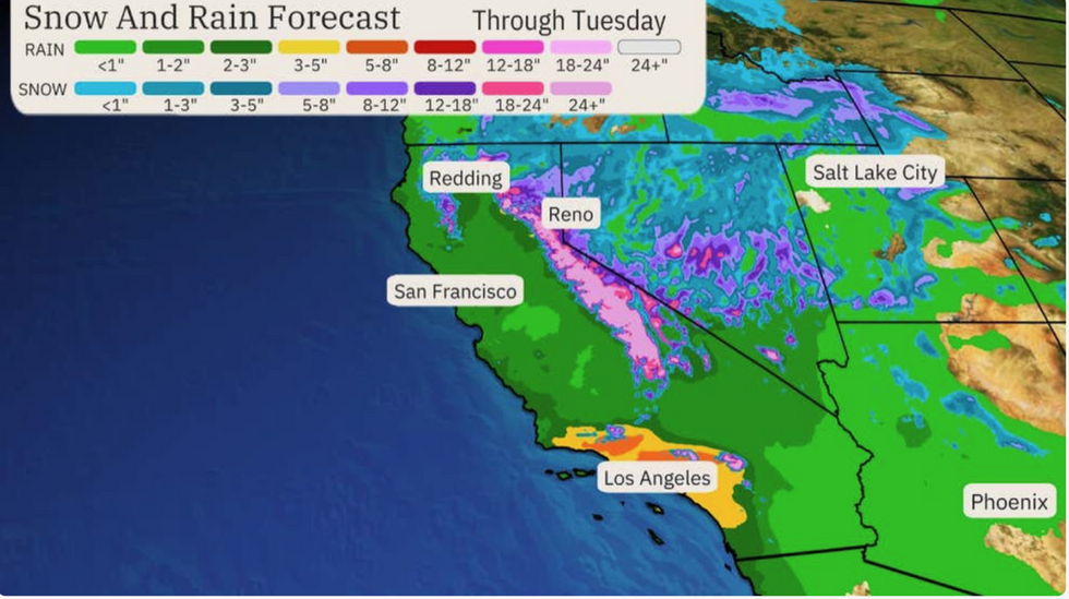
“It is going to be a lot of rain that adds up between now and Wednesday, we could see up and over five to eight inches of rain. This is a fairly rare situation.”
Heavy rain will trigger dangerous flooding as the "pineapple express" storm smashes the west coast, with over 14million in the southern part of the state facing a rare high risk of excessive rainfall.
California has borne the brunt of rain and flooding through the start of the month, largely driven by atmospheric rivers.
The huge columns of moisture carry tonnes of water which fall as heavy rain when they pass over land.
Further downpours over the coming days threaten landslides and travel chaos while heavy snow as the hills and mountains are buried under blankets of snow.

Potentially "unprecedented floods" will be driven by torrential downpours whipped through the region by fierce gales
WXCHARTS
A Weather Channel meteorologist warned of "life-threatening flash flooding" as "multiple feet of snow pile up in the Sierra and Southern California mountains".
They added: “This will be the second such ‘pineapple express’ event for California in just a couple of days.
“The first brought flooding across the state, but this second round will be ‘the largest storm of the season’", according to the National Weather Service office in Los Angeles.
“You should take this ‘high risk’ forecast seriously”.
Torrential rain and floods will hit the United States just a few miles from where South America is under fire from scorching heat and wildfires.
Extreme weather means that spanning the hemisphere, the two American continents are jumping from ‘one catastrophe to another’.
Jim Dale, US weather correspondent and meteorologist for British Weather Services, said: “The threat for the west coast this week will be from very heavy and persistent rain, and with it, the flooding which will be largely across California.

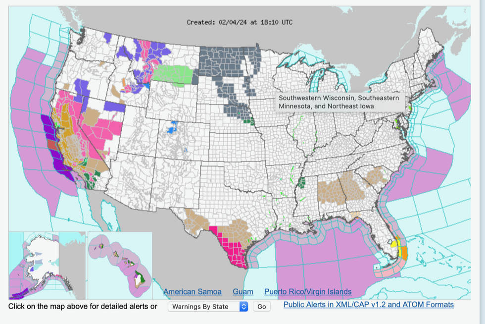
Breakdown of alerts in each area
WXCHARTS
“This is happening while in the southern hemisphere, Chile is getting drought, extreme heat and wildfires.
“It is one catastrophe after another on either side of the hemisphere, which driven by El Nino and climate change, is another example of the weather balancing itself with these sorts of extreme events.”
On the other side of the country, Florida is on alert for tornadoes and heavy rain triggered by a plume of warm air from the Gulf of Mexico.
Mr Dale, co-author of forthcoming ‘Surviving Extreme Weather’, added: “This is due to the very warm stuff coming out of the Gulf of Mexico.
“Here, there will be a further risk of tornadoes and torrential rain.”
A spokesman for the National Weather Service said: “Some locally heavy downpours will be possible with the chance for an isolated instance or two of flash flooding.
“Locally higher low-level shear from South Florida into the Florida keys may lead to some more organized, supercell storms.”


