Mystery as 'ghost island' spotted by Nasa satellite before vanishing in matter of months
By the end of last year, the island almost completely disappeared, leaving behind only a 'greatly diminished' portion of the bank above water
Don't Miss
Most Read
A mysterious "ghost island" off Azerbaijan's coast has vanished almost completely, Nasa satellites have revealed.
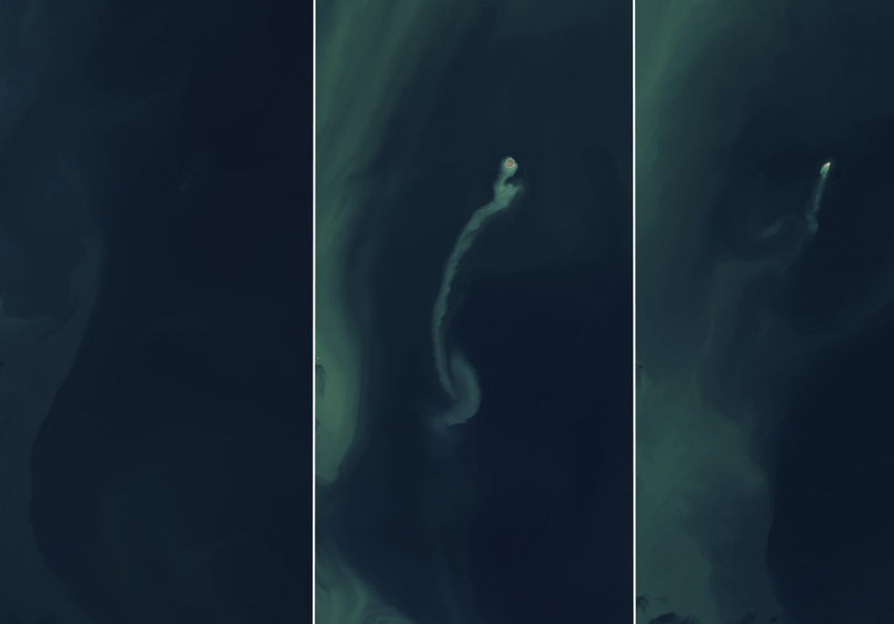
The temporary landmass initially emerged in the Caspian Sea following a mud volcano eruption in early 2023 but, by the end of last year, the island had nearly eroded away entirely, with NASA Earth Observatory noting it retreated from view "like an apparition".
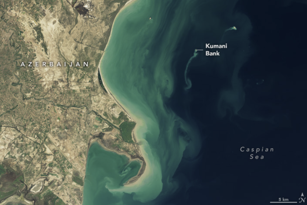
The phenomenon occurred at the Kumani Bank mud volcano - also known as Chigil-Deniz - which lies approximately 25 kilometres off Azerbaijan's eastern coastline.
According to Mark Tingay, a geologist at the University of Adelaide, satellite observations indicated the island formed between January 30 and February 4, 2023, measuring around 400 metres in diameter at its peak.

Satellite observations indicated the island formed between January 30 and February 4 2023, measuring around 400 metres in diameter at its peak
|NASA
Initial satellite imagery from November 2022 showed the volcano's crest remained below the sea surface, but the island had emerged prominently over time, with satellite images capturing a distinctive sediment plume drifting away from the formation.
By December 2024, the island had disappeared almost entirely, leaving only a "greatly diminished" portion of the Kumani Bank visible above water.
The volcano's previous eight recorded eruptions typically lasted less than two days, producing islands of varying sizes and durability.
The most significant eruption occurred in 1950, generating a substantially larger island measuring 700 metres across and reaching six metres in height.
LATEST DEVELOPMENTS:
Tingay has described mud volcanoes as "weird and wonderful features", although he has admitted that they remain "largely understudied and little understood".
Nasa's Landsat eight and nine satellites documented the island's dramatic transformation through a series of images taken at key intervals.
The first image was captured on November 18, 2022, showing the underwater volcano crest through its varying stages, including its development as well as its diminishment.
Azerbaijan stands out for its unusually high concentration of mud volcanoes, with scientists documenting more than 300 in the eastern region and offshore in the Caspian Sea.
Most of these formations occur on land, within a convergence zone where the Arabian and Eurasian tectonic plates collide.

Tingay has described mud volcanoes as "weird and wonderful features", although he has admitted that they remain "largely understudied and little understood"
|NASA
These mud volcanoes can pose significant hazards due to their ability to expel large quantities of material over brief periods.
They are also known for their spectacular displays, with NASA adding that "past eruptions of this and other nearby mud volcanoes have sent towers of flame hundreds of meters into the air".
Stanford University's Professor Eric Dunham has said that "volcanoes are complicated and there is currently no universally applicable means of predicting eruption".
Researchers track various warning signs - including volcanic infrasound - where changes in sound frequency can signal rising lava lakes.
Seismic activity typically increases before eruptions as magma moves through the volcano's system, while other indicators include gas emissions, particularly sulphur dioxide levels, and ground deformation, which can manifest as swelling or cracking of the volcano's surface.


