
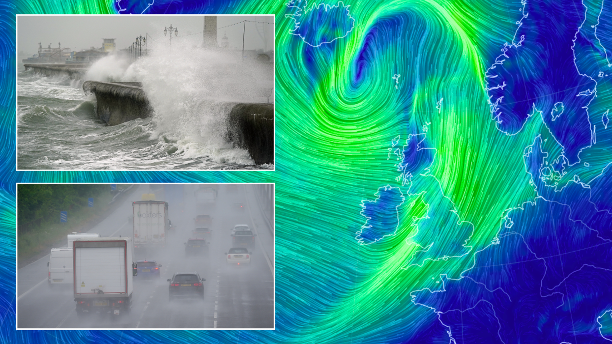


Summer looks to have come to a close before August has even finished as hurricane-force winds continue to batter Britain.
The tail end of Hurricane Ernesto, which had bruised Bermuda on its way across the Atlantic, smashed into Scotland yesterday after drenching parts of Ireland.
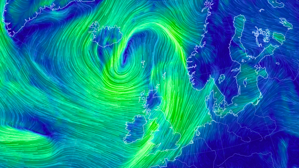
Though Ernesto may be petering out as it heads north to the Arctic, northwestern parts of the country have been told to brace for hurricane-force winds - with the Met Office maintaining a pair of yellow wind warnings covering areas of England, Scotland and Wales.
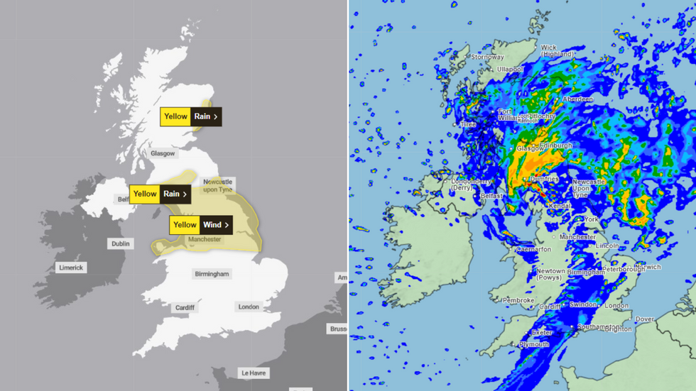
The yellow warnings cover cities including Bangor, Carlisle and Edinburgh, with residents urged to take special care as winds approaching 75mph smash into the north of the UK.
Northwestern parts of the country have been told to brace for hurricane-force winds
|Earth.nullschool.net
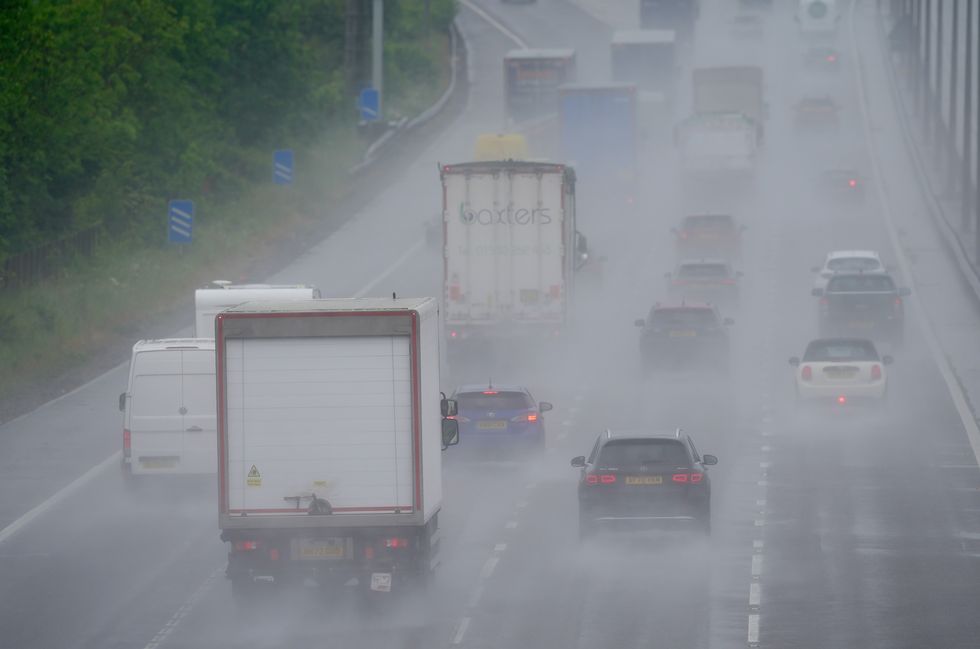
The Met Office has warned those affected by the warnings to prepare for delays (file photo)
|PA
The Met Office has warned those affected by the warnings to prepare for delays across road, rail, air and ferry transport, with coastal routes likely to be subjected to large waves.
On Friday, a swathe of Britain stretching from Newcastle and parts of Scotland to Manchester has been slapped with a yellow wind warning.
Across that area the Met Office has said that the high winds could wreak havoc.
Forecasters have warned of "damage to buildings" as well as "injuries and danger to life from flying debris" as Ernesto's tail end strikes.
MORE AS STORMS SCUPPER SUMMER:
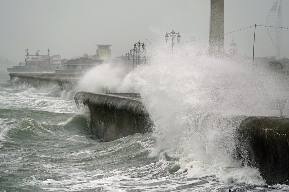
Strips of southern and eastern Scotland have been given further yellow weather warnings for rain (file photo)
|PA
At the same time, strips of southern and eastern Scotland have been given further yellow weather warnings - this time, for rain.
Residents in locations including Aberdeen, Lockerbie and Dumfries have been cautioned that "flooding of a few homes and businesses is likely" as a result of the impending 12-hour downpours, set to last from 9pm on Thursday to 9am on Friday.
Other meteorologists have drawn attention to 75mph hurricane-force winds - NetWeather's Jo Farrow warned how "severe gales with gusts over 75mph are showing on the UKV for Friday morning".
Farrow said the gusts, which could impact north Wales and/or northwest England, were "something to watch".
The Met Office has named the impending storm "Storm Lilian"
|Met Office
The Met Office has named the impending storm "Storm Lilian" - though its chief meteorologist Jason Kelly exercised more restraint in his forecasts than those predicted by NetWeather.
He said: "Storm Lilian will bring some potentially damaging gusts during Friday morning, with gusts widely in the 50-60mph range, with the possibility of some gusts in excess of 75mph in a few places.
"There's associated rainfall with Lilian that has also resulted in a Met Office warning for parts of Scotland.
"Within the warning area, another 50mm of rain is possible over high ground, with 20-30mm falling quite widely. Much of this is falling on saturated ground so increases the chance of some surface water flooding."