


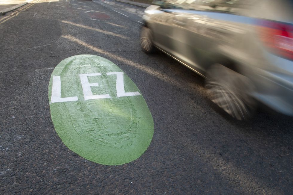
Drivers are being warned of four new Low Emission Zones set to begin charging within weeks, which could see millions of motorists hit with hefty fines.
Major cities across the UK have been taking steps to improve air quality, with emissions-based charging zones being favoured by many, with four new zones being set up in Scotland.
All non-compliant vehicles entering a LEZ across Scotland will see them hit with a £60 fine, with the rate doubling for each subsequent breach, capped at £480 for cars and LGVs, while minibuses, buses, coaches and HGVs could see maximum fines of £980.
The minimum criteria include Euro 4 for petrol vehicles (generally registered from 2006 onwards), Euro 6 for diesel (registered from September 2015 onwards) and Euro VI for buses, coaches and HGVs (January 2013 onwards).
Do you have a story you'd like to share? Get in touch by emailingmotoring@gbnews.uk
Enforcement for the four Low Emission Zones will take place in the coming days
ABERDEEN CITY COUNCIL
Aberdeen
The Low Emission Zone in Aberdeen will begin charging drivers from Saturday, June 1, as it looks to clean the air in the city, which was mandated by the Government in 2022.
Estimates suggest that 85 per cent of vehicles in the city are already compliant with the LEZ, with drivers able to check the status of their vehicle with the emissions rules on the Aberdeen City Council website.
The zone will cover areas inside the northern boundary of Skene Street, School Hill, Upper Kirkgate and Littlejohn Street; North Street and Commerce Street to the east; Virginia Street, Guild Street, College Street, and Willowbank Road to the south; and Rose Street, Thistle Street; and Holborn Street to the west.
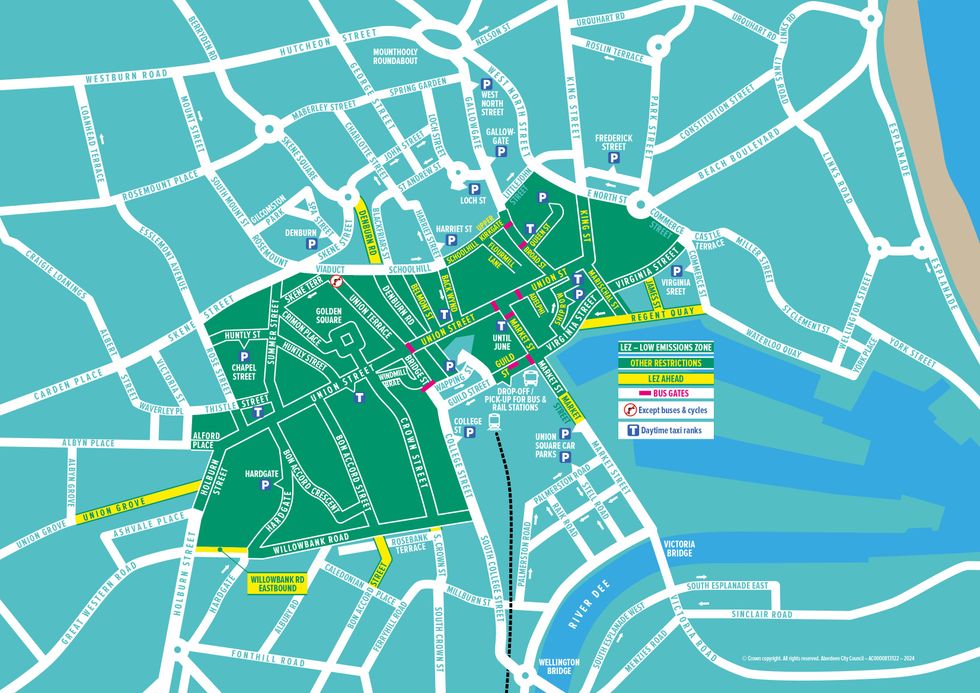
Aberdeen LEZ boundary map
ABERDEEN CITY COUNCIL
Dundee
The city originally launched its Low Emission Zone on May 30, 2022, although a two-year grace period was introduced, giving locals time to switch their vehicles, with enforcement beginning on May 30, 2024.
The area impacted will be within the A991 Inner Ring Road, excluding the Bell Street, West Marketgait NCP and Wellgate car parks.
Two support schemes are still available for drivers to make use of if they need to retrofit or change their vehicles. Households can receive up to £3,000 and businesses may be given £2,000.
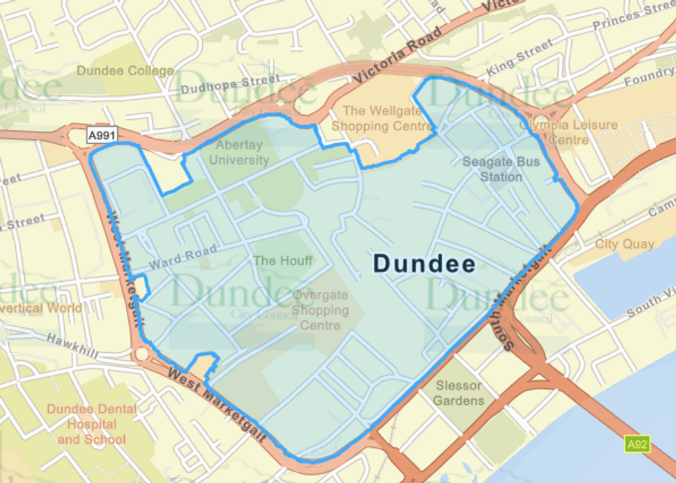
The Dundee LEZ boundary map
DUNDEE CITY COUNCIL
Edinburgh
The Scottish capital will operate its LEZ for 24 hours a day, 365 days a year, with the commencement of enforcement and fines beginning from June 1, 2024.
The zone is sign-posted at entry and exit points, with Automatic Number Plate Recognition (ANPR) cameras being used to catch any drivers flouting the rules.
Motorists are urged to be mindful when driving inside the city centre, with the LEZ circling from Tollcross in the south to Palmerston Place in the west along Queen Street in the New Town to Picardy Place around Abbeyhill and onto Holyrood Road along the Pleasance in the east before heading back along the Meadows to Tollcross.
LATEST DEVELOPMENTS:
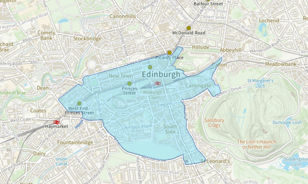
The Edinburgh LEZ boundary map
EDINBURGH CITY COUNCIL
Glasgow
Phase one of the LEZ was launched in December 2018, although this only applied to buses, followed by phase two for all vehicles on June 1, last year. From June 1, 2024, enforcement for vehicles registered to a residential property within the zone will begin to apply.
A Glasgow City Council spokesperson said: "Scottish LEZs operate by way of a penalty system, set in legislation to discourage non-compliant vehicle entry and to maximise the air quality benefits that can be delivered."
The LEZ is approximately one square mile in size and covers an area of the city centre bounded by the M8 motorway to the north and west, the River Clyde to the south and Saltmarket/High Street to the east.
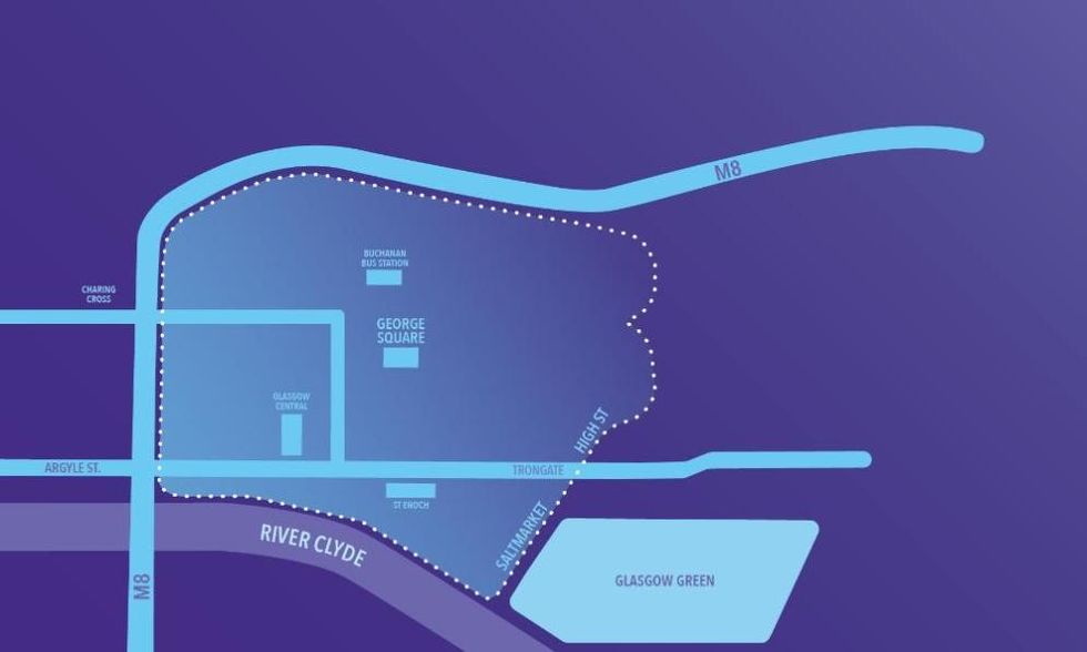
The Glasgow LEZ boundary map
GLASGOW CITY COUNCIL
