US weather warning: Tropical storm Tammy to smash Florida and Eastern US states

Tropical disturbance forms off the coast of Africa
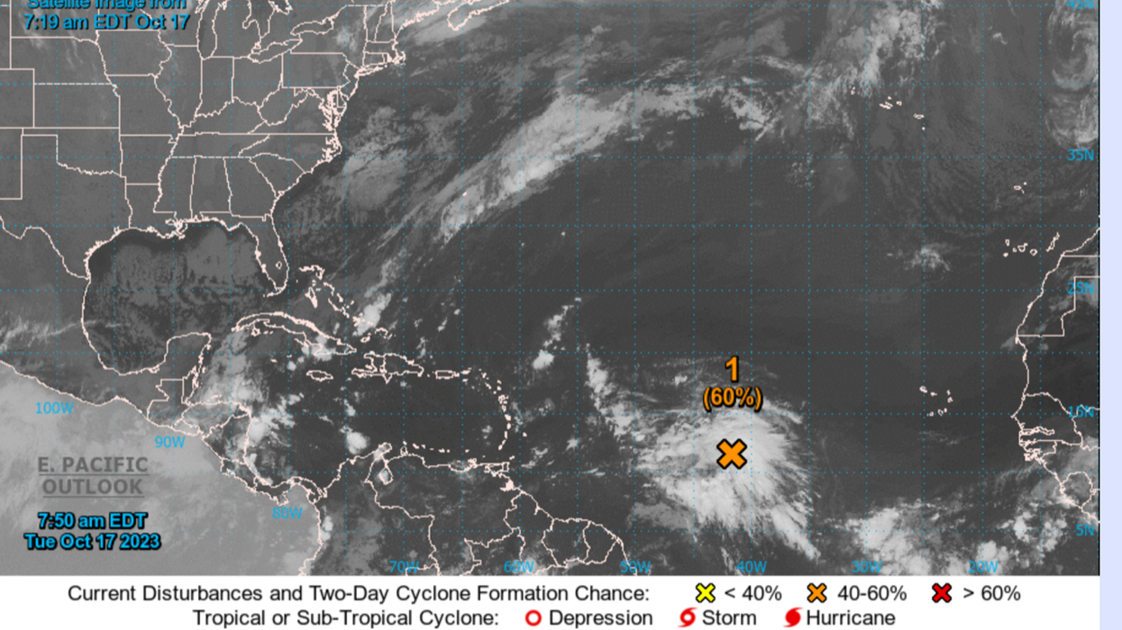
|NOAA

Meteorologists are watching a ‘disturbance’ building off the coast of Africa
Don't Miss
Most Read
Latest
FLOOD-stricken US states may face further hurricane hell with an ‘unusually late’ tropical storm feared to be forming in the Atlantic.
Meteorologists are watching a ‘disturbance’ building off the coast of Africa which, they say, could spawn the twenty-sixth storm of the season – Tammy.
It would arrive strangely late in the season, which ordinarily would be slowing down this late in October.
However, freakishly high sea temperatures are being blamed for unstoppable tropical storm activity in the Atlantic.
Jim Dale, US weather correspondent and senior meteorologist for British Weather Services, said: “This is one that will need to be watched and if it does develop into a hurricane or tropical storm, we would expect to see that in the next 10 days or so.

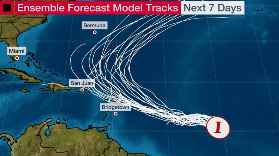
Possible path of the storm through the next week
|The Weather Channel
“It is fairly unusual to see this happening in October, but this could be due to sea temperatures still being high, even this late in the year, and this is helping to spawn these systems.
“It is being slightly slowed down because it will be coming in behind Tropical Storm Sean.”
Once again, most at risk will be flood-hit Florida and the eastern seaboard which has been ravaged by heavy rain through the past weeks.
Relentless storm systems circling the region have been boosted by tropical storm activity leading to intense flooding.
Heavy rain dragged in by another hurricane or tropical storm would add to the misery, Mr Dale warned.
He said: “This could add to the flooding problems across Florida and the northeast seaboard.

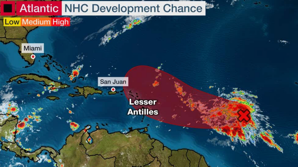
Storm developing and heading towards the Eastern States
|The Weather Channel
“This part of the United States has been getting a lot of precipitation, particularly around coastal regions.
“So, another incursion from the Atlantic would add to the disruption they have been seeing there.”
Tammy would be the third to last tropical storm named this season, leaving just Vince and Whitney.
It would follow Sean earlier this month, and Idalia, Ophelia, and Lee, which all wrought havoc earlier in the season.
Meteorologists have eyes trained on a developing depression in the tropical Atlantic called Invest 94 (AL94), around 1,100 miles east of the Windward Islands.
It could develop to become a ‘tropical depression’ within two to three days, according to the National Hurricane Centre (NOAA).
A spokesman said: “A broad area of low pressure located over the central tropical Atlantic about 1100 miles east of the Windward Islands continues to produce a large area of disorganized showers and thunderstorms.
“Environmental conditions are expected to remain conducive for gradual development, and a tropical depression will likely form during the next two to three days while the system moves westward to west-north-westward across the central and western tropical Atlantic.”
The Weather Channel meteorologist Domenica Davis added: “We continue to track Invest 94L.
“This is sitting in the Central Atlantic between the coast of Africa and the Windward Islands.
“The models push it off to the west and then eventually to the northeast so what we are going to be watching over the next couple of days is conducive development for tropical activity.
“What we will see is that by late week this will be a tropical depression.
Some rain could come in we could see some gusty winds with this.
A cold front will shunt this to the east.


