


Relentless downpours will strike in the wake of Hurricane Francine as the Atlantic spawns tropical storm number seven – Gordon.
The remains of Hurricane Francine will batter southern states the east coast faces a deluge of flash flooding unleashed by a coastal storm.
Further into the Atlantic, Tropical Storm Gordon has become the seventh to be named this season.
Although it is unlikely to hit the US directly, arriving so quickly after Francine it signals a strengthening of the Atlantic storm season.

The remnants of Hurricane Francine are expected to batter southern states
|The Weather Channel
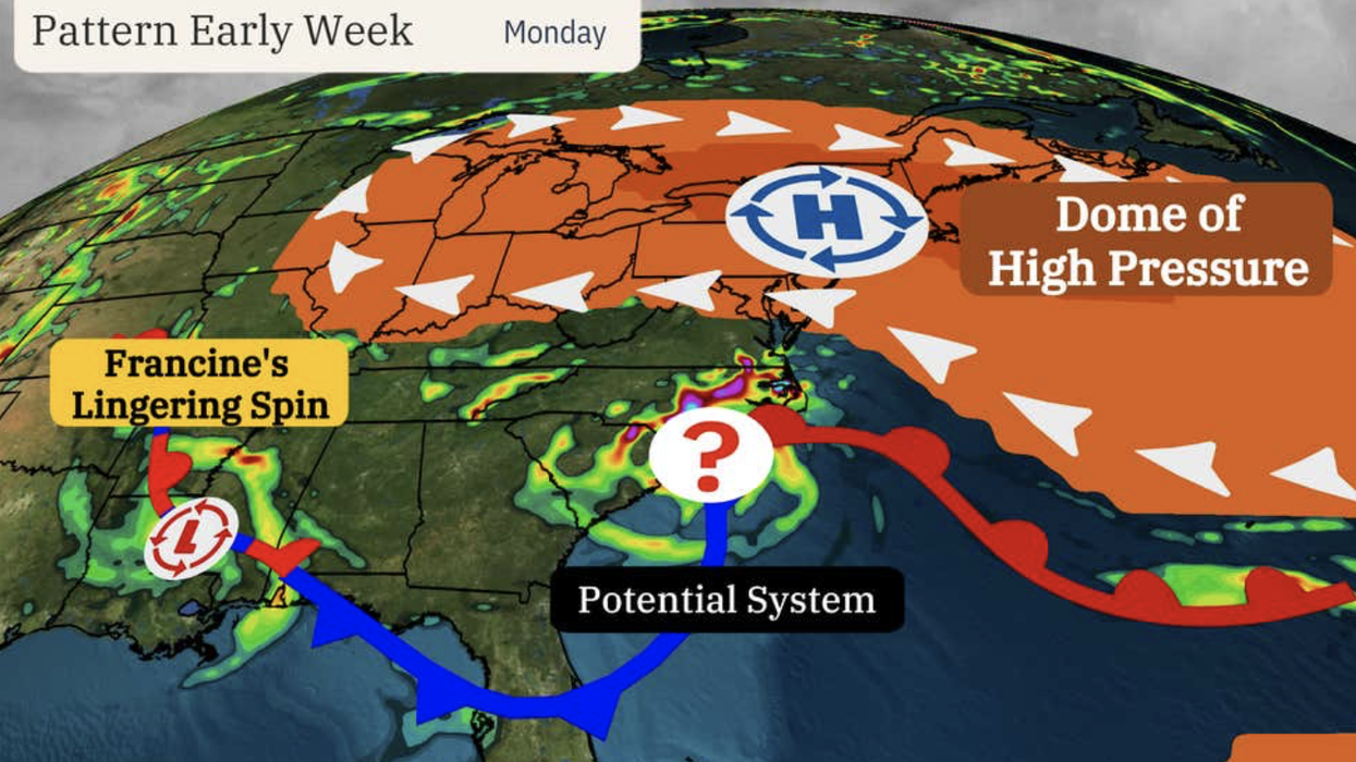
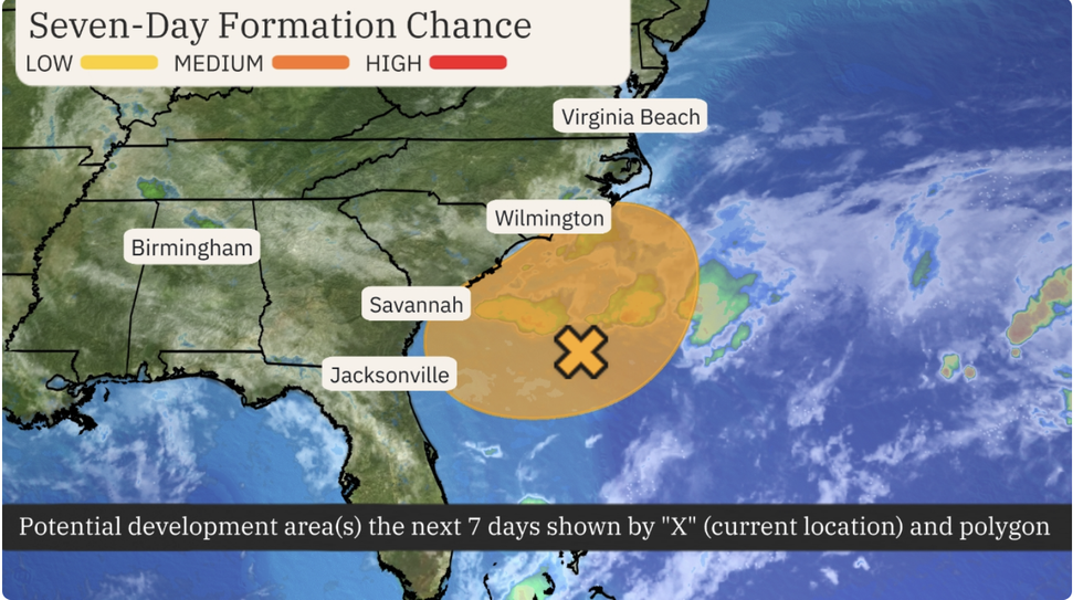
A smaller potential storm spinning off the east coast presents a more immediate threat, experts warn.
Weather Channel meteorologist Jonathan Belles said: “An area of low pressure developing off the coast of the Carolinas or Georgia this weekend could this week take on some tropical or subtropical characteristics.
“This system is developing along the same remnant frontal boundary that provided spin to Francine in the days before that storm developed in the Gulf of Mexico.
“Whether this system gets recognised as a depression or storm or not, onshore winds will bring the dangers of rainfall flooding, rip currents and, perhaps, some coastal flooding.”
The ‘bullseye’ of the storm will hover around the south coast through the next five days, he said.
Several inches of rain threaten the Carolinas while rip currents and dangerous sea conditions will concern Virginia and Florida, he added.
LATEST DEVELOPMENTS:
The ‘bullseye’ of the storm will hover around the south coast through the next five days
|The Weather Channel
He said: “Rip currents have already been a problem for the Georgia coast and the northeast coast of Florida.
“This system will be embedded in the same old stationary front that has been draped over the Southeast for the better part of this month, and it may pull some energy from the front, the nearby warm Gulf Stream current and some spin from the remnants of Francine.”
The Atlantic hurricane season has picked up since a late-summer calm with Tropical Storm Gordon becoming the latest.
Its track, however, is expected to be different from Francine, veering north-eastwards before reaching the US.
The storm will then weaken and drift into the Atlantic having little or no impact on the US.
A spokesman for the US National Hurricane Centre said: “Gordon should continue toward the west-southwest or west.
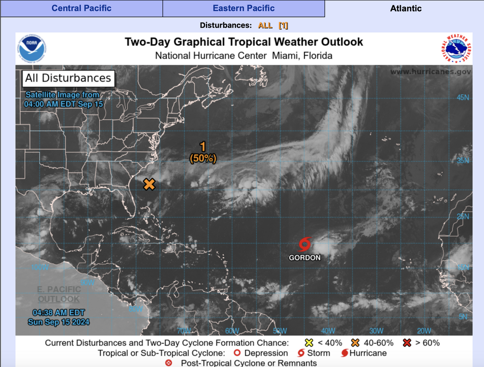
Tropical Storm Gordon is making its way across the Atlantic
|National Hurricane Centre
“The cyclone should gradually turn toward the north-northwest by the end of the period.
“Global models agree that the cyclone will become a remnant low toward the end of the week.”
Eastern and southern coasts are in the firing line through the coming days for the worst of the weather.
Jim Dale, US meteorologist for British Weather Services and co-author of ‘Surviving Extreme Weather’, said: “The remains of Francine will affect parts of the country while further east, a low-pressure system off the coast will bring further heavy rain and the risk of winds and tornadoes.
“Flooding will be a concern in these regions, which have already had a lot of rain over the past weeks.
“With this, there will be a risk of thunder with an unsettled picture through the rest of the week.”