


Deadly Hurricane Beryl has swerved on its path to the Caribbean raising concerns of impact with the United States.
The colossal megastorm–the biggest ever to form this early in the season–has veered northwards, according to ‘concerned’ experts.
Although it is still forecast to make a direct impact with Jamaica, southern Texas and Louisiana were last night put on the watch list.
Changes in wind direction – so-called "shear"– that would weaken the storm appear absent, allowing higher atmospheric winds higher to guide Beryl to the US coast.
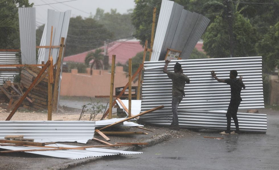
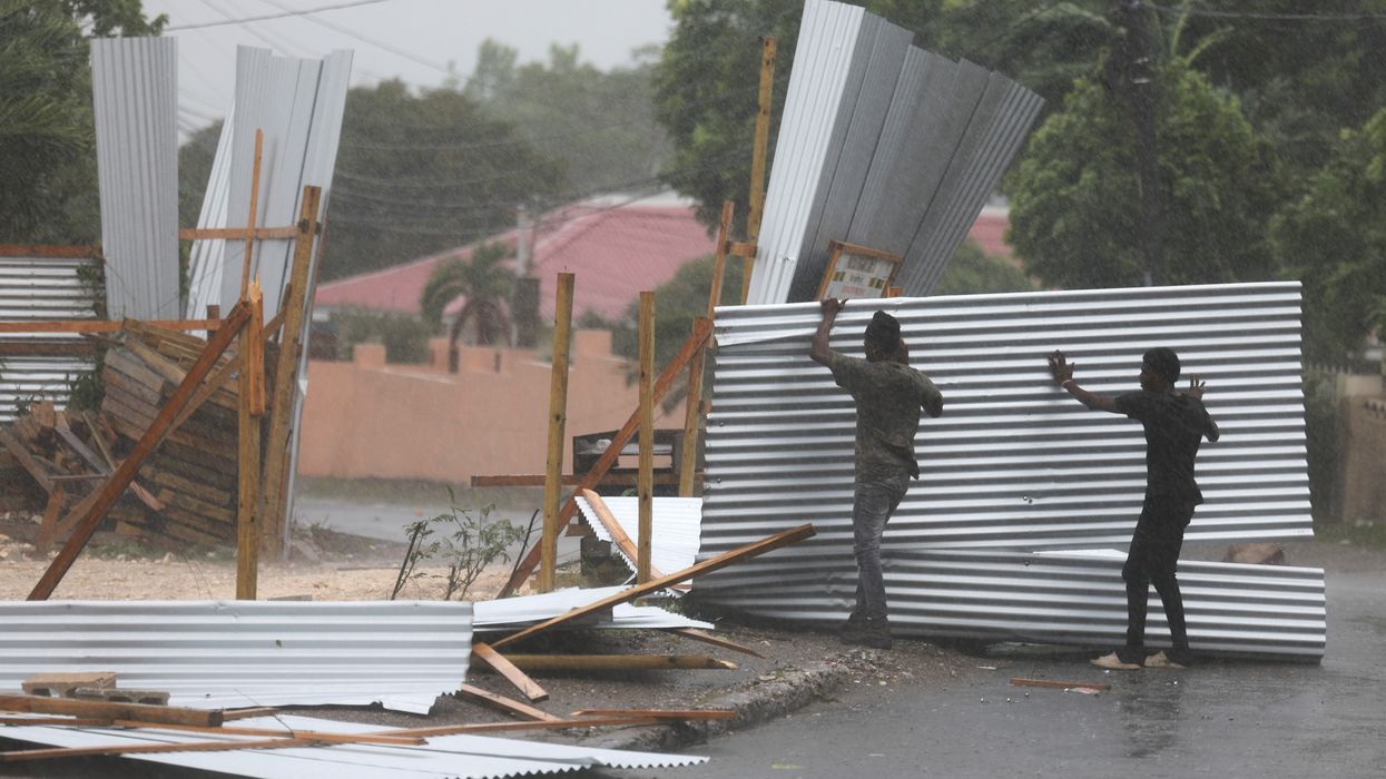
Hurricane Beryl has caused devastation in Barbados and Jamaica
|GB News
AccuWeather meteorologist Alex DaSilva said: “We’re getting more concerned that the upper-level atmospheric winds that steer a hurricane like Beryl can support a turn to the north this weekend.
“If Beryl is torn apart by wind shear over the next few days, it’s more likely to follow the trade winds and move west into Mexico.
“Unfortunately, we’re more concerned the storm will be a little stronger, which combined with the steering winds, may lead to Beryl moving toward the Texas Gulf Coast.”
Weather Channel meteorologist Jonathan Erdman said: “An upper-level heat dome over the southeast retreats off the east coast and weakens by the weekend.
“This leaves a nose of high pressure aloft over the Gulf Coast, and that opens the possibility that if Beryl emerges in the southwest Gulf of Mexico it may be able to bend a little bit towards the northwest.”
The storm, which has unleashed chaos across the Windward Islands in the Caribbean Sea, threatens affected states with devastating winds, rain and flooding.
LATEST DEVELOPMENTS:
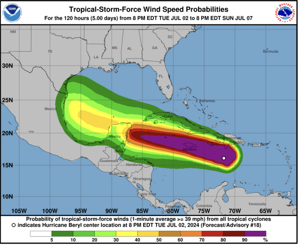
Hurricane Beryl is making its way towards Mexico and the south of the US
|National Weather Service
Beryl should be lessened by category by the weekend, though it will nevertheless pack a punch.
She is expected to downgrade to a "tropical" storm as she crosses the Bay of Campeche and enters the Gulf of Mexico.
Beryl is the first hurricane of the 2024 season, with another "cluster of storms" gathering pace in the Atlantic.
“We are tracking another cluster of thunderstorms over the south-central Atlantic that is showing signs of development,” said a spokesman for AccuWeather.
“Currently, there is a moderate to high risk of the system evolving into a tropical storm or hurricane later this week as it takes a very similar track to Beryl.
“However, because waters have been churned by Beryl, bringing cooler waters to the surface, we think this tropical rainstorm in the Atlantic is unlikely to reach the same intensity as Beryl.”
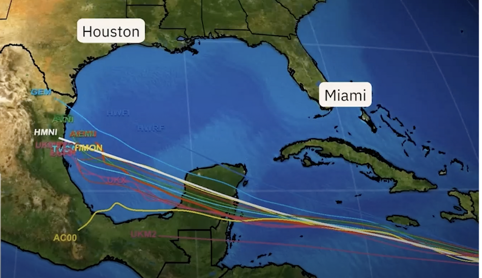
Possible trajectory for Beryl
|The Weather Channel
Meanwhile, temperatures across swathes of America are reaching fever pitch as a 110F-plus heatwave triggers alarm bells.
A blowtorch surge from the Gulf of Mexico has joined forces with a high-pressure ‘heat dome’ to rocket the mercury.
This has helped drive a separate spate of inland thunderstorms across western and southern America.
A spokesman for the National Weather Service (NOAA) said: “While heat will keep a gripe on large portions of the West and South, stormy weather will continue across portions of the Plains into the Lower Missouri Valley and Middle to Upper Mississippi Valley.
“While much of the country will see temperatures above average over the next few days, areas from the Northern Rockies into the Northern and Central Plains will see cooler than average temperatures.
“High temperatures across these regions are forecast to be 10 to 15 degrees cooler than average.”