
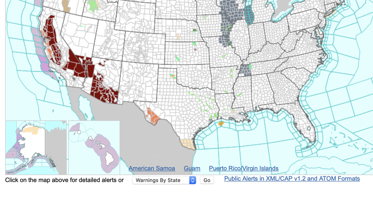


A ‘late-season atmospheric river’ will put a 1,000-mile stretch of the US on flood alert amid warnings for a month-long thunder deluge.
The west coast from northern California to Arizona aces flooding and mudslides from inches of rain dumped by a torrential deluge.
It will be driven by an atmospheric river–a dense column of moisture from the Pacific carrying up to 15 times as much water as in the mouth of the Mississippi.
As a plume of heat rises from the Gulf of Mexico, clashing air masses will spark thunderstorms and high winds, experts warn.
A spokesman for the National Weather Service (NOAA) said: “A late-season atmospheric river event will kick-off across the Pacific Northwest, bringing strong winds and moderate to heavy rain early in the week.
“Excessive rainfall and severe thunderstorms are possible over parts of the Great Plains and Mississippi Valley and heavy to excessive rainfall is possible across parts of the Northwest.
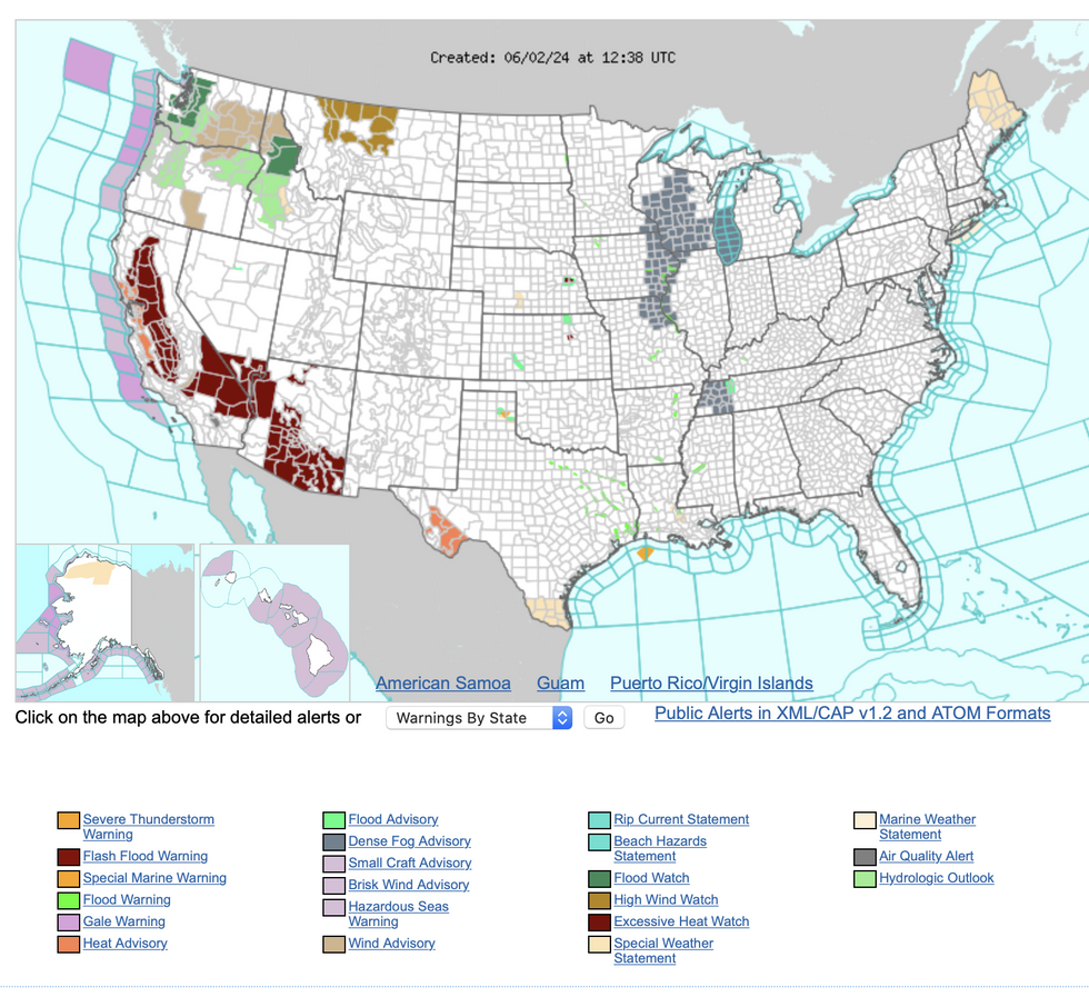
NOAA issues flash flood alerts
|NOAA
“Very large hail, severe wind gusts of greater than 75 mph, and a few tornadoes are expected while rain rates could be enough to cause flash flooding.”
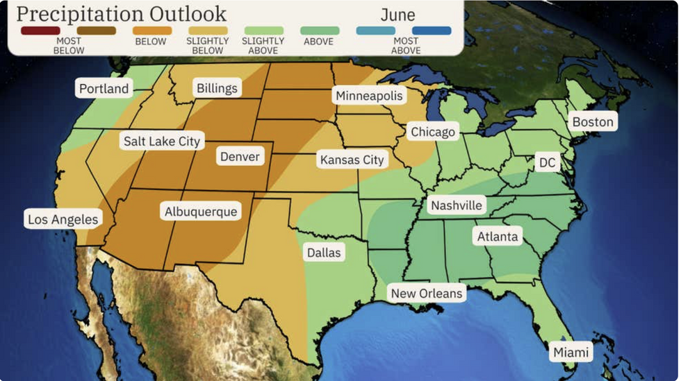
Rising temperatures across western states could drive thunderstorms and above-average rainfall through the start of summer.
Frequent electrical eruptions are likely through June as air masses compete through the change of seasons.
North-western, eastern and some central states are most at risk of a wet June, according to The Weather Channel.
A spokesman said: “A wet start to summer is possible in the South and southern mid-Atlantic, with thunderstorms that blossom during hot summer days to be a bit more common this June.
“This is likely from the lower Mississippi Valley to Georgia, the Carolinas and Virginia, where above-average rainfall is favoured.
 |
| THE WEATHER CHANNEL
“The driest conditions compared to average are expected from the Southwest into the Rockies and Northern Plains.”
A ‘hot ridge’ of high pressure will build over western America during the first week of June, he said, pushing temperatures higher than average.
However, over the Midwest and Great Lakes, the jet-stream pattern may drive cooler conditions for a time, he added.
He said: “Think of this outlook as an overview of how the month will fair as a whole.
“The June outlook is now hotter in the nation's northern tier while the South will be typical of June, and the West might see a split in temperatures.
“The Southeast and southern mid-Atlantic could be in for a soggy start to summer.”
As temperatures across southern states surge through the start of summer, cooler air will persist to the north.
A clash between the two will continue to drive a barrage of devastating storms which has caused havoc through spring.
Central states, where air masses collide, will continue to be at the greatest risk of storms and tornadoes.
Jim Dale, US weather correspondent and meteorologist for British Weather Services, said: “We are not out of the woods as far as the storms are concerned.
“Cool air from the north mixing with hot air from the south will continue to propagate storms and bring the risk of tornadoes.
“We are expecting more storm activity through the start of June, especially across central states.
“Further storms are expected this week as heat from the south builds.”