


Violent ‘devil winds’ driving torrential rain and snow across the US threaten a Christmas nightmare of landslides, rockslides and lethal floods.
Battered America is braced for another vicious attack from the elements with a churning storm poised to strike from the Pacific.
Deepening pressure systems across the eastern regions threaten to fuel the assault, opening the gates to furious Santa Ana winds from the desert.
Also called ‘diablo’ or ‘devil’ winds, the powerful gusts roar downslope from regions sandwiched between high and low pressure.
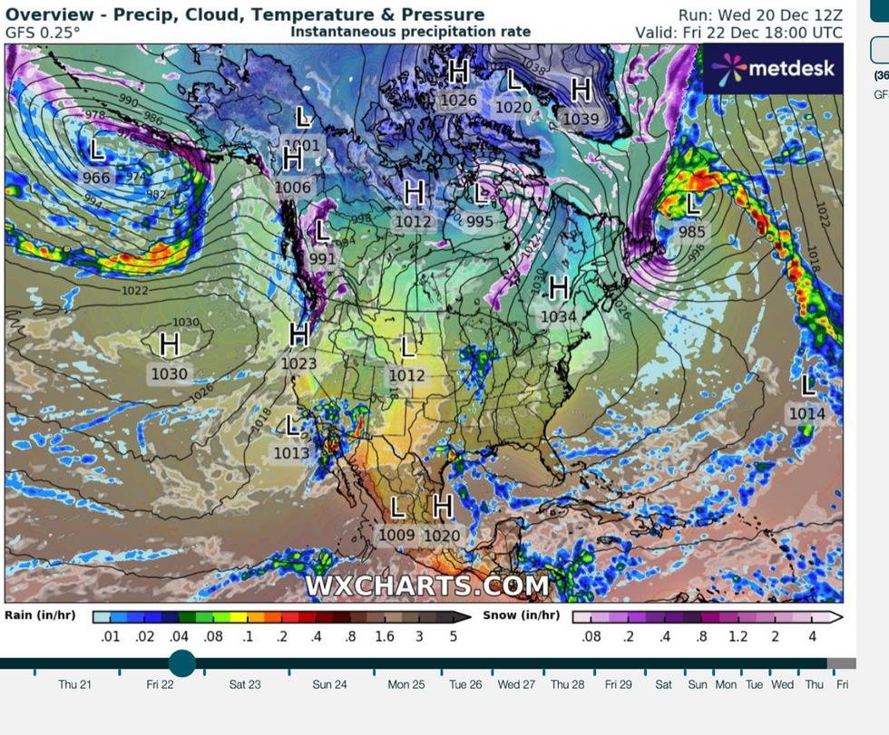
Battling pressure systems threaten devil winds and rain
|WX charts
California is in the firing line for torrential rain, snow, thunder and clouds of dust swept in from desert states, experts warn.
Jim Dale, US weather correspondent and meteorologist for British Weather Services, said: “Low pressure will build across California from the middle of the week, and this is going to put the region at risk of a vigorous storm.
“This could also trigger Santa Ana winds coming in from the desert states including Nevada and the surrounding area.
“This could end up bringing a lot of dust across from the region, and this will cause additional problems.”
Plunging temperatures will mean the usually warm Santa Ana winds will arrive with a chilly winter bite.
US LATEST: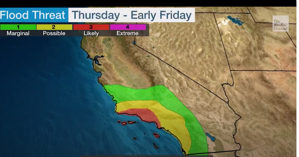
Coastal regions on alert for floods
|The Weather Channel
However, the main risk from the storm will be torrential downpours through the rest of the week.
Dale said: “This low is going to arrive with a lot of moisture, so the main risk in the run-up to the weekend will be from the rain and the potential for flooding.
“This is partly due to the ‘ocean effect’, in that this is being fuelled by the warmer-than-average ocean waters.”
The US National Weather Service has issued a raft of flood alerts on Friday across northwest California and San Diego.
Parts of the region are on alert for two to four inches of rain, although the worst-hit regions could get eight inches.
Fast-flowing flood water also threatens debris flow, rockslides and mudslides, according to The Weather Channel.
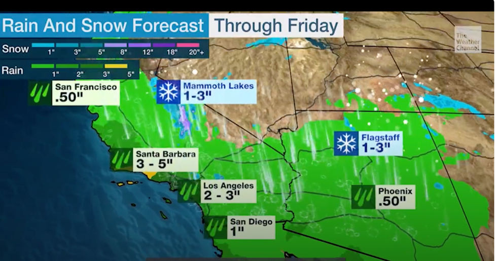
Rain and snow deluge forecast for Friday
|The Weather Channel
Meteorologist Chris Dolce said: “A slow-moving storm will drench Southern California with heavy rain, triggering possible flooding and debris flows in recent burn areas, as well as rockslides and mudslides over the next couple of days.
“The storm will slowly track inland across Southern California through Thursday and the first half of Friday.”
Weather Channel meteorologist Domenica Davis added: “The main event weatherwise is certainly out to the west.
“We have a slow-moving system that is going to be targeting California and the Desert Southwest over the next couple of days.
“This is going to be especially in southern California where we are expecting heavy rainfall and impacts through Thursday and even through much of Friday.”
Rain will turn to snow through Friday with up to three inches expected in parts including Mammoth Lakes, California, and Flagstaff, Arizona.
Coastal areas will bear the brunt of the deluge where unstable atmospheric conditions could drive thunderstorms, Davis warned.
She said: “We could be looking at some mudslides, and certainly flash flooding is going to be the biggest concern.
“We could have some thunder in the forecast as well, so a little bit of a severe component could be on the cards, especially Thursday and into Friday.”