


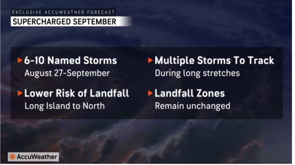
America faces a ‘supercharged September’ threatening a five-week ‘parade’ of 10 tropical mega storms.
Near-record ocean temperatures and humidity from the summer heatwave will turn the Atlantic into a hurricane hotbed.
A Saharan dust cloud, which has until now kept a lid on the storm season, will clear, paving the way for a high-octane assault.
AccuWeather meteorologist Alex DaSilva said: “We could see a parade of storms developing during the month of September.
AccuWeather warns of 'supercharged September'
|AccuWeather
“The statistical peak of the hurricane season is September 10, and we expect the Atlantic basin to be incredibly active.
“Water temperatures are near or at record-high levels across much of the Atlantic, Caribbean and Gulf of Mexico.”
The hurricane season, which officially kicks off in June, has so far this year been relatively quiet.
August heralds peak storm season, but atmospheric conditions including high levels of Saharan dust have dampened activity so far this year.
Hurricane Ernesto battered the Caribbean mid-month after Beryl and Debby struck earlier delivering more of a punch to the US.
US LATEST: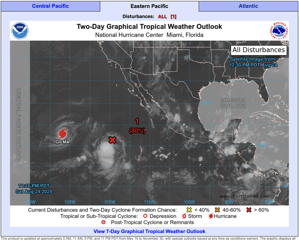 US weather: America faces ‘supercharged September’ amid 5-week storm threat | National Hurricane Centre
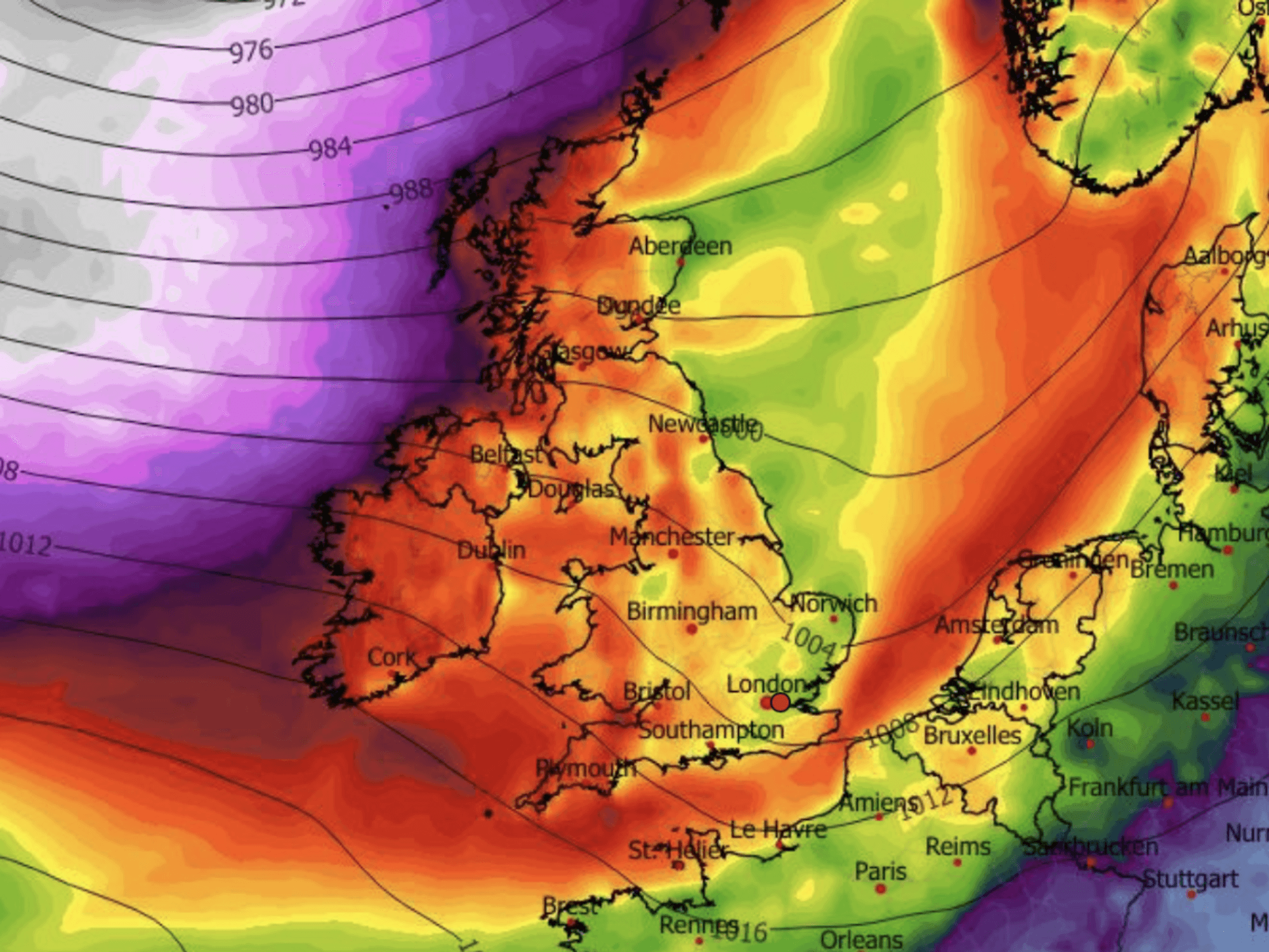
The dampening dust cloud will clear through the end of the month as ‘boiling’ ocean temperatures set the hurricane season alight.
Jim Dale, US meteorologist for British Weather Services, said: “The hurricane season is about to ramp up and we expect to see Atlantic activity grow through the start of autumn.
“Saharan dust has stifled hurricane development so far, apart from Ernesto recently and Debby earlier in the season, but this is starting to clear.
“We are also looking at boiling sea temperatures in the Gulf of Mexico and so we have a witches’ cauldron ripe for hurricane formation.”
AccuWeather predicts between six and 10 named storms through the next five weeks will deliver a ‘back-to-back’ assault.
Multiple storms could form on the same day, experts warn, which could be strong enough for greater inland impacts.
DaSilva said: “We are warning people to prepare for back-to-back tropical threats in the Atlantic basin in the coming weeks.
“It is possible that we could see multiple tropical storms and hurricanes in the Atlantic basin on the same day, similar to the frequency of storms that we’ve seen during other supercharged hurricane seasons like 2020.
“The inland impacts we’ve already seen from hurricanes this year are vivid reminders that everyone needs to be prepared across much of the eastern United States, even if they live hundreds of miles from the coast.”
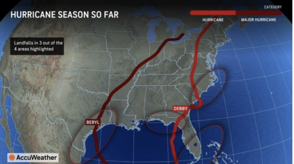
AccuWeather maps shows hurricane season so far
|AccuWeather
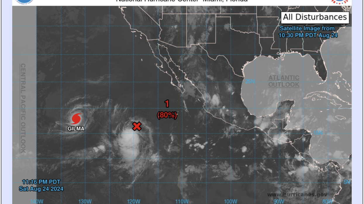
The warnings come as two storms –Hurricane Gilma and Tropical Storm Hone– gather pace in the eastern Pacific.
Hawaii is braced for strong winds and torrential rain as both systems charge west across the Islands
The US National Hurricane Centre has tropical storm warnings in force for the region through the start of the week.
A spokesman said: “Hone's main threats continue to be the potential for heavy rainfall leading to flooding, damaging winds and large surf along east-facing shores.
“Strong and gusty easterly winds and periods of heavy rain will occur through Monday as Tropical Storm Hone passes south of the islands.
“A return of breezy areawide trade winds is expected from Monday night through the remainder of the week as Hone continues its westward trek away from the island chain.”