US weather: Freak pulse of tropical heat to bring 26C blast for a WEEK

US weather: Freak pulse of tropical heat to bring 26C blast for a WEEK
|Weather.us

The bizarre heat spike is likely to be the result of El Nino
Don't Miss
Most Read
Latest
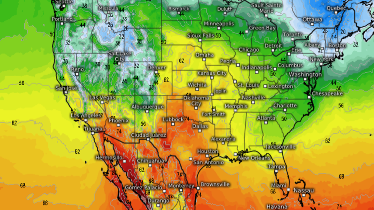
A freak pulse of tropical heat and humidity is about to push temperatures in parts of the United States into the 80Fs.
Sweltering gusts from Mexico sweeping southern and southwestern states this week will nudge the cold for a late taste of summer.
California, Arizona, New Mexico, and the western half of the US will simmer in 25C-plus temperatures–well above average for the first week in December.
WATCH HERE: UK weather outlook
Warm weather will hold out for much of the week before a cold front dampens the fire of the warm spell.
Jim Dale, US weather correspondent and meteorologist for British Weather Services, said: “A pulse of warmth from Mexico will sweep the western half of the US this week, and we could see temperatures, unusually, hit 24C or 25C.
“This is above average or the time of year, and there will be some humidity with the heat as its origin is tropical in origin.
“This is likely to hold out through the week before it turns a bit colder.”
US LATEST:The bizarre heat spike is likely to be the result of El Nino–the warming of the East Pacific, near the coast of Peru.
El Nino, which can affect weather patterns around the world, was confirmed earlier in the year before strengthening into a significant event.
It occurs when the easterly trade winds slow or even reverse, allowing warm water to build off South America.
In the United States, it can sometimes lead to colder and wetter conditions, or warmer drier weather.
Mr Dale said: “The hot spell we are about to see could be an effect of El Nino.
“Some of the impacts of this are already starting to be seen around the world, and this seems to tie in with what is happening in the United States.
“It may also be the result of higher sea temperatures after the hot weather during the summer.”

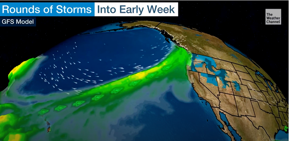
But storms will hit parts of the country
|The weather Channel
Meanwhile, volatile atmospheric conditions triggered by hot air crashing into colder air have put parts of the country on storm alert.
South-eastern and north-western states are braced for fireworks with experts warning the region could be the target for tornadoes.
Weather Channel meteorologist Reynolds Wolf said: “Low-lying areas could be susceptible to that water really piling up, so be careful.”
The US National Weather Service (NOAA) forecasts temperatures to persist through the start of the week, with the potential for records to topple.
A spokesman said: “A fast-moving disturbance tracking southeast through the Upper Midwest may bring light rain and snow to portions of the region Monday night and into Tuesday.
“Temperature-wise, most of the continental US remains devoid of frigid or winter-like air masses.
“[Record-breaking mild temperatures are] possible in the Pacific
Northwest Monday and Tuesday mornings.
“Temperatures will continue to warm up in the West by Tuesday, but colder temperatures look to make a return in the East by mid-week.”


