
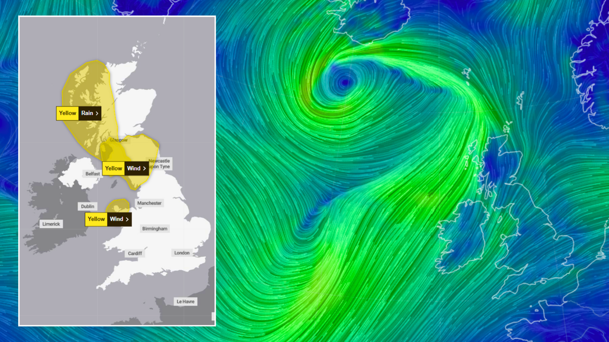


The Met Office has issued yellow weather warnings across Scotland, Wales and England as the UK braces for impact from the tail of a hurricane.
Hurricane Ernesto had careered across the western Atlantic Ocean for a number of days, smashing into Bermuda as it made its way over the water.
With its tail end already whipping up large waves on the Irish coast, the Met Office has slapped western Scotland, northern England and north Wales with two days of yellow weather warnings as Britons are urged to batten down the hatches.
On Wednesday, a sizeable yellow rain warning is in place across much of west Scotland - which carries on through to Thursday, when it is joined by two yellow wind warnings in Wales and the North West.
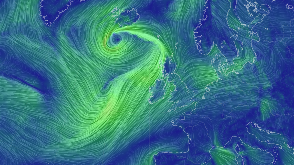
Simulated wind maps show how western parts of the UK and Ireland are heading for a wind-whipping
|Earth.nullschool.net
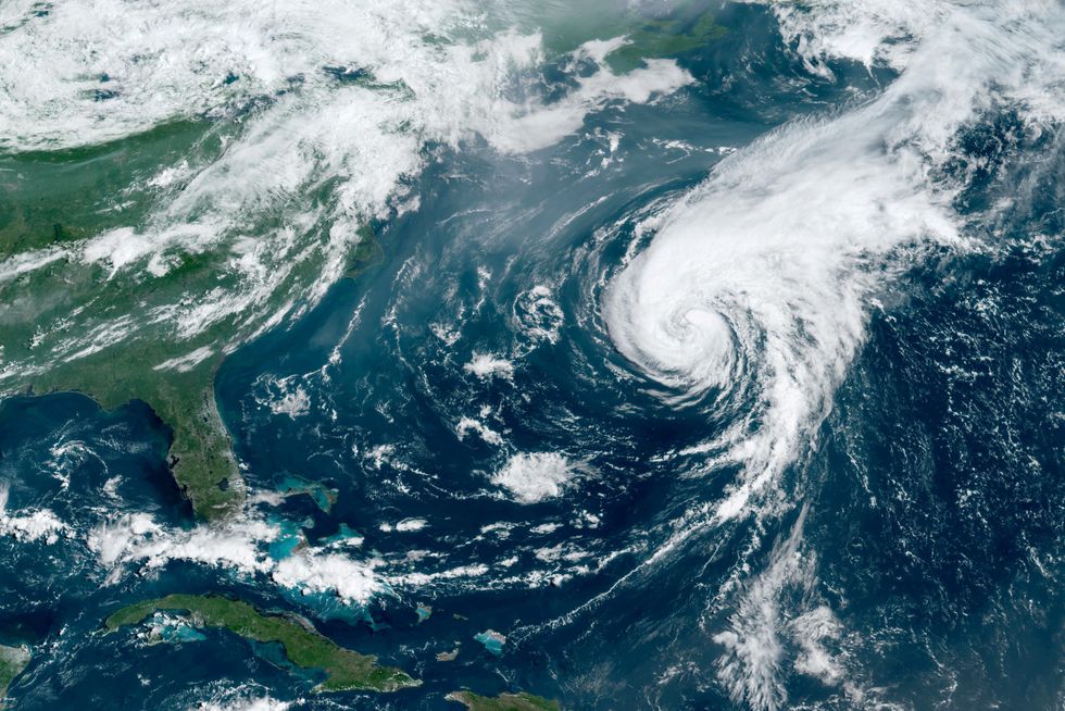
Extraordinary satellite footage of Ernesto was released by NOAA which showed it crossing the Atlantic
|NOAA via Reuters
Fortunately, the UK is set to escape the worst winds of the waning hurricane, with simulated mapping showing the eye of the storm circling in around Iceland and the North Atlantic.
But still, parts of Scotland are in for a drenching, with 150mm of rainfall - a month's worth - set to fall in a mere 24 hours.
Meanwhile, strong winds with gusts of up to 60mph are slated to streak across Scotland - leading to what forecasters have called "dangerous conditions".
The Scottish Environment Protection Agency has issued 12 flood warnings and 14 flood alerts across parts of the country.
LATEST WEATHER UPDATES:
The Met Office's chief meteorologist Jason Kelly said: "A band of rain will move in from the west on Wednesday morning and will become slow-moving with heavy bursts of rain at times, especially over high ground in Scotland.
"This rain will persist into Thursday for many within the warning area, with 75-100mm likely quite widely, with higher accumulations possible over the higher ground.
"Gusty winds will accompany the rain, with 50-60mph possible near Irish Sea coasts and the west of Scotland.
"Coupled with spring tides, this could lead to some dangerous coastal conditions before winds gradually ease later on Thursday."
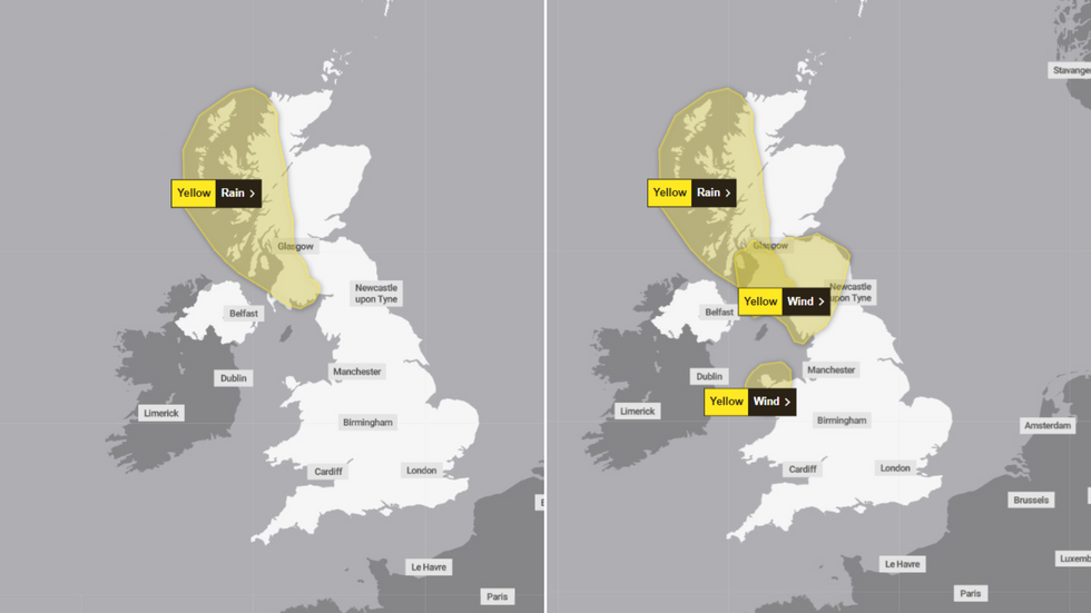
The Met Office has issued yellow rain and wind warnings for the UK on Wednesday (left) and Thursday (right)
|Met Office
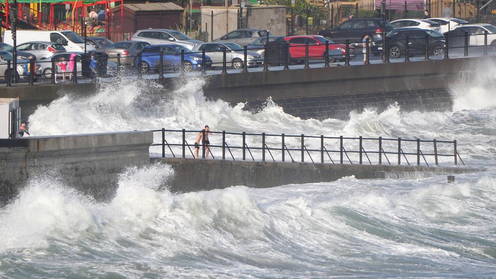
The hurricane has already battered the Irish coastline
|PA
After the inclement climes come to a close, the outlook for the UK as a whole is much milder, according to the Met Office's three to five day forecast.
Meteorologists have said conditions will likely remain "unsettled", with the southeast of the country set for wet weather - which will then sweep north across the UK.
Looking forward after that, the Met Office counsels that "persistent rain and strengthening winds" can be expected across the north and west of Scotland and Northern Ireland, with "dry and settled" conditions expected for other parts of the countries.
Its early long-range forecast says: "Temperatures overall will probably be close to average at first with a chance of some warmer conditions developing in the south and east, probably extending to most parts [of the UK] by the middle of next week."