
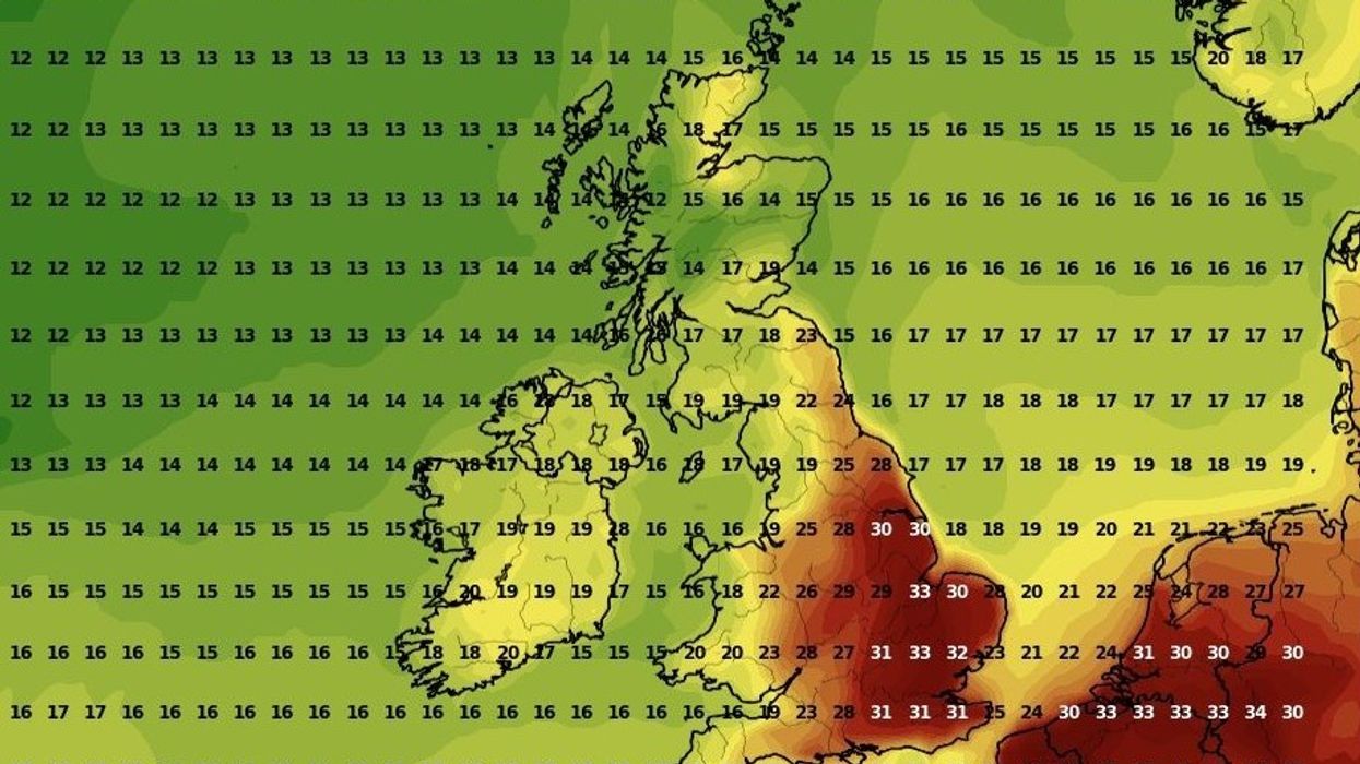


Temperatures could reach a sweltering 35C today as a hot blast brings summer sunshine back to the UK, meteorologists have claimed.
High-pressure winds will drag warm continental air to Britain, with mercury climbing yesterday.
Conditions will return to around an average level of Tuesday, the Met Office has claimed.
Temperatures will not likely exceed the 40C experienced in Coningsby, Lincolnshire, in July 2022.
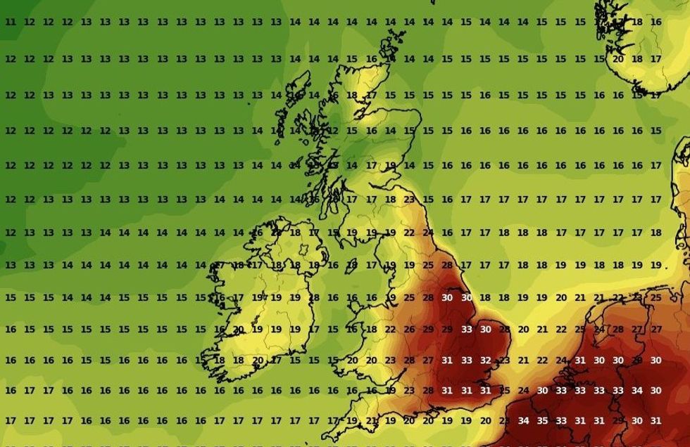 UK weather: Warmest day of the year set to strike Britain TODAY in 35C hot blast | WXCHARTS
However, Met Office forecaster Craig Snell said: “It's going to be hot. The weather is coming with a lot of humidity, so it will feel quite uncomfortable out there across central eastern England.
“Elsewhere, it's still going to be warm and humid, but the hottest weather will be in central eastern England.”
The Met Office recommends that people keep curtains closed during the peak of the day and drink lots of water.
London, the East of England and South East will see the warmest weather today, with highs of 35C in London.
LATEST DEVELOPMENTS: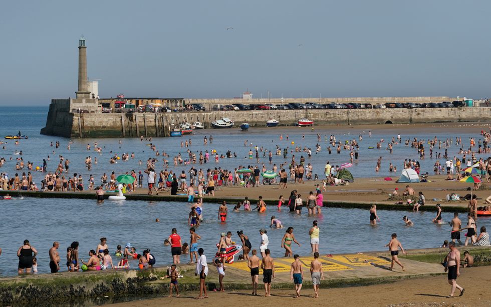 A view of a busy beach in Margate, Kent. Thunderstorms are set to hit parts of the UK amid a record-breaking September heatwave | PA
Manchester will witness slightly cooler conditions at 26C, with Edinburgh dipping to 21C.
The hottest day in 2024 was recorded last month, with the mercury hitting 31.9C in Central London on July 19.
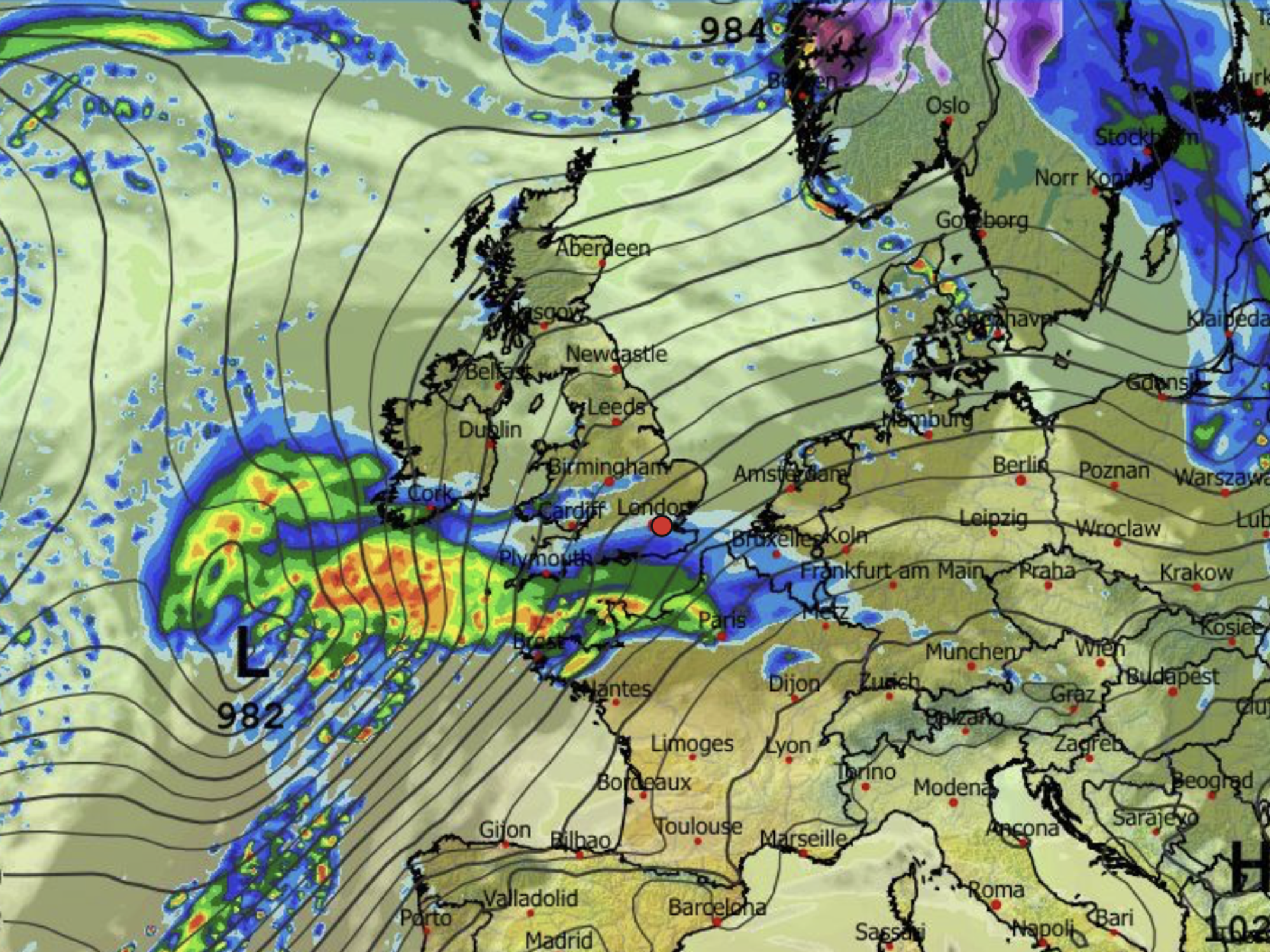
However, the Met Office is also warning Britons in Scotland and the North of England about potential thunderstorms occurring in the aftermath of the hot weather.
The UK’s national weather service, which issued the warning from 2am to 1pm, said: “Thunderstorms are expected to develop over western parts of the UK and move northeast during the second half of Sunday night becoming organised into Monday morning.
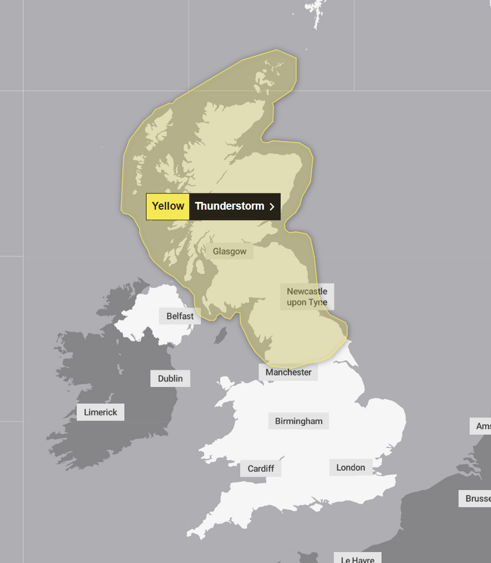
The Met Office's yellow weather warning
|MET OFFICE
“Although not all parts of the warning area are expected to see them, an area of increasingly organised thunderstorms is likely to produce a combination of frequent lightning, heavy rain, hail and short periods of strong winds.
“Some torrential downpours are likely, with 20-40 mm in places, and a potential for 40-60 mm of rain to fall in 1-2 hours very locally, with hail up to 2 cm in diameter.
“Thunderstorms are expected clear towards the northeast by Monday afternoon.”
The Scottish Environment Protection Agency has also issued 18 flood alerts.