


A rogue snowstorm hitting America could rescue Britain’s summer and finally coax the sun out of hiding.
After weeks of rain and miserable temperatures, the weather this week is showing signs of a major U-turn.
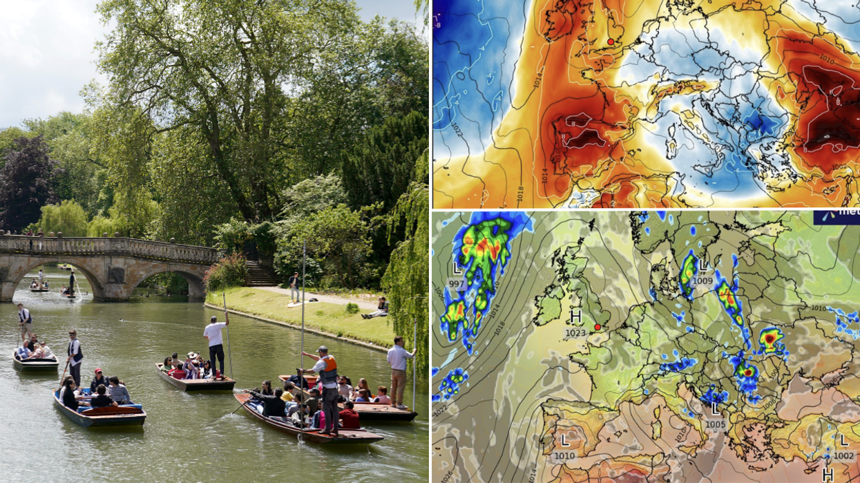
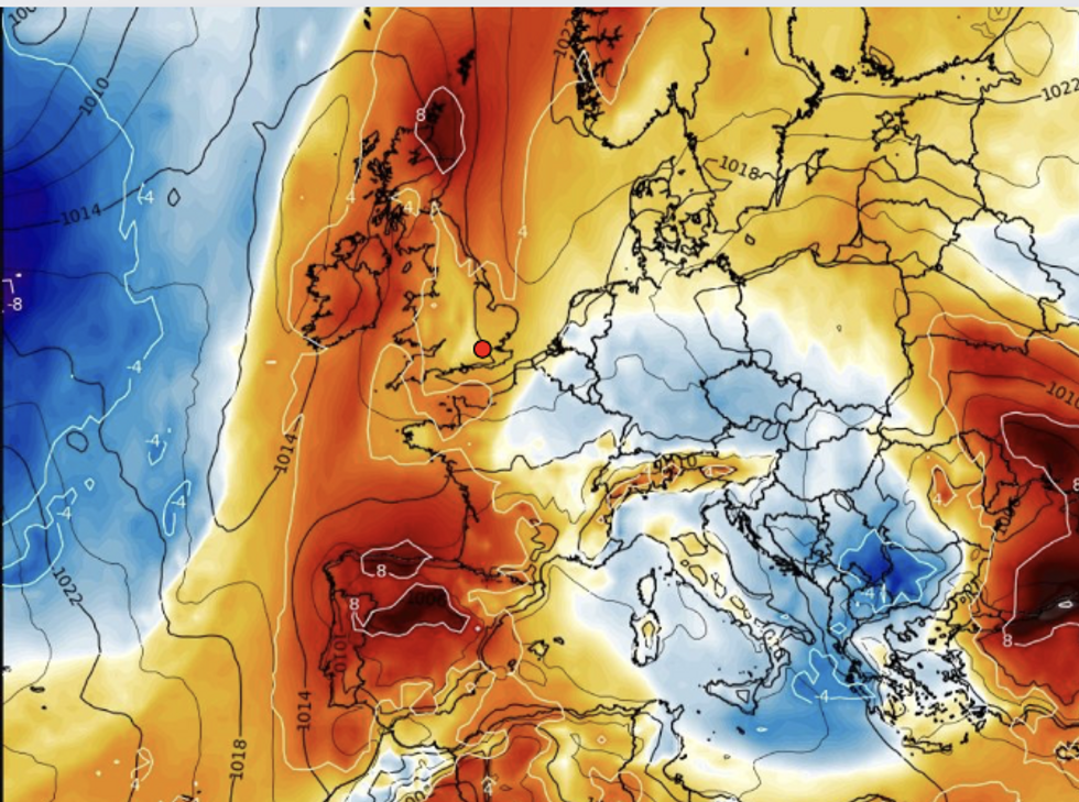
The change is down to a huge contrast in temperatures across the US firing the jet stream and boosting high pressure close to the UK.
It will feel warmer from mid-week, according to the Met Office, although rain will return at the weekend.
Warmth returning
|WXCHARTS
Met Office deputy chief meteorologist Dan Harris said: “In stark contrast to the first half of June, where temperatures have widely been below average, we are expecting to see a steady uptick through the second half of this week, rising to around or above average, and it will likely feel very warm for those in the sunshine.
“This initial spell of warm conditions isn’t expected to last too long however, as it turns more changeable through Friday and into the weekend with areas of cloud and rain spilling east across the UK.”
The jet stream has come under the influence of a massive temperature contrast across the United States.
Northwest America is currently on alert for inches of snow while the south bakes in a 110F heatwave.
The supercharged jet stream, a huge driver of the UK weather, will race across the Atlantic to the rescue of the British summer.
A Met Office spokesman said: “A strengthening of the jet stream, generated by temperature contrasts in North America, will cause a shift in the UK’s weather this week, with a ridge of high pressure toppling across the UK ahead of frontal systems being driven along by the jet.
LATEST DEVELOPMENTS:
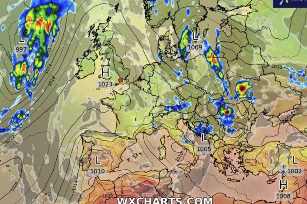
High pressure builds over UK
|WXCHARTS
“The westerly wind will bring temperatures back up to average quite widely and becoming above average in sunnier periods mid-week.”
Britain’s undecisive weather has had meteorologists tearing their hair out for weeks as temperatures fluctuate wildly while torrential downpours and thunder suddenly give way to sunshine.
The outlook for June has been on a knife edge over the past week, with experts only now taking their fingers off the panic button.
Independent forecasters agree Britons can finally put away winter coast and take barbecues out of storage.
James Madden, forecaster for Exacta Weather, said: “Summer should finally arrive to the UK through the coming week as high pressure has more of an influence on the weather.
“By the middle of the week, parts of southern Britain will see temperatures in the mid-20Cs, or even higher, and in the north, temperatures could hit the low 20Cs.
“The outlook is good for next week, too, with high pressure again causing temperatures to rise.”
But it will not be a straight run, with Britons warned they will be ‘dodging bullets’ before the hot weather sets in.
Jim Dale, meteorologist for British Weather Services, said: “As we go into July, we are likely to see long-overdue high pressure start to build and that will bring the summer sunshine that has been lacking so far.
“But before then, we are going to be dodging the bullets with the risk of more rain as fronts come through and the possibility of thunderstorms.”