UK weather: 'Monster anticyclone' to wreak havoc across Britain as 'battle' with westerly 'cyclonics' threatens snow blast

WATCH: The GB News weather forecast for January 17 with a look ahead to the weekend
|GB News

The victor will decide whether January climaxes in an easterly snow blast or another round of wet and windy storm misery
Don't Miss
Most Read
Latest
Storms and the risk of snow threaten a tumultuous end to January as Britain takes centre stage in a battle between the Baltic and the Atlantic basin.
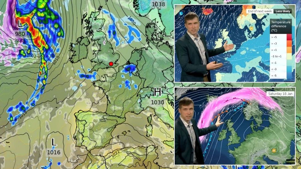
A monster ‘anticyclone’ encroaching from eastern Europe is about to clash swords with a rowdy mob of westerly ‘cyclonics’.
The victor will decide whether January climaxes in an easterly snow blast or another round of wet and windy storm misery.
Most likely is for the month to close on the latter, although ‘not out of the question’ is a shivery blast from the East.

Storms and the risk of snow threaten a tumultuous end to January as Britain takes centre stage in a battle between the Baltic and the Atlantic basin
|Met Office/ WXCHARTS
Met Office meteorologist Alex Burkill said: “Towards the end of next week, we have a ridge of high pressure building.
“Because it moves through quite quickly, we wouldn’t see much of an easterly developing, instead we have low pressure not too far away and so we get a west, south-westerly quite mobile pattern and this is the most likely scenario for the end of next week.
“But not out of the question scenario is for high pressure to be somewhere a little bit nearer over Scandinavia, and if this comes off we could end up with an easterly wind over the UK and at this time of year that’s a cold direction and we could see temperatures dropping.”
Recent reports of a beast from the east snow mega-blast were ‘unlikely’, he added, although a colder start to February was possible.
Britain’s weather will also be driven by a cold plunge off the coast of America fuelling a powerful jet stream.
This could strengthen low-pressure storm systems on their path towards the UK brining wet and windy weather.
A ‘battle’ between a high-pressure ‘anticyclone’ to the east and low pressure ‘cyclonic systems’ to the west will keep Britain’s weather in the balance.
Burkill said: “High pressure has been in control for a while, and it is going to cling on for a couple more days, but exactly how long it’s going to last is uncertain.
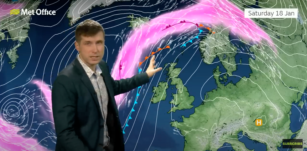
“Around this time next week we will end up with a sort of battle ground, and where high pressure is going to be will be pivotal to the weather, and there is the potential for something a bit more changeable and a bit more mobile coming in from the west as we go through the latter part of next week

Met Office’s Alex Burkill explains that there is low pressure from the west
|Met Office
“Over the Atlantic, a cold plunge of air is important because that will strengthen the jet stream which will play a pivotal role in how our weather is going to play out over the next week or so.
“That strengthening jet is going to bring a bit of mobility, so we will see an area of low pressure developing and this is going to bring some warmer air with it and that is going to strengthen the jet stream.”
Experts agree that after a relatively calm weekend, the most likely picture is a return to wind and rain.
Jim Dale, meteorologist for British Weather Services and social commentator, said: “After the weekend, we are most likely to go back into an Atlantic regime, and this will follow a relatively quiet period.
“This is another respite in the run of storms and colder weather we have seen since the beginning of winter, but it is going to come to an end, and I think that this will most likely happen with a more changeable pattern from the Atlantic.”


