


Soaked Britons have been issued a fresh yellow weather warning as new downpours are set to hit in just days, bringing with them up to four inches of rain.
Over the weekend, parts of the UK experienced a month’s worth of rain in just 24 hours, signalling the official end of summer.
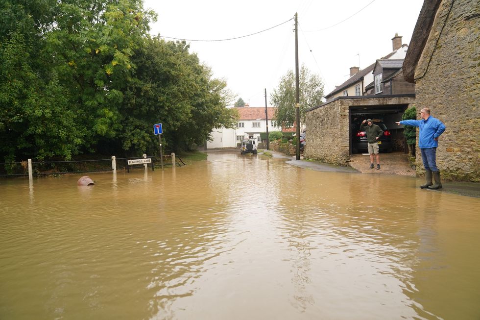
Commuters experienced travel chaos with roads shut, tube lines part-suspended, and disruption to train lines, whilst parents struggled with childcare arrangements as many schools shut their doors for the day.
Both an amber and a yellow warning were in place, whilst 87 flood warnings were issued.
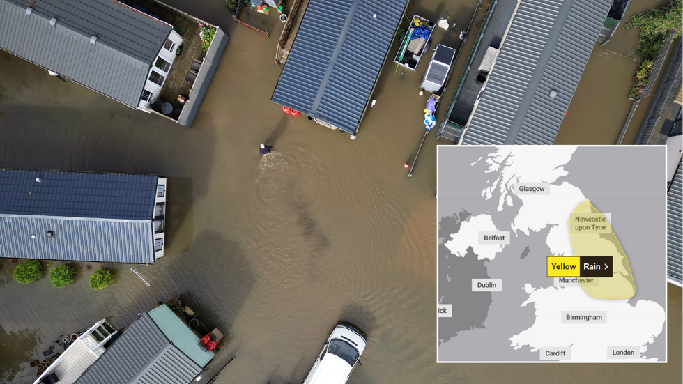 Rain-soaked Britain issued fresh yellow weather warning as deluge to hit in just days |
 PA/Met Office
Whilst Britons have enjoyed a slight respite from the dreary weather, heavy rain is set to resurface on Thursday, causing more travel disruption in its wake.
A newly issued yellow warning is in place for the entirety of Thursday, beginning at 12.00am and ending at 11.59pm.
However, this time, a different part of Britain will be hit by heavy downpours.
Parts of the East Midlands, North East England, North West England, and Yorkshire & Humber could see up to 100mm of rain.
WEATHER LATEST:
⚠️ Yellow weather warning issued ⚠️
— Met Office (@metoffice) September 24, 2024
Rain across northern parts of England
Thursday 0000 – 2359
Latest info 👉 https://t.co/QwDLMfRBfs
Stay #WeatherAware⚠️ pic.twitter.com/XmNRbEv95O
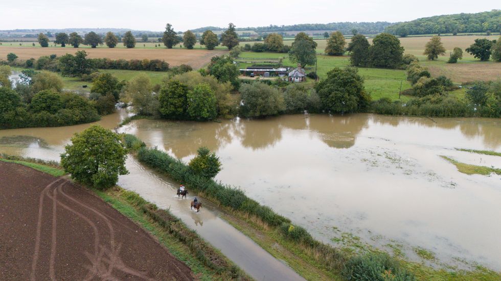
Horse riders make their way through flood water in Walton in Warwickshire
|PA
The Met Office has cautioned that there is a “slight chance of power cuts and loss of other services to some homes and businesses”.
Flooding is also a possibility, albeit small, and if there is a deluge, some buildings could be damaged.
Travel disruptions are also to be expected, whilst driving conditions could also be compromised.
“There is a small chance that some communities will become cut off by flooded roads,” the weather service added.
The Met Office wrote of the upcoming alert: “A period of heavy and persistent rain is expected to affect parts of northern England and north Midlands during much of Thursday. The heaviest rainfall is likely to be across the Pennines and North York Moors where 80-100 mm of rainfall could accumulate during the course of the day.
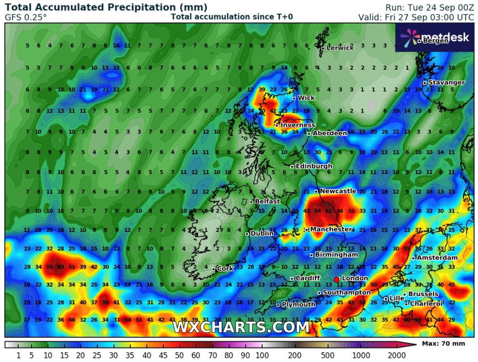
Heavy downpours are expected in the next couple of days
|WXCharts
The Environment Agency issued 76 alerts for 'possible' flooding and 13 warnings for 'expected' flooding
| PA“Elsewhere, totals are likely to be lower, reaching 20-30 mm widely but with a risk of 50-70 mm in some locations.
“Strong winds may also affect coastal locations and routes over high ground.”
Met Office Chief Meteorologist Paul Gundersen said: “The rainfall from Monday has now cleared away to leave a drier interlude for many, whilst some residual rain moves southwards across parts of Scotland. This drier spell will last until early Wednesday for most, before the next area of low pressure brings further rain later on Wednesday and into the latter part of the week.
“Further rain is likely for parts of England and Wales on Thursday. If and where this falls on saturated ground, the sensitivity to potential impacts is increased. At present, the heaviest rain looks like falling across east-facing hills of northern England, although there is some uncertainty in the regional focus.”