


Britons should brace themselves for a rainy start to September after the Met Office issued a rare “danger to life” weather warning.
A severe rain alert, which will see up to two inches of rainfall across a couple of hours, has been issued for large parts of England and some areas of Wales.
The alert covers the east of England, south east, east Midlands, west Midlands, south west, London and parts of Wales. It begins at 9pm on Wednesday and lasts until 9am on Thursday.
Power cuts, flooding and travel chaos are all likely over the 12-hour period, the weather forecaster has warned, adding that “danger to life” is possible.
Met Office issues rare 'danger to life' weather warning for rain
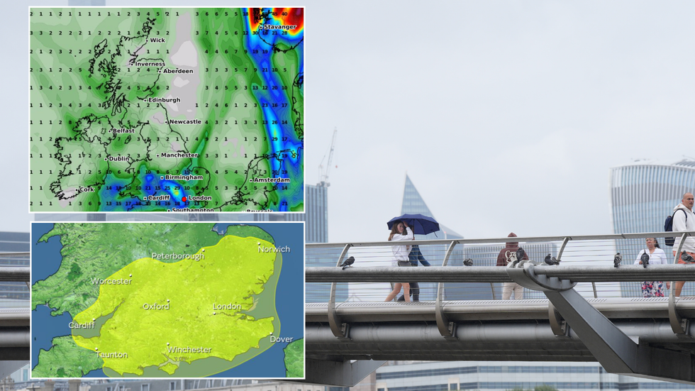
|PA/Met Office/WXCharts
It predicts that in areas of heavy downpour, between 20-50mm of rain could occur in a period of just an hour or two.
The Met Office cautioned that spray and flooding could create treacherous driving conditions and lead to some roads being closed.
Cancellations to public transport services are also likely in areas where flooding or lightning occurs.
“There is a slight chance that power cuts could occur and other services to some homes and businesses could be lost,” the weather office added.
WEATHER LATEST:
“There is a small chance that homes and businesses could be flooded quickly, with damage to some buildings from floodwater, lightning strikes, hail or strong winds.”
In addition, the warning said: “There is a small chance of fast flowing or deep floodwater causing danger to life.”
The weather forecaster said: “Whilst there is some uncertainty, and not all areas will be affected, scattered heavy showers on Wednesday evening may merge into longer spells of heavy, showery rain in places through Wednesday night into Thursday morning.
“Where heavy downpours occur, perhaps thundery in places, accumulations of 20-40 mm are possible in an hour or two, with the small chance of isolated accumulations over 50 mm, potentially impacting the Thursday morning commute in some areas.”
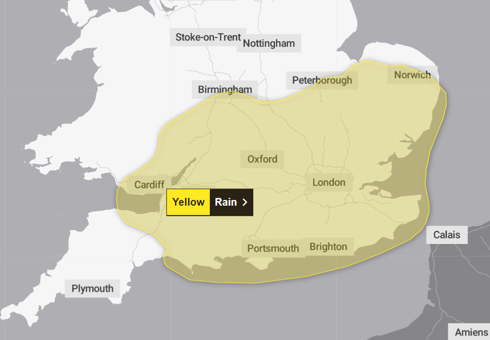
The alert covers the East of England, South East, East Midlands, West Midlands, South West, London and parts of Wales.
|Met Office
The warning is not the first of its kind this month - on just Sunday, a yellow alert was in place for almost two days across large swaths of the UK.
Britons were told to brace for heavy showers, “frequent lightning strikes” and thunderstorms, with meteorologists warned that up to 40mm of rain could fall in just an hour in some areas.
Met Office Deputy Chief Meteorologist Dan Harris said: “Through Saturday night and into Sunday we'll see a gradual change in our weather across the UK with an increasing chance of heavy thundery showers developing, particularly across central parts of the UK.
“Not everywhere within the warning area will see thunderstorms, and confidence in any individual location being affected remains extremely low at this time.”