


An Arctic-circle storm trio locked in battle with a Bermudan heat dome will hit Britain with tropical warmth and showers.
Temperatures in parts this week are back on the rise while elsewhere, brollies and raincoats are on standby.
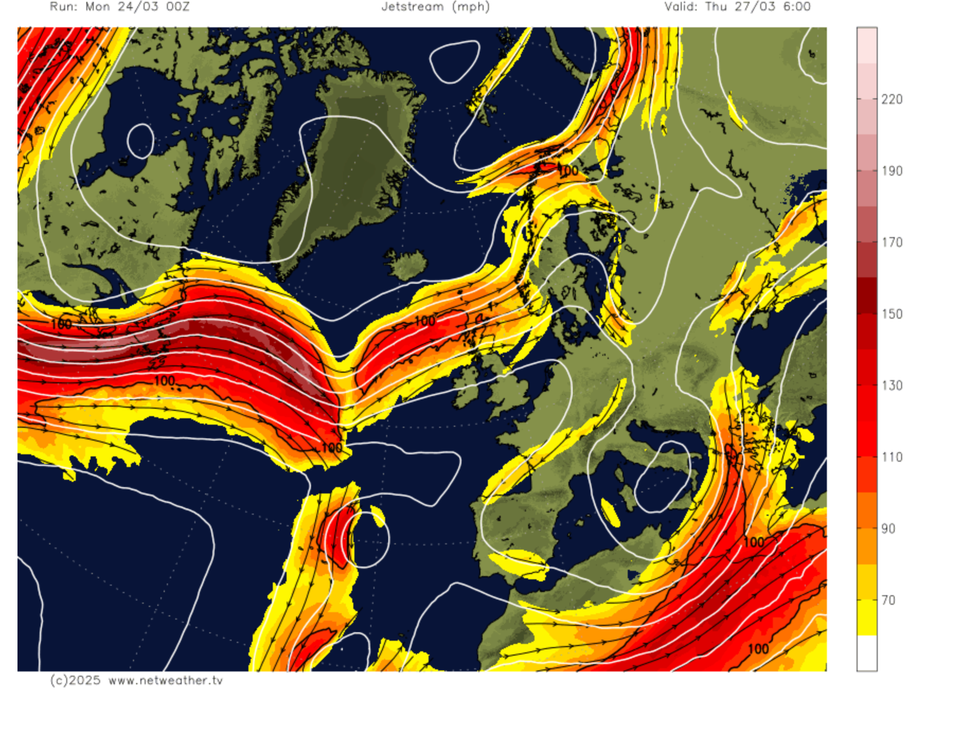
Britain’s weather will once again fall to the mercy of the jet stream as it plays linesman to warring weather systems.
To the north, low-pressure cyclones skimming Scotland threaten rain while to the south, temperatures will rise under the watch of the Azores, or Bermuda, High.
An Arctic-circle storm trio locked in battle with a Bermudan heat dome will hit Britain with tropical warmth and showers
|Netweather
Arrival of the Azores High at this time of year can drive summer-like warmth and ‘block’ the last efforts of the stormy Atlantic.
Jim Dale, meteorologist for British Weather Services, said: “The Azores high starts to drift up towards the UK and becomes our own area of high pressure towards the end of this week.
“Away from the northwest of the country, which will be under the influence of low pressure passing Iceland, the picture is very dry, and we are looking at an overall dry picture into April.
“As we go through early spring, we are likely to see huge shifts between daytime and overnight temperatures, from high to very low.”
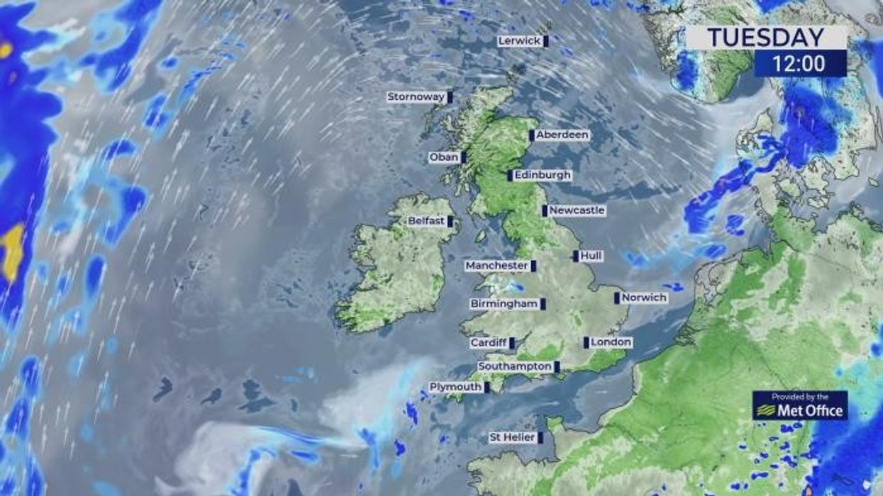
While showers are expected across Scotland and northern Britain, mid-spring is showing up as unusually dry.
As the jet stream surges to the north of the country, high pressure will block rain-bearing lows.
Dale said: “Everything has shifted about 1,000 miles to the north of the country, and this means that high pressure is over much of the country while low pressure is to the north, over Scotland.
LATEST DEVELOPMENTS:
“To the northwest of Scotland and over the Highlands, there is going to be the risk of unsettled weather through the rest of this month.
“The jet stream is right up to the north of us, and at this time of year we would expect it to be closer to Britain.”
High pressure will keep the jet stream at bay, blocking Atlantic wind and rain through the end of the month.
Three low-pressure systems passing over Iceland and the Arctic circle this week will bring showers to the north.
The alignment of pressure patterns through the middle of spring will dictate whether summer starts on a hot and dry, or wetter note.
Met Office meteorologist Aidan McGivern said: “We go from north-westerlies and showery weather with average temperatures, towards more blocked weather patterns, and that means we are not likely to see a raging Atlantic jet stream bring low after low.
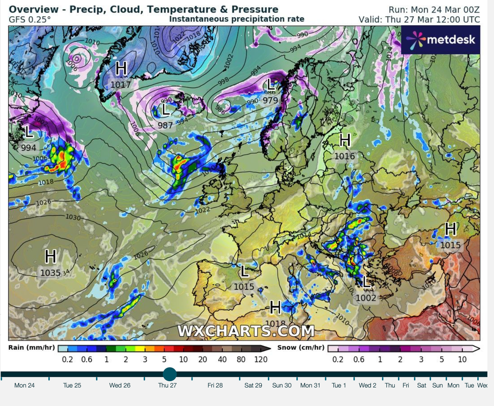
To the north, low-pressure cyclones skimming Scotland threaten rain while to the south, temperatures will rise under the watch of the Azores, or Bermuda, High
|WXCHARTS
“We are more likely to see a slow-moving area of high pressure, and that high pressure is most likely to begin to sit towards the north of the UK, and that is where the driest weather is likely to end up as we go into April.”
Verdicts on late spring and summer are still in the balance with a late spanner in the works a risk from atmospheric winds over the North Pole.
Alarm bells have sounded for a Sudden Stratospheric Warming (SSW) event which could drive a cooler start to the season.
SSW was behind the notorious 2018 Beast from the East, although nothing on that scale is expected this year.
However, tussling Atlantic and tropical weather patterns are keeping meteorological juries guessing on the arrival of summer heat.
McGivern said: “The trend, and we can extend it through the next six weeks, shows the first week of April, and the second, third and fourth week, is for higher pressure to the north.
“The main uncertainty is how much the high to the north will influence the whole country and how much the low to the south could bring some more unsettled weather to southern parts.”