
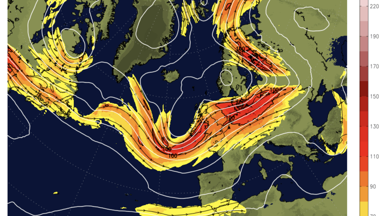


Britain is about to heat up again although a near-200mph jet stream will sweep in a torrent of thundery downpours.
Warm air will waft in from the Continent next week around a huge ‘Scandinavian High’ pressure system settled off the east coast.
Temperatures will rise around 5C from the current chilly lows, although torrential downpours threaten half a month’s rain.
The weather will be steered by high pressure to the east, low pressure to the west, and a powerful jet stream in between.
 UK weather: Hot blast to give way to rain as Jet Stream to bring thundery downpours | Netweather
Met Office meteorologist Alex Burkill said: “Currently, we have an active jet stream across the UK, and it is running at about 185mph which is pretty strong, particularly for the time of year.
“On Monday, there is an area of high pressure out towards Scandinavia and that means we are going to be drawing in our air from the south.
“Scandinavian highs can influence the UK quite highly and bring settled weather, but at the moment it looks like that high will be shifted a little bit too far to the east, so while we may see that warmer air coming in from the south it doesn’t necessarily mean our weather is going to turn particularly settled.”
Rain will move in from the Atlantic at the start of the weekend before turning heavier and more widespread on Sunday.
Southern and central regions face the heftiest downpours where more than an inch and a half could fall.
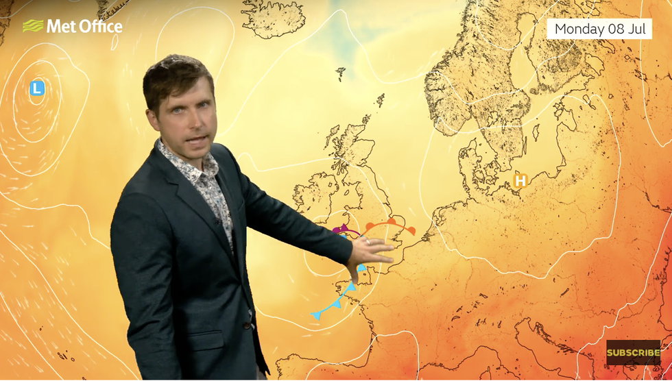
Met Office’s Alex Burkill says it’s getting warmer
|Met Office
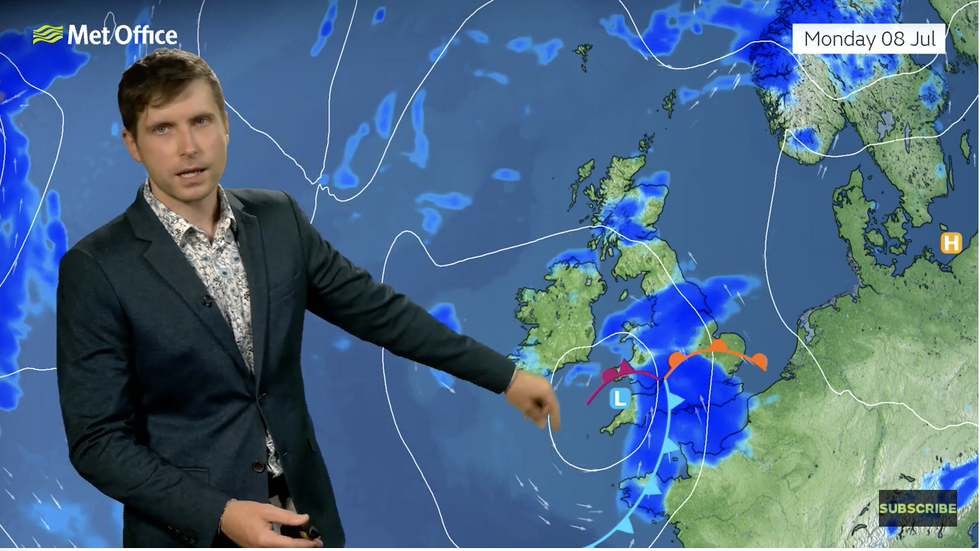
However, Burkill said it would also get wetter
|Met Office
Mr Burkill said: “We could get more than 40mm over 36 hours across some central and southern parts of the UK, which is a pretty wet day, we don’t have any warnings out at the moment, but we may need to issue some.
“On Saturday, there will be some further showers in the north before the showers develop again quite widely on Sunday, and some of these could be heavy and could even by thundery.
“Even though the Scandinavian high is likely to bring some warmer air to us, it doesn’t mean it is going to be particularly dry, and in fact, next week we are more likely to have slightly wetter than average conditions.”
Where the sun does poke through, Britons can look forward to some ‘pleasant’ summer weather.
Although a July heatwave is unlikely, temperatures will hover around the 21C mark across the south.
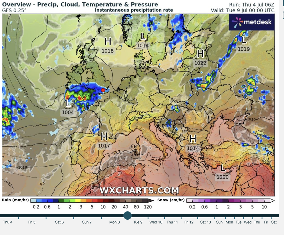
Scandinavian high to the east
|WX charts
However, Britain’s weather will be dominated by the Atlantic prompting warnings to keep brollies at the ready.
Jim Dale, meteorologist for British Weather Services and social commentator, said: “Where the sun comes out it is going to be very pleasant.
“We are looking at temperatures of around 20C or 21C, although it will be cooler and windier across Scotland.
“We are also expecting a feed off the Atlantic, which means there will be an ongoing risk of showers, and we expect to stay in this Atlantic regime for the foreseeable future.”
Britons thinking of packing away their barbecues are reassured not to give up all hope.
Some longer-range outlooks suggest a more summery outlook towards the middle of the month.
Exacta Weather forecaster James Madden said: “We expect the more southern-driven jet stream to drive northwards during next week.
“This will allow a much warmer airflow over an extended period, and it will also place us in an extremely favourable position for high pressure rises and some hot to very hot temperatures.”