UK weather: Met Office says Britain to receive 'very warm' heat blasts in just days

Met Office says Britain to receive 'very warm' heat blasts in just days
|PA/Met Office

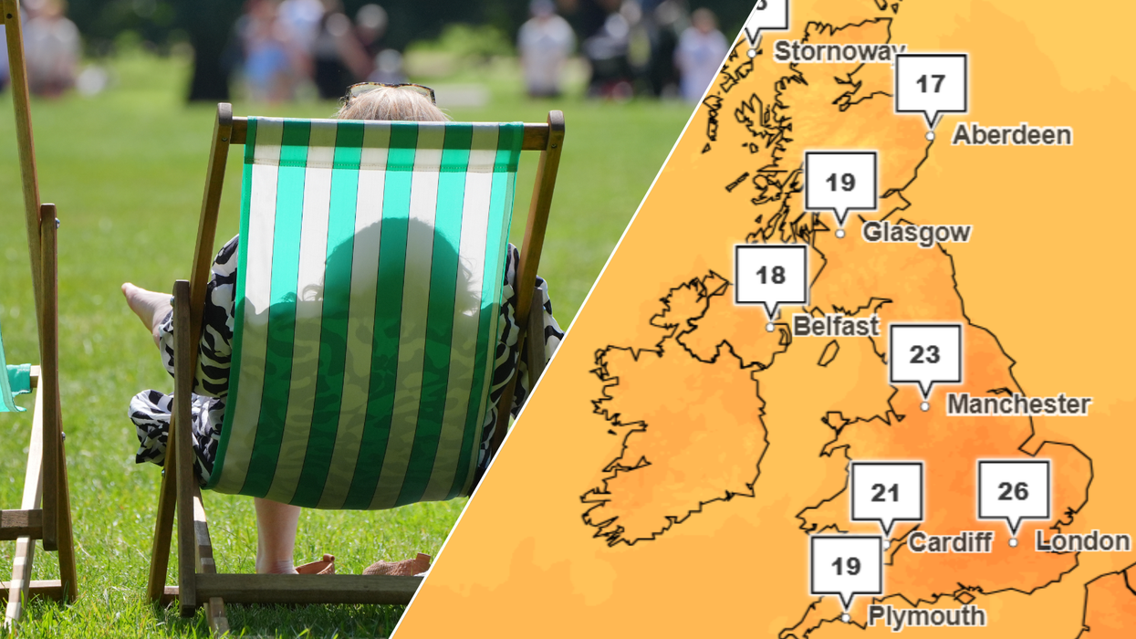
Highs of 27C are expected in some areas starting from tomorrow
Don't Miss
Most Read
Britons can rejoice as more scorching weather is set to hit the UK, as the Met Office predicts that a “very warm” heat blast is just around the corner.
The weekend started off with glorious highs of 31.9C recorded in London on Friday - making it the warmest day on record in 2024. However, the sunshine was quickly replaced with clouds and cooler weather on Saturday and Sunday.
Whilst the week will commence with a “rather cloudy start”, with light patches of rain expected in the south, and heavier showers likely in the north, the beloved warm weather is shortly set to make a reappearance.
By Tuesday, the mercury will begin to climb towards highs of 27C in some areas, continuing into Wednesday too.
 Met Office says Britain to receive 'very warm' heat blasts in just days | PA/Met Office
The Met Office and the UK Health Security Agency (UKSHA) issued a statement on the upcoming heat blast hitting Britain this week and any potential alerts that can come with it.
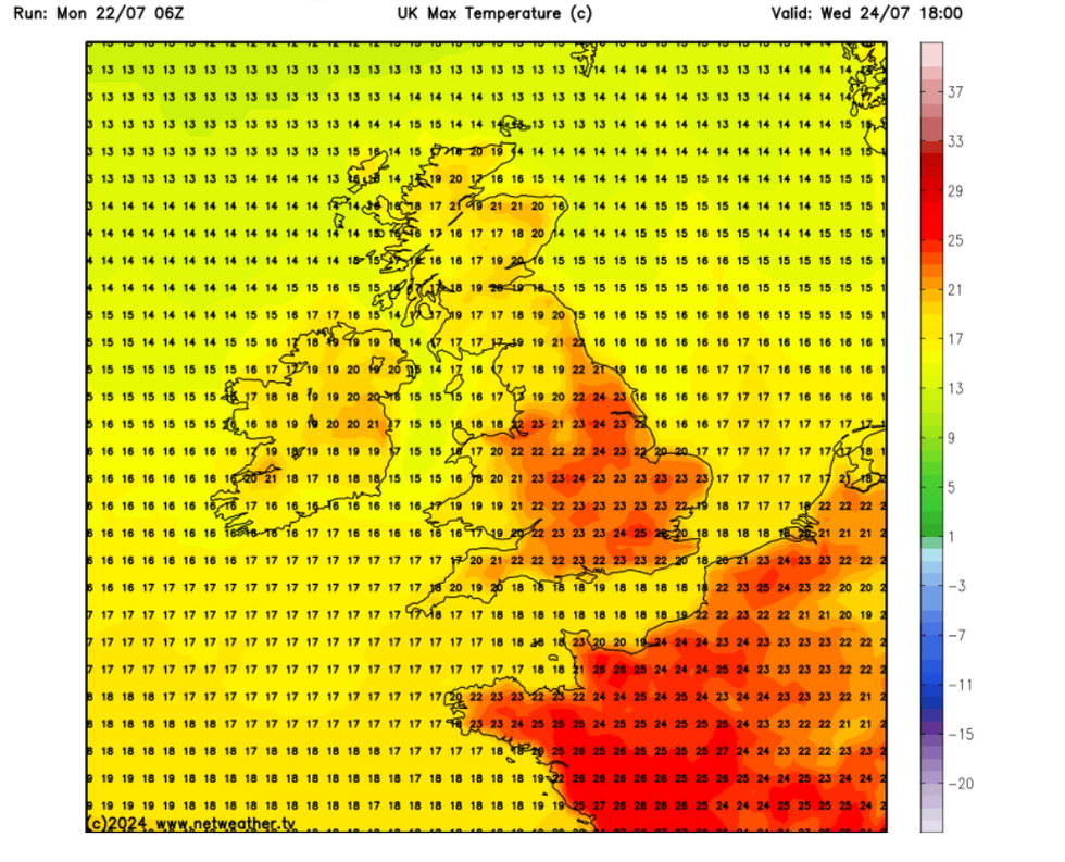
It said: “By Wednesday, a brief spell of more settled weather develops, although a risk of showers, perhaps heavy in the east. Conditions potentially warm or very warm across some central, southern and eastern areas of England, here 26-27 degrees Celsius is a possibility during the day, and overnight minima also likely rather warm, sitting in the mid-teens, elsewhere around average.”
“The Low threshold for temperatures may therefore be reached briefly on Wednesday through to Thursday morning.”
On Thursday, wet weather will sadly return, with “cloud, rain and wind” spreading quickly from the east before temperatures settle down and return to average going into next weekend.
WEATHER LATEST:

More warm weather is on the horizon
|NetWeather
Met Office meteorologist Craig Snell said: “It won’t be wall-to-wall sunshine and we’ll see rain in the north on Monday and the rest of the country on Thursday. It also won’t be as hot as recent days but warmer than the start to July. It will be an improvement.
“Overall, the southeast and south are likely to see the warmest temperatures next week.”
The sunny spell has been a welcome relief in the middle of a damp and chilly July. London received 154 per cent of its average monthly rainfall for July in just the first two weeks.
Temperatures at last soared at the end of last week, resulting in heath alerts being put in place across the Midlands, eastern and southern England from Friday until 11am on Saturday.

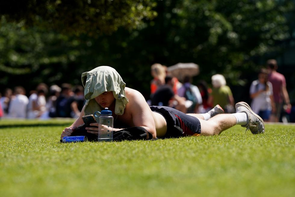
A sunbather enjoys the warm weather in London on Friday
|PA
Looking ahead to the end of the month and into August, the Met Office and the UKSHA predict that the threshold for issuing an alert could be reached again, as more scorching temperatures are on their way.
The statement said: “Temperatures initially average but as settled weather continues, day by day sunshine should allow for temperatures to creep up in central, southern and eastern regions, with above average temperatures likely at times, and low chance of hot conditions developing.
“It is likely that at some point during this period, the low impact temperature threshold will be reached.”


