


A freak explosion of tropical storms in the Atlantic threatens autumn weather chaos as Britain faces a month of stifling heat spikes and torrential downpours.
The UK could be about to get a trans-Atlantic shake-up as unusually high sea temperatures turn Caribbean waters into a hurricane breeding ground.
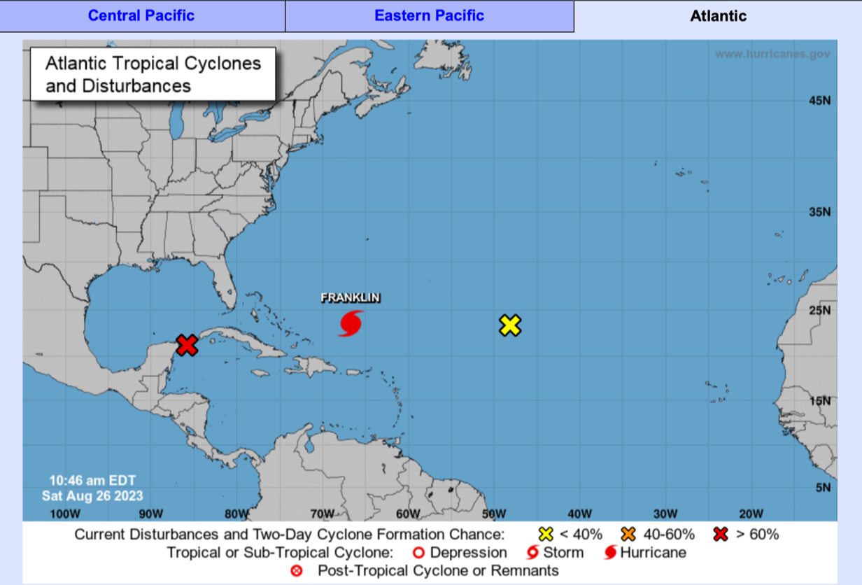
The US National Hurricane Centre last week said three tropical storms, Emily and Gert and Harold, and a hurricane, Franklin, had formed in under two days – setting a record.
In the past 24 hours a fifth – Tropical Storm Idalia – has spawned off the Central American coast, whipping up 60mph wind speeds as it churns waters near Mexico.
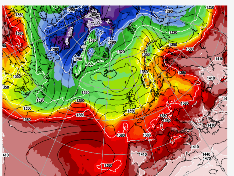
The UK could be about to get a trans-Atlantic shake-up as unusually high sea temperatures turn Caribbean waters into a hurricane breeding ground
|Netweather
The remains of such storms can eventually drift towards Britain, ploughing tropical energy into the jet stream and driving extreme weather events.
The UK Met Office is currently watching Ex-tropical storm Emily which could drive high pressure and settled conditions this weekend.
UK Met Office meteorologist Alex Deakin said: “There is quite an active set up in the Caribbean at the moment.
“We are getting towards peak season with the seas warming up.”
In the longer term, prolific hurricane activity through the coming weeks could put the UK through a month-long ‘Jekyll and Hyde’ washing cycle.
Jim Dale, meteorologist for British Weather Services, said: “The very warm, moist air from these tropical storms and hurricanes can get sucked into the atmosphere and reaches us via the jet stream.
“This could give the weather a shake over the next month as we go through September, and this is shown in the weather models which are still all over the place.
“What is likely is a mix of intense downpours at times before we go straight back to summer with high pressure bringing warm temperatures and more settled conditions.
“But these conditions can cause a real headache for meteorologists, and what we are looking at is a real Jekyll and Hyde scenario for the next few weeks.”
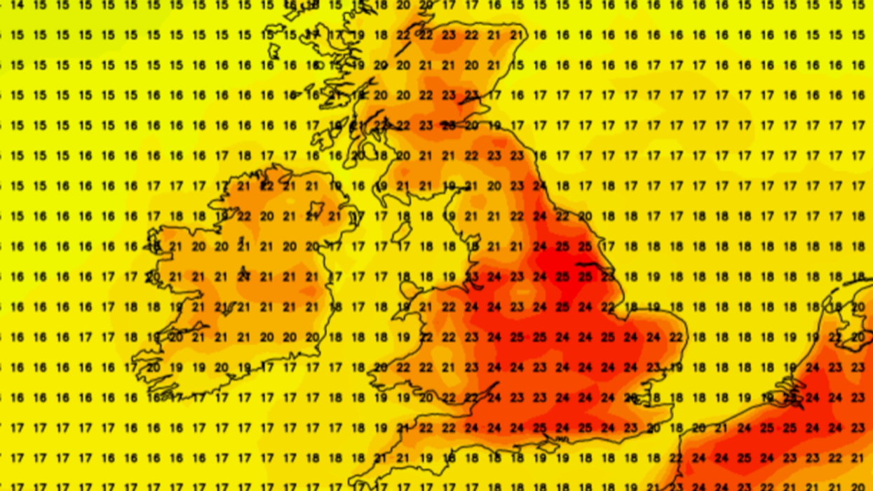
Britons could be about to see summer return in a blaze of glory with early autumn temperatures rocketing through the roof.
Weather models show thermometers after the bank holiday weekend lifting into the mid-20Cs – around 5C higher than average for late summer.
This will be driven, in part, by the remains of ex-Tropical Storm Emily as it drifts towards the British Isles as a bubble of humid air.
Mr Dale, author of ‘Weather Or Not?’, said: “The remains of Emily look like moving northwards bringing in southerly air later this weekend.
“This could also drive the Azores High to build towards Britain bringing some very good weather through the coming days.“
However, the influence of tropical storm activity makes the forecast very uncertain, and what I expect is a real mixed back through the next few weeks.”
Meteorologists and Oceanologists say the Atlantic Hurricane season is reaching the peak of what could be an unusually active period, blaming usually high sea temperatures.
How these storms develop and track across the ocean will determine the extent to which they affect the UK weather.
Met Office meteorologist Aidan McGivern added: “At the moment we are heading towards peak tropical cyclone season in the Atlantic.“
There are some uncertainties in the forecast mainly centred around how these ex-tropical storms behave in the next few days.
“But it looks likely that a cool and changeable weather pattern prevails through next week before a more settled weather in the south for the start of September.”
Britons could be about to see summer return in a blaze of glory with early autumn temperatures rocketing through the roof
|National Hurricane Centre
Britain’s weather through the next three months is likely to fall under the influence of a trend of climate warming, high local sea temperatures and an El Nino warming of waters in the east Pacific.
The Met Office predicts a 35-per cent chance of warmer-than-normal conditions until October, with a 15-per cent chance it may be cooler than average.
There a 10-per cent chance the season will be windier than average, and a 15 per cent chance it will be wetter.
Higher than average sea temperatures could drive warmer temperatures through the next few months.
A Met Office spokesman said: “Drivers relevant to the current outlook are the warming of UK climate consistent with wider global warming trends.
“Sea-surface temperatures around the UK are above average. El Nino continues to develop in the Pacific Ocean.
“[The Atlantic tropical cyclone season] usually peaks in August and September and is forecast to have above-average activity, this acting to reduce confidence in the forecast.”
Bookmakers are also feeling the heat, slashing the odds on the hottest September on record.
Ladbrokes spokesman Alex Apati said: “Things could be about to take a turn for the better on the weather front with temperatures back on the up.
“We've slashed odds on a potentially record-breaking hot September.”