


Britons have been told to brace for the “worst storm of the year” as the Met Office issues a total of six weather warnings.
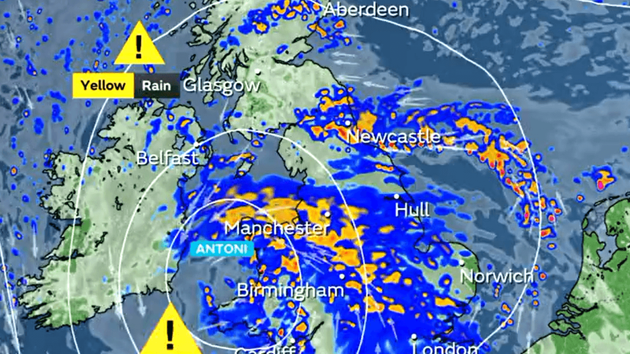
Storm Antoni looks set to wreak havoc across the United Kingdom as torrid conditions pose a possible threat of injuries and danger to life.
The storm has resulted in four yellow weather warnings for thunderstorm, wind and rain.
Two amber wind warnings have also been issued between 11am and 7pm.
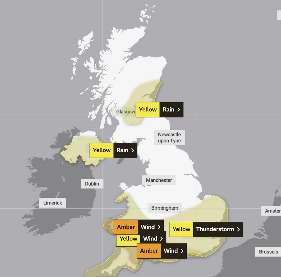
Weather warnings are in place across all four corners of the UK
|Met Office
The amber wind warning will impact parts of the South West of England and Wales.
The Met Office said:” An area of low pressure, Storm Antoni, will bring particularly strong winds for the time of year to parts of southwest Wales and southwest England during Saturday.
“Strong northwesterly winds are likely to peak during the middle of the day in southwest Wales, and through the afternoon in southwest England, before easing during the evening.
“Gusts of 40-50 mph are expected widely even inland, with a few spots peaking around 60 mph, while exposed coastal areas and hills could see gusts around 70 mph.
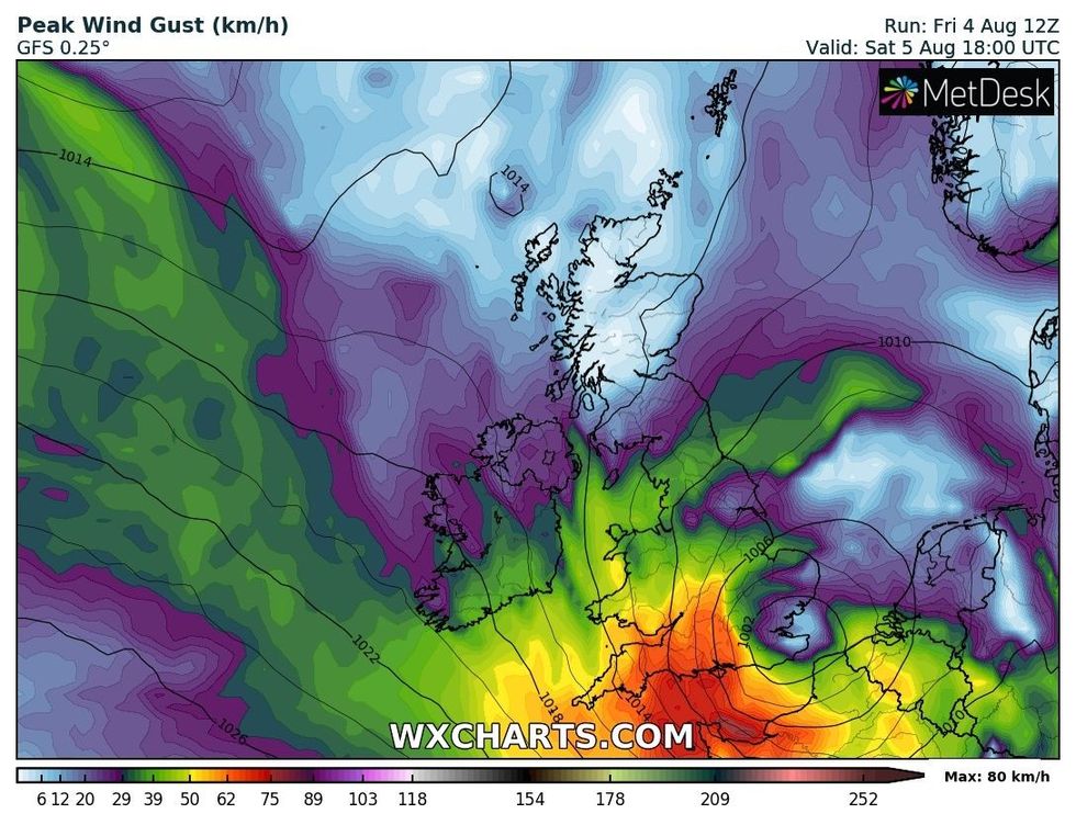
Storm Antoni will bring strong winds in places
|WXCHARTS
“Such values are rarely encountered during the summer season.”
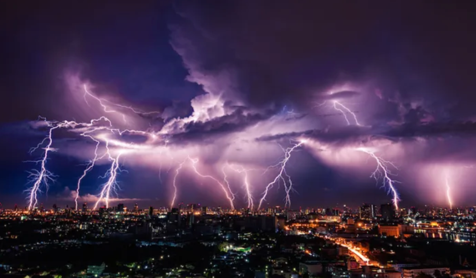
Large swathes of England have been alerted about thunderstorms between 11am and 10pm.
The Met Office claimed thunderstorms could cause flooding and travel disruption.
It added: “Heavy showers and thunderstorms are expected to develop this afternoon, some being slow moving, particularly across southeastern parts of England later.
“Whilst some places will miss the worst of these, there is the potential for 15-25 mm of rain to fall locally within the space of an hour and perhaps 30-40 mm to accumulate in 2-3 hours.
“Lightning and hail may be additional hazards. Conditions will improve from the west through the evening, although only a slow improvement is expected across eastern England.”
The East Midlands, East of England, London & South East England, South West England and West Midlands could all be impacted.
A yellow rain warning is in place for Northern Ireland and and yellow wind warning will impact other parts of South West England, Wales and the West Midlands.
 The UK is set to be rocked by thunderstorms | PA
Meteorologist Simon Partridge warned the six warnings could constitute the worst storm of the year.
He said: “It’s the first named storm of the entire season and the worst storm in over a year, and because it’s summer the impact will be much greater.
“Many people will be camping, using caravans and going to the beach as part of their summer holiday plans and this weather could pose a risk to them.
“Named storms are about the level of danger to the public and that is at its highest since last February.
“Trees with leaves are more likely to catch the strong winds and get uprooted.
“Ferry crossings may be stopped because they are unsafe and bridge crossings may also be halted.”