


Britons have been warned to brace for five yellow weather alerts as Storm Betty threatens to wreak havoc this weekend.
The low-pressure system is forecast to cause problems on both sides of the Irish Sea.
The cyclone is expected to bring higher impacts to the Republic of Ireland but will spread to Northern Ireland as Saturday nears.
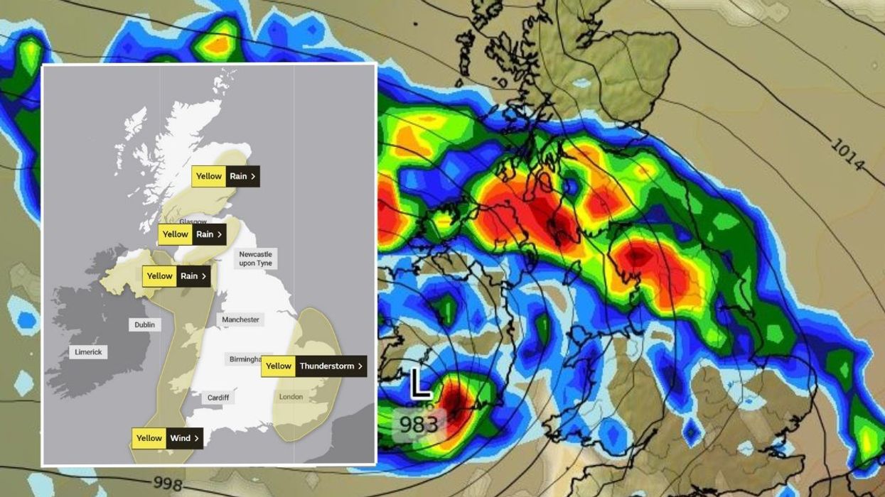
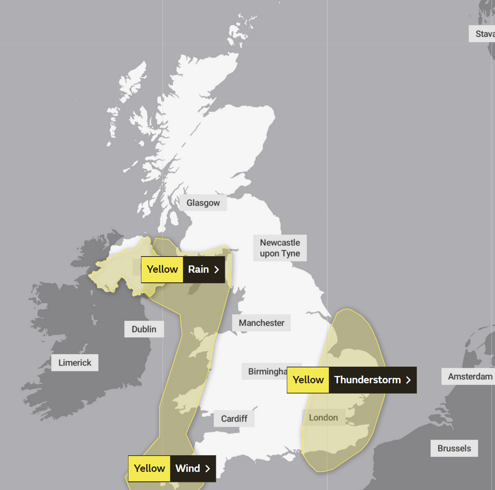
Three yellow weather warnings have been issued across the United Kingdom today.
Met Office weather warnings in place on Friday
|Met Office
Ulster looks set to experience heavy downpours from 9pm until 6am tomorrow.
“The highest rainfall totals are expected over east-facing high ground of the Mourne Mountains, Antrim Hills and Sperrins where 40 to 80 millimeters could accumulate,” the Met Office said.
A wind warning will cover large swathes of North West England, Northern Ireland, South West Scotland & Lothian Borders, South West England and Wales from 6pm until midday tomorrow.
The UK’s national weather service added: “Storm Betty is expected to bring a swathe of very strong and gusty winds to the Isles of Scilly early Friday evening, quickly transferring north across many western parts of the UK overnight and into Saturday morning.
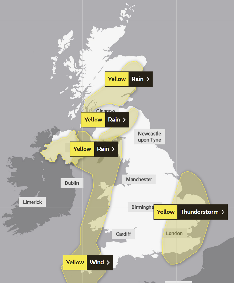
Met Office weather warnings in place on Saturday
|Met Office
“Strongest winds will be along south to southwest facing coasts where gusts of 60-70 miles per hour are possible, whilst gusts of 45-55 miles per hour are possible elsewhere.”
However, the East of England, London and the South East could face “torrential thunderstorms” from 8pm to 5am tomorrow.
Additional rain warnings have been imposed in two patches across Scotland on Saturday from 3am to midday.
The Met Office said: “Totals of 20-30 millimeters could fall quite widely within the warning area, with the highest rainfall totals expected over east-facing high ground in the Angus Hills and the Grampian Mountains where 40-60 millimeters could accumulate in two spots, and much of the rainfall will occur in a relatively short period [of] time, typically three to four hours.”
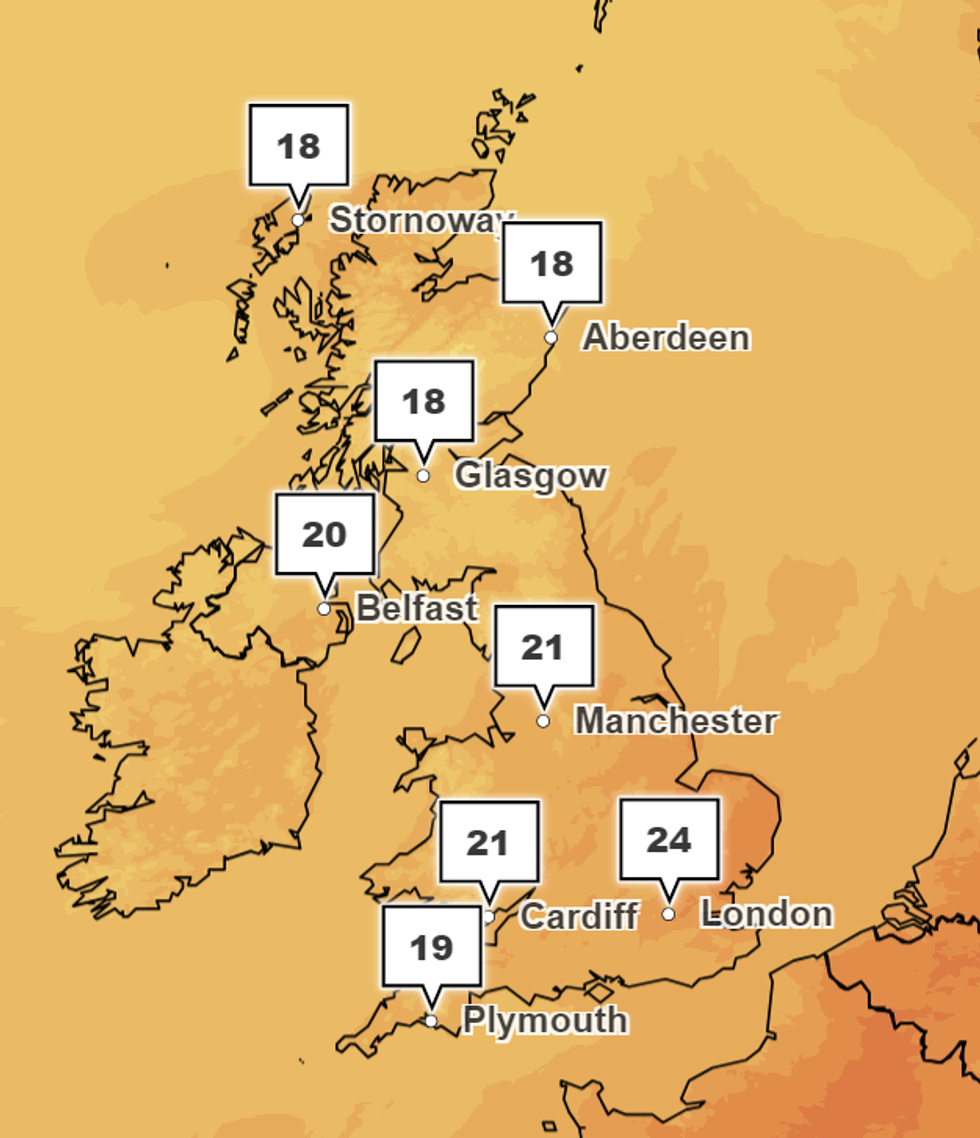
Temperatures across the UK at 4pm on Saturday
|Met Office
Downpours north of the border come as the Scottish Environment Protection Agency have used nine flood alerts.
However, temperatures could reach as high as 24C in London on Saturday.
Cardiff and Manchester could see mercury hit 21C.
Glasgow and Belfast will remain slightly cooler at 18C and 20C respectively.