


Forecasters have warned that Britain could see its first snowfall this winter within a matter of days as an Arctic plume looks set to hit the UK.
A band of low pressure is expected to bring icy conditions and freezing temperatures across the next two weeks.
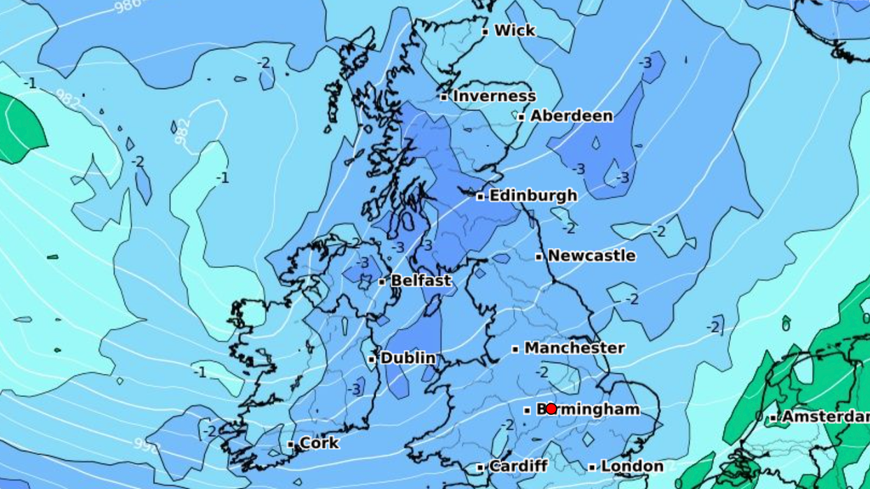
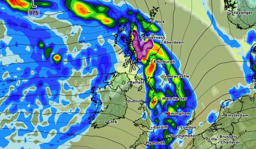
Weather expert James Madden said it is "likely" snow will fall across some parts of Britain as a band of low pressure moves from the north.
The Exacta Weather forecaster said that, from around mid-month onwards, the UK could see "even greater and more significant dumps of snow across higher ground in the north".
Weather expert James Madden said it is 'likely' snow will fall across some parts of Britain as a band of low pressure moves from the north
|WXCHARTS
He added: "It is now increasingly likely that we will see at least 1-2 notable wintry blasts from late November and into the first half of December, but it may turn milder or much milder later.
"However, a sudden stratospheric warming event from later this month and into December could change that outlook to an even colder and more wintry theme for many parts of the country.
"And would drastically change the overall outlook for December as a whole, particularly, during the second half of the month, and increasing our white Christmas chances significantly under such circumstances."
Temperatures could plummet below 5C on November 11, according to Madden.
LATEST DEVELOPMENTS:
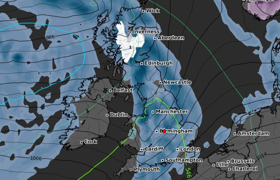
Weather maps suggest a band of snow could hit the west coast of Scotland from November 10.
However, the Met Office say conditions are likely to "remain generally on the mild side" over the coming weeks.
The forecasters claim conditions between Thursday November 9 and Saturday November 18 are set to remain "predominantly unsettled".
Experts say low pressure is "likely to track east across northern areas of the UK at the end of coming weeks, bringing further rain or showers to many areas."
It follows storms Ciarán and Domingos which caused destruction across the UK and are set to be followed by four more Atlantic storms in the coming days
|WXCHARTS
It adds: "By mid month, the most unsettled conditions are likely to transfer further north, with areas further south perhaps having some drier spells of weather at times.
"Within these drier spells, some overnight frost and fog is possible, but possibly becoming relatively mild by day."
It follows storms Ciarán and Domingos which caused destruction across the UK and are set to be followed by four more Atlantic storms in the coming days.
Bookmakers Coral cut odds on November being the wettest on record to 1/2 odds-on, after parts saw quadruple the normal October rainfall.