UK weather forecast: ‘On fire’ ocean temperatures to spark unusually warm spring and summer heatwaves

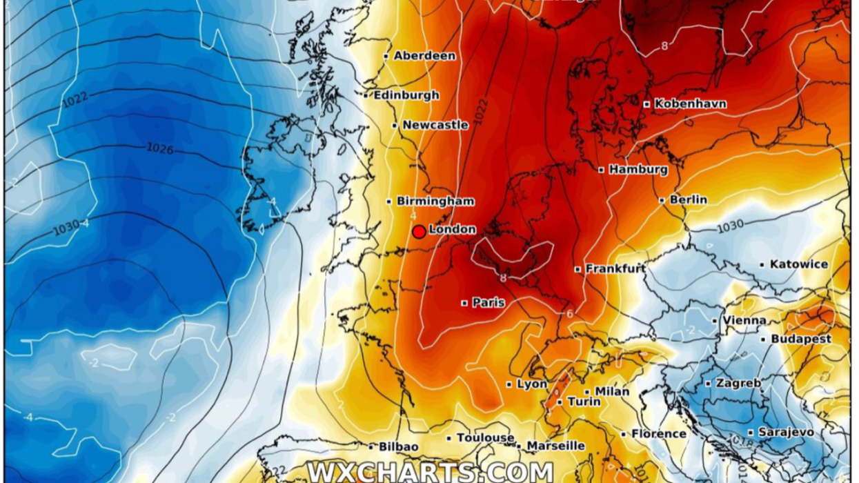
Warming trend through March. Red colours show temperature 'anomaly'
|WX CHARTS

The prediction is based on a series of ‘superensemble’ models which combine several forecast models to generate a seasonal overview
Don't Miss
Most Read
Sea temperatures ‘on fire’ threaten to light the gas under Britain, triggering a balmy spring and risk of summer heatwaves.
As the nation hunkers down for a late-winter chill, long-range forecasts suggest a U-turn at the start of March.
Above-average temperatures are forecast through the next five months with a repeat possible of 2022’s and last year’s extreme heat.
While the southern continent will see the warmest weather, the UK is expected to catch the tip of the warming trend.
Dr Todd Crawford, meteorologist for Atmospheric G2, said: “Warmer than normal temperatures are expected to be the norm for the next few months in the UK.
“The reality is that the North Atlantic Ocean is ‘on fire’ right now and it is very difficult to get sustained colder than normal temperatures.

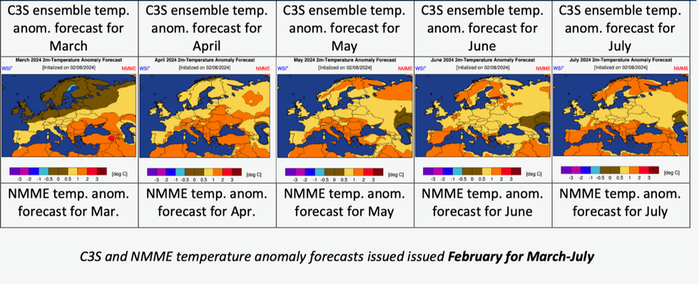
Above average temperatures through next five months
|Atmospheric G2/ Dr Todd Crawford
“Looking at the monthly breakdown of the climate model temperature forecasts, we can see that [they] are generally consistent moving through spring into early summer in depicting the most anomalous warmth across the south, and also in depicting a real lack of below-normal temperatures.”
However, a switch from El Nino to La Nina expected this spring, could scupper the warm weather, he warned.
He said: “There is some evidence that cooler and wetter springs can occur during rapid transitions from El Nino to La Nina as we expect to see over the next few months.
“So, there are some mixed signals for the UK over the next few months.”
Atmospheric G2 forecasts temperatures between April and June to be around 0.5C to 1C above average, with July possibly up to 2C above.
The prediction is based on a series of ‘superensemble’ models which combine several forecast models to generate a seasonal overview.

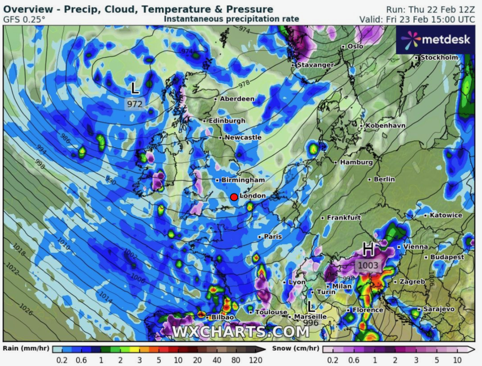
More wind and rain is on the way for the weekend
|WX CHARTS
While the overall temperature increase may appear low, it can have noticeable effects on the weather.
It means that Britain could be looking at a warm spring with the potential for another warmer-than-normal summer.
Jim Dale, meteorologist for British Weather Services and social commentator, said: “One degree above normal is significant, and I would expect to see this trend through the coming months.
“What this means is that we are looking, once again, at the prospect of hotter weather during the summer, and the increased risk of heatwaves.
“This is what we are seeing not just across Europe, but across the northern hemisphere.”
El Nino, the warming of ocean waters off the coast of South America, will contribute to the hot weather, he said.
A particularly strong El Nino which set in last summer is now on the wane and threatens to pendulum swing into its counterpart La Nina.
Dale said: “The residue of El Nino will be a factor in the temperatures over the summer.
“We will need to see the right conditions, which include not only this warmer trend, but the right weather conditions, the synoptics.
“But if this comes together, there is every possibility we could be looking at the plumes that come up from Africa and Spain that push temperatures into the high 30Cs or even the low 40Cs.”
Meanwhile, the UK is braced for a cold snap with the recent mild weather to give way to the cold this weekend.
Britain is also on warning that the wet and windy end to the week will hold out through the coming days.
A Met Office spokesperson said: “Temperatures are returning more towards average for the time of year compared to the recent mild weather.
“Showers should reduce through Saturday, giving most areas a drier spell of weather.
“Further persistent rain and locally strong winds are likely to move into some southern areas on Sunday.”


