


The Met Office has issued two yellow weather warnings as Britons look set to get battered by gale force winds over the weekend.
Wind warnings have been put out on Friday and Saturday.
Friday’s warning is in place between 7am and 7pm.
It will bring strong winds and the potential for disruption, particularly in delaying travel, damaging trees and making driving conditions difficult.
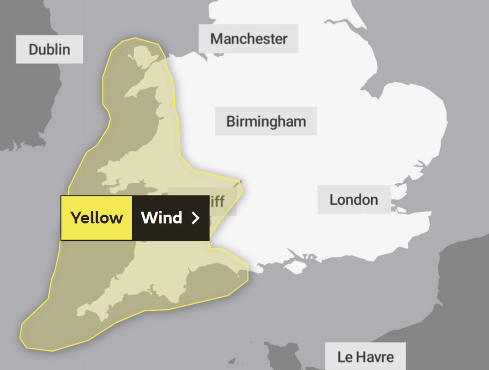
Friday's yellow weather warning will impact Wales and the South West
|Met Office
Gusts could exceed 50 mph in coastal and hilly areas.
The UK’s national weather service identified South West England and Wales as the areas affected by the wind warning.
The Met Office said: “Strong winds will develop across southwest England early on Friday, extending northwards through the day to affect parts of Wales.
“Gusts of 35 to 45 mph are likely quite widely for a time, with gusts over 50 mph affecting some coasts and hills, mainly across Cornwall and west Wales.
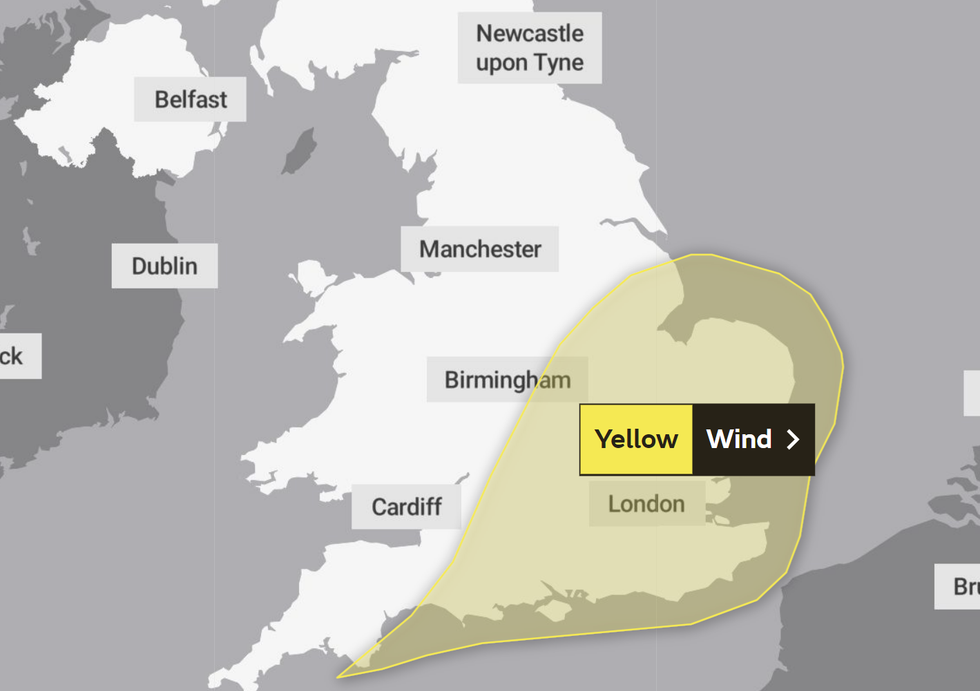
Saturday's weather warning will impact much of southern England
|Met Office
“This is likely to lead to difficult driving conditions and some disruption given the unusual time of year for such winds.
“In addition, heavy rain will lead to standing water and spray on roads.
“Winds are expected to ease through the evening.”
Unseasonable levels of wind have led to a second yellow warning between 9am and midnight on Saturday.
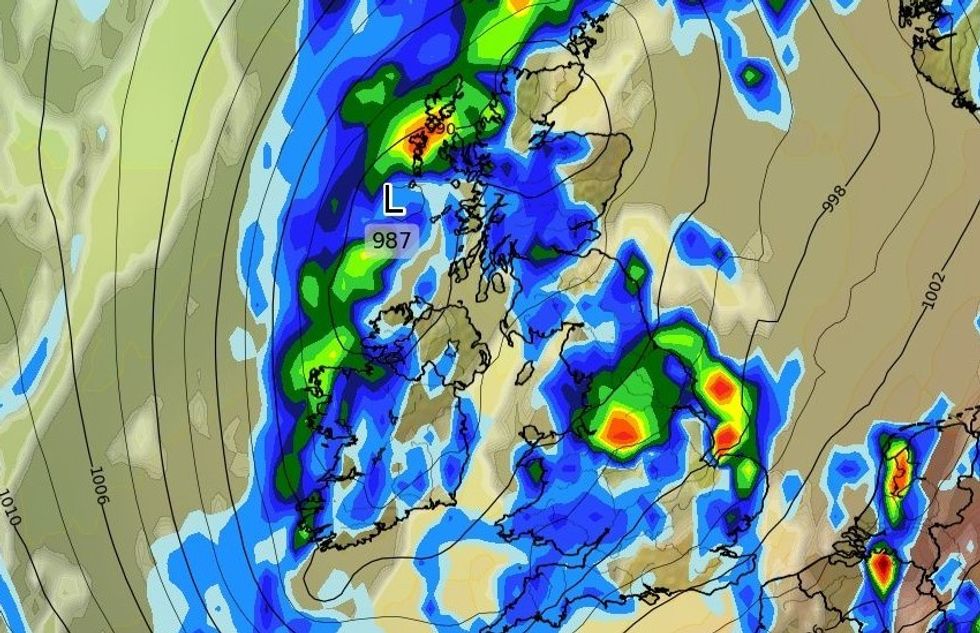
A weekend washout remains possible, WXCHARTS has suggested
|WXCHARTS
Large parts of England have been labelled as affected, including the East, East Midlands, London, South East, South West and West Midlands.
The Met Office added: “A deep area of low pressure will affect parts of the UK on Saturday with some very strong gusts of wind likely to its south.
“A blustery and showery day (with some thunder) will see winds gust widely to 40 mph, and locally up to 50 to 55 mph during the daytime.
“The strongest gusts are likely to occur mainly, but by no means exclusively, over hills and along the south coast.”
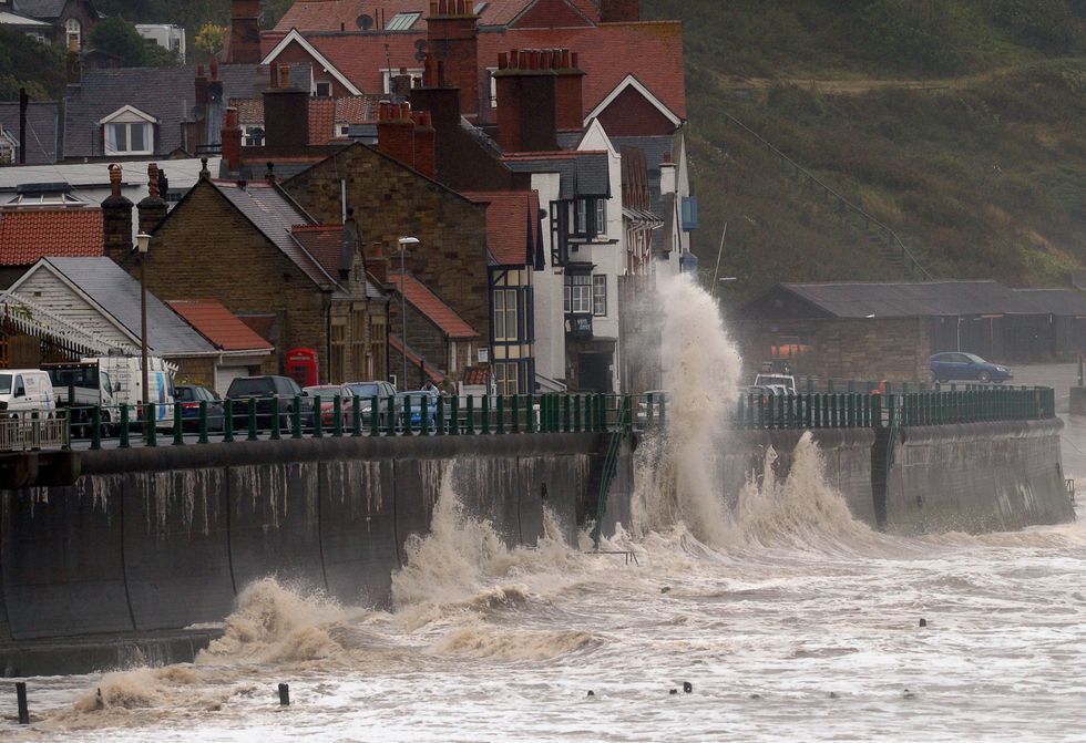
Gale force winds drive waves over the coastal road at Sandsend near Whitby
|PA
The UK’s national weather service suggested minor damage and travel disruption is also likely on Saturday.
However, gusts will become less intense throughout the day, with winds labelled “moderate” later in the evening.
Britain’s wider weather forecast warns of heavy rain on Friday followed by blustery showers on Saturday.
Thunderstorms are also likely to hit certain parts of the UK over the weekend.