


A bubble of energy dumped in the Atlantic by a former hurricane will jolt the jet stream to send temperatures rocketing.
Heat and humidity will engulf swathes of the UK this weekend as the remnants of Hurricane Debby sweep northern Europe.
Now a tropical depression, Debby threatens torrential rain and storm surges along the east coast of the United States.
She will bump the jet stream at the weekend, ‘amplifying’ it into a loopy position to douse parts of Britain in a steam-bath sweat plume.
Met Office meteorologist Annie Shuttleworth said: “Debby starts to build the shape of the jet stream amplifying it up to the north, and then it dives down to the south of the UK before coming back up to the north by Saturday, and this amplified pattern is going to drive tropical air and very humid air across the UK Sunday into Monday.
“The heat and humidity will build for a time on Sunday and into Monday for many areas of the UK.
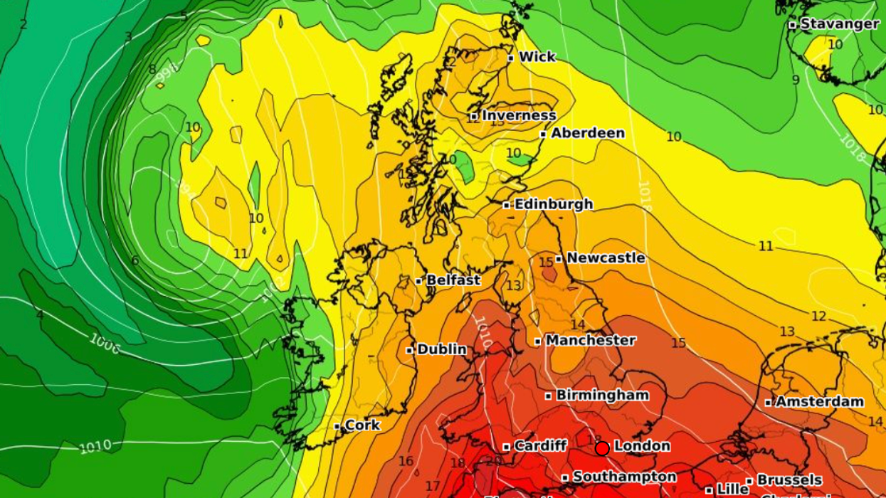
Temperatures are set to rocket this weekend
|WX CHARTS
“Quite a lot of dry weather can be expected on Saturday, and in the sunshine temperatures will be in the low-20Cs or the high-teens, or possibly in the mid-20Cs where we hold on to humid air for a little longer in the southeast.”
In keeping with the theme of this summer, the hot spell will be ‘short-lived’, fizzling out by mid-week.
On its tail will be low pressure, dishing up more rain and the risk of thunderstorms, Miss Shuttleworth added.
She said: “It is going to be a fairly short-lived hot spell, and temperatures will likely peak on Monday.
“We could see temperatures climb into the low-30Cs for parts of the southeast.
“For a wide area of parts of England and Wales temperatures are expected to exceed 25C coming close to the high-20Cs, and in the southeast temperatures exceeding 30Cs.
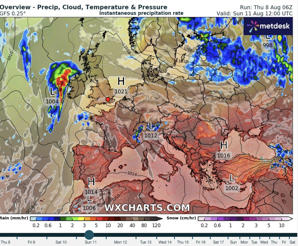
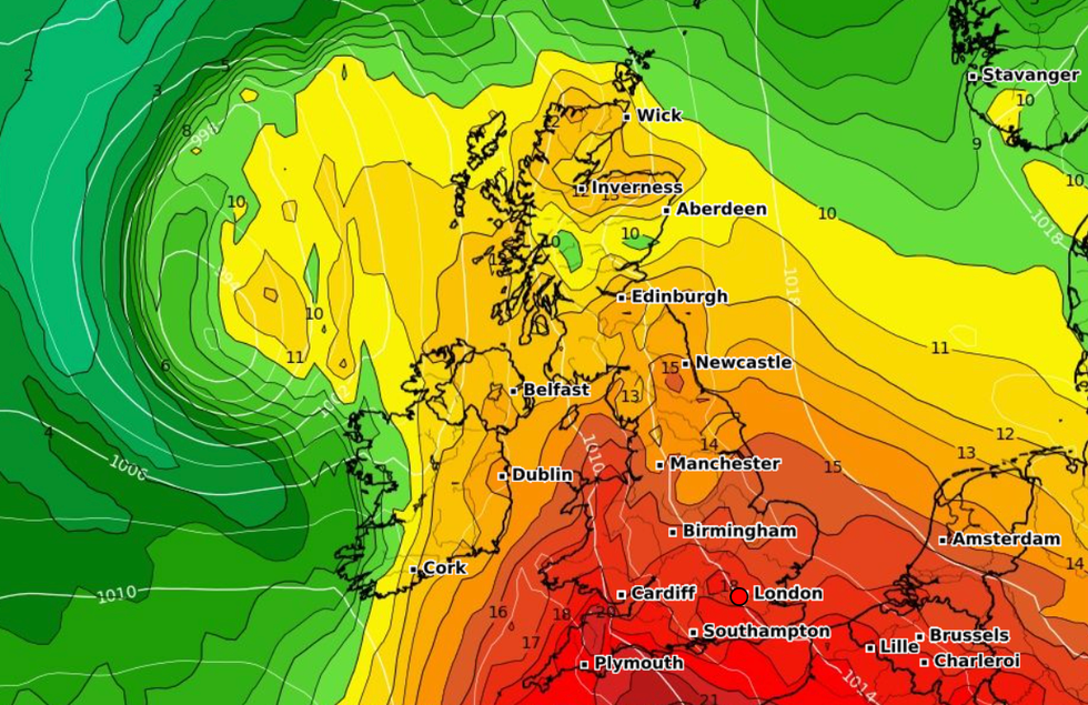
High pressure builds across the UK
|WX CHARTS
“Heat will ease as we head into Tuesday, and then we will see a spell of wet weather push across the country we will also see a spell of thunderstorms develop quite widely on Sunday, Monday and into Tuesday.”
Britain’s dire summer so far has been in part down to the jet stream settling over the country acting as a low-pressure conveyor belt.
High pressure, the driver of dry, settled conditions, has been scarce, appearing infrequently in short bursts of sunshine.
The remnants of Debby will shunt the jet stream allowing a last thrust of high pressure to build in its loops.
James Madden, forecaster for Exacta Weather, said: “High pressure will arrive to bring warm to hot conditions over the coming days and through the weekend.
“Temperatures could hit the low- to mid-30Cs in parts of southern and central England, with highs in the mid- to high-20Cs elsewhere.
“The high pressure, and warmer temperatures, will extend into the start of next week for a day or two.”
Jim Dale, meteorologist for British Weather Services and co-author of ‘Surviving Extreme Weather’, said: “The effects of Debby will depend on how it interacts with the jet stream.
“If it goes further north, then this will encourage warm air up from the south and push temperatures back up.”